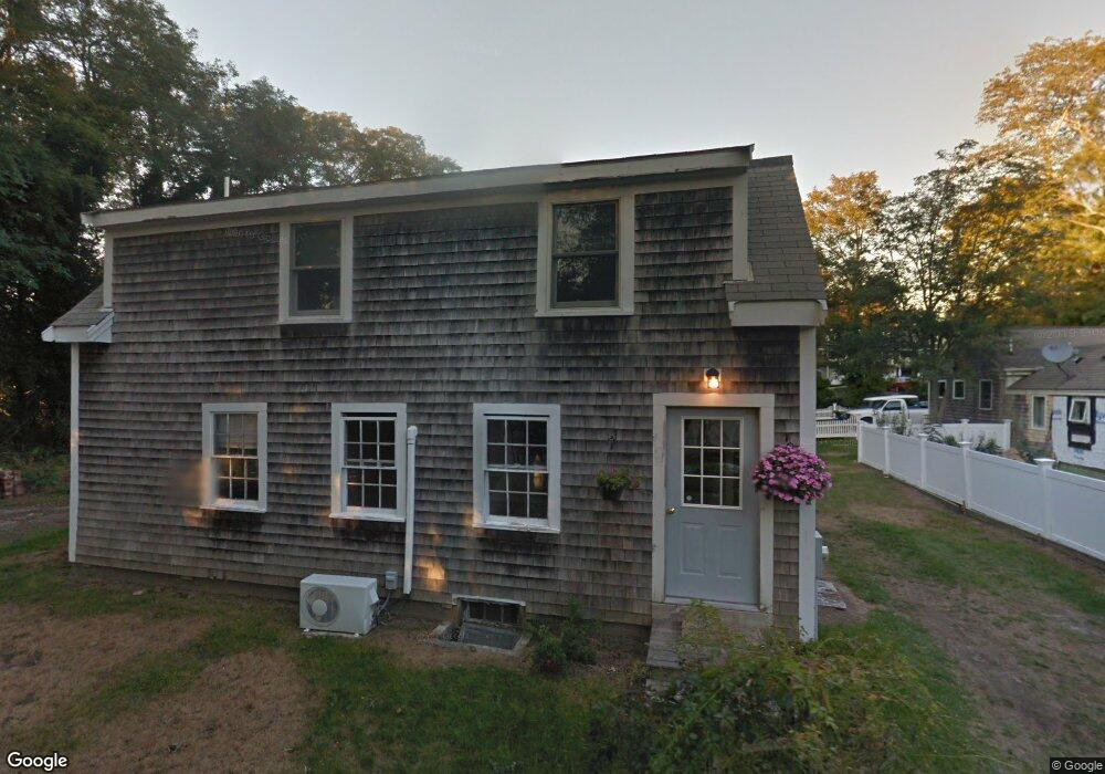
86B Rt 6a Orleans, MA 02653
Estimated Value: $708,603
3
Beds
3
Baths
949
Sq Ft
$747/Sq Ft
Est. Value
About This Home
This home is located at 86B Rt 6a, Orleans, MA 02653 and is currently estimated at $708,603, approximately $746 per square foot. 86B Rt 6a is a home located in Barnstable County with nearby schools including Orleans Elementary School, Nauset Regional Middle School, and Nauset Regional High School.
Ownership History
Date
Name
Owned For
Owner Type
Purchase Details
Closed on
Apr 4, 2006
Sold by
Hussey James R
Bought by
Smith Michael C
Current Estimated Value
Home Financials for this Owner
Home Financials are based on the most recent Mortgage that was taken out on this home.
Original Mortgage
$375,000
Outstanding Balance
$212,608
Interest Rate
6.32%
Mortgage Type
Purchase Money Mortgage
Estimated Equity
$495,995
Purchase Details
Closed on
Jul 3, 1998
Sold by
George Thomas N
Bought by
Hussey James R and Hussey Louella G
Create a Home Valuation Report for This Property
The Home Valuation Report is an in-depth analysis detailing your home's value as well as a comparison with similar homes in the area
Home Values in the Area
Average Home Value in this Area
Purchase History
| Date | Buyer | Sale Price | Title Company |
|---|---|---|---|
| Smith Michael C | $375,000 | -- | |
| Smith Michael C | $375,000 | -- | |
| Smith Michael C | $375,000 | -- | |
| Hussey James R | $43,000 | -- | |
| Hussey James R | $43,000 | -- |
Source: Public Records
Mortgage History
| Date | Status | Borrower | Loan Amount |
|---|---|---|---|
| Open | Smith Michael C | $375,000 | |
| Closed | Smith Michael C | $375,000 | |
| Previous Owner | Hussey James R | $25,000 |
Source: Public Records
Tax History
| Year | Tax Paid | Tax Assessment Tax Assessment Total Assessment is a certain percentage of the fair market value that is determined by local assessors to be the total taxable value of land and additions on the property. | Land | Improvement |
|---|---|---|---|---|
| 2025 | $3,356 | $537,800 | $257,200 | $280,600 |
| 2024 | $3,282 | $512,000 | $252,100 | $259,900 |
| 2023 | $2,957 | $474,600 | $233,500 | $241,100 |
| 2022 | $2,933 | $407,300 | $212,200 | $195,100 |
| 2021 | $2,657 | $338,900 | $177,900 | $161,000 |
| 2020 | $2,473 | $327,100 | $169,000 | $158,100 |
| 2019 | $2,365 | $319,600 | $164,300 | $155,300 |
| 2018 | $2,059 | $310,500 | $161,200 | $149,300 |
| 2017 | $1,979 | $312,600 | $169,700 | $142,900 |
| 2016 | $1,992 | $308,400 | $168,300 | $140,100 |
| 2015 | $1,933 | $301,100 | $164,900 | $136,200 |
Source: Public Records
Map
Nearby Homes
- 13 S Orleans Rd Unit 28
- 3 Reilly Run
- 2 Reilly Run
- 32 Locust Rd
- 36 Old Colony Way Unit 21
- 36 Old Colony Way Unit 3022
- 44 Tonset Rd
- 20 Namskaket Rd
- 42 Old Colony Way Unit 15
- 42 Old Colony Way Unit 29
- 42 Old Colony Way Unit 5
- 42 Old Colony Way Unit 30
- 42 Old Colony Way Unit 14
- 188 Rock Harbor Rd
- 17 Kings Way
- 181 Rock Harbor Rd
- 95 S Orleans Rd
- 78 Old Colony Way Unit 3
- 18 West Rd Unit 307
- 18 West Rd Unit 315
- 88 Rt 6a
- 0 River
- 90 Massachusetts 6a
- 90 Rt 6a
- 87 Cranberry Hwy Unit C
- 84 Massachusetts 6a
- 84 Massachusetts 6a
- 84 Rt 6a
- 94 Rt 6a
- 86 Massachusetts 6a
- 85 Massachusetts 6a
- 85 Massachusetts 6a Unit 1
- 87 Massachusetts 6a
- 87 Massachusetts 6a Unit 3
- 87 Massachusetts 6a Unit 2
- 87 Massachusetts 6a Unit 1
- 87 Massachusetts 6a Unit 13
- 85 Rt 6a Unit 1
- 85 Rt 6a
- 85 Rt 6a Unit 4
Your Personal Tour Guide
Ask me questions while you tour the home.