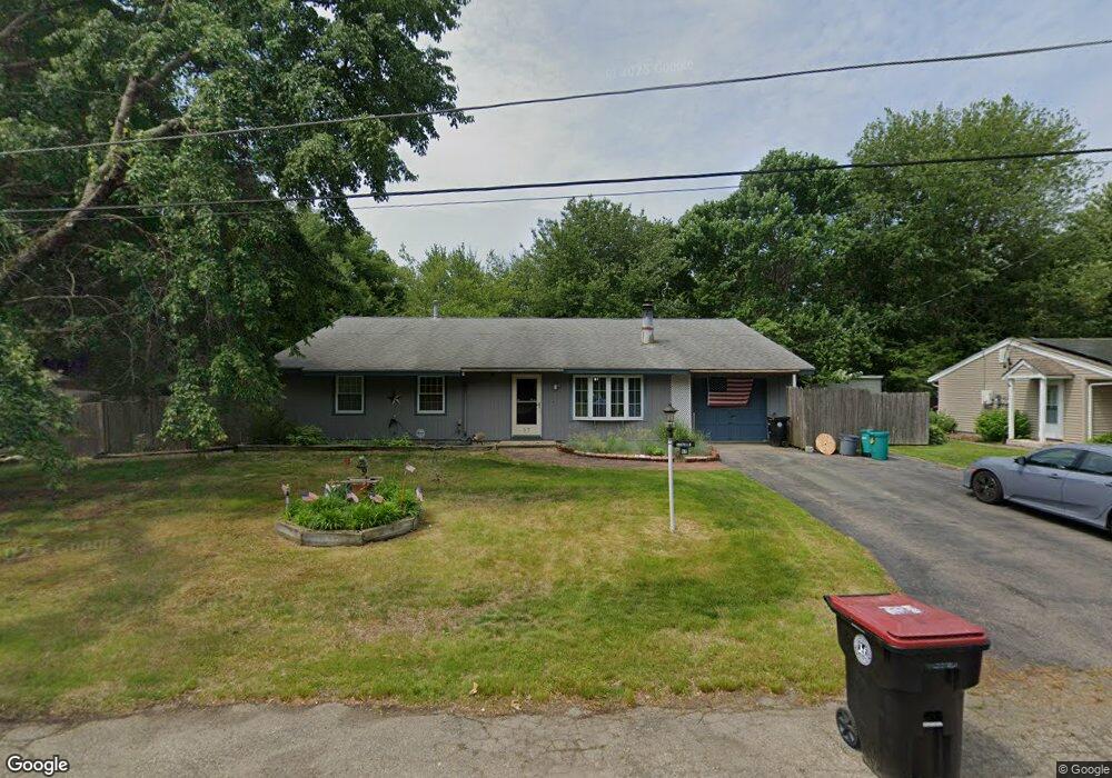
87 Appleby St Brockton, MA 02302
Campello NeighborhoodEstimated Value: $534,901 - $609,000
5
Beds
2
Baths
1,848
Sq Ft
$304/Sq Ft
Est. Value
About This Home
This home is located at 87 Appleby St, Brockton, MA 02302 and is currently estimated at $561,475, approximately $303 per square foot. 87 Appleby St is a home located in Plymouth County with nearby schools including Gilmore Elementary School, Davis K-8 School, and John F. Kennedy Elementary School.
Ownership History
Date
Name
Owned For
Owner Type
Purchase Details
Closed on
Feb 27, 2004
Sold by
Costello Sylvia L and Costello John J
Bought by
Costello Sylvia L and Costello John J
Current Estimated Value
Create a Home Valuation Report for This Property
The Home Valuation Report is an in-depth analysis detailing your home's value as well as a comparison with similar homes in the area
Home Values in the Area
Average Home Value in this Area
Purchase History
| Date | Buyer | Sale Price | Title Company |
|---|---|---|---|
| Costello Sylvia L | -- | -- |
Source: Public Records
Mortgage History
| Date | Status | Borrower | Loan Amount |
|---|---|---|---|
| Previous Owner | Costello Sylvia L | $30,000 | |
| Previous Owner | Costello Sylvia L | $65,000 |
Source: Public Records
Tax History
| Year | Tax Paid | Tax Assessment Tax Assessment Total Assessment is a certain percentage of the fair market value that is determined by local assessors to be the total taxable value of land and additions on the property. | Land | Improvement |
|---|---|---|---|---|
| 2025 | $5,509 | $454,900 | $160,400 | $294,500 |
| 2024 | $5,139 | $427,500 | $160,400 | $267,100 |
| 2023 | $4,974 | $383,200 | $110,700 | $272,500 |
| 2022 | $4,658 | $333,400 | $100,600 | $232,800 |
| 2021 | $4,481 | $309,000 | $93,500 | $215,500 |
| 2020 | $4,603 | $303,800 | $82,000 | $221,800 |
| 2019 | $4,311 | $277,400 | $78,300 | $199,100 |
| 2018 | $4,160 | $259,000 | $78,300 | $180,700 |
| 2017 | $3,600 | $223,600 | $78,300 | $145,300 |
| 2016 | $3,659 | $210,800 | $74,600 | $136,200 |
| 2015 | $3,280 | $180,700 | $74,600 | $106,100 |
| 2014 | $3,378 | $186,300 | $74,600 | $111,700 |
Source: Public Records
Map
Nearby Homes
- 578 Plain St
- 1 Thomas Cir
- 16 Jason Way
- 31 Friendship Dr
- 9 Longworth Ave Unit 135
- 9 Longworth Ave Unit 113
- 16 Liberty St
- 15 Longworth Ave Unit 226
- 25 Longworth Ave Unit 4
- 23 Dondi Rd
- 118 Deanna Rd
- 35 Longworth Ave Unit 25
- 18 American Ave
- 12 Paulin Ave
- 15 Wachusetts Rd
- 12 Finny's Way
- 326 Copeland St
- 549 Summer St
- 463 Pleasant St
- 41 Riverview St
Your Personal Tour Guide
Ask me questions while you tour the home.