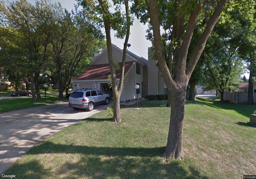
8700 Snapdragon Ln Urbandale, IA 50322
Estimated Value: $181,000 - $188,000
3
Beds
2
Baths
1,094
Sq Ft
$169/Sq Ft
Est. Value
About This Home
This home is located at 8700 Snapdragon Ln, Urbandale, IA 50322 and is currently estimated at $184,974, approximately $169 per square foot. 8700 Snapdragon Ln is a home located in Polk County with nearby schools including Urbandale Middle School, Urbandale High School, and St Pius X School.
Ownership History
Date
Name
Owned For
Owner Type
Purchase Details
Closed on
Mar 29, 2006
Sold by
Gross Paul A and Gross Roberta L
Bought by
Gross Paul A and Gross Roberta L
Current Estimated Value
Home Financials for this Owner
Home Financials are based on the most recent Mortgage that was taken out on this home.
Original Mortgage
$120,000
Outstanding Balance
$68,458
Interest Rate
6.33%
Mortgage Type
Fannie Mae Freddie Mac
Estimated Equity
$116,516
Purchase Details
Closed on
Dec 21, 1999
Sold by
Perrine Daniel G
Bought by
Gross Paul A and Benham Roberta I
Home Financials for this Owner
Home Financials are based on the most recent Mortgage that was taken out on this home.
Original Mortgage
$87,200
Interest Rate
7.87%
Create a Home Valuation Report for This Property
The Home Valuation Report is an in-depth analysis detailing your home's value as well as a comparison with similar homes in the area
Home Values in the Area
Average Home Value in this Area
Purchase History
| Date | Buyer | Sale Price | Title Company |
|---|---|---|---|
| Gross Paul A | -- | None Available | |
| Gross Paul A | $89,500 | -- |
Source: Public Records
Mortgage History
| Date | Status | Borrower | Loan Amount |
|---|---|---|---|
| Open | Gross Paul A | $120,000 | |
| Closed | Gross Paul A | $87,200 |
Source: Public Records
Tax History Compared to Growth
Tax History
| Year | Tax Paid | Tax Assessment Tax Assessment Total Assessment is a certain percentage of the fair market value that is determined by local assessors to be the total taxable value of land and additions on the property. | Land | Improvement |
|---|---|---|---|---|
| 2025 | $2,826 | $189,200 | $24,600 | $164,600 |
| 2024 | $2,826 | $166,500 | $21,400 | $145,100 |
| 2023 | $2,940 | $166,500 | $21,400 | $145,100 |
| 2022 | $2,904 | $145,900 | $19,000 | $126,900 |
| 2021 | $2,894 | $145,900 | $19,000 | $126,900 |
| 2020 | $2,840 | $138,100 | $19,000 | $119,100 |
| 2019 | $2,464 | $138,100 | $19,000 | $119,100 |
| 2018 | $2,370 | $115,700 | $16,900 | $98,800 |
| 2017 | $2,184 | $115,700 | $16,900 | $98,800 |
| 2016 | $2,126 | $105,400 | $16,500 | $88,900 |
| 2015 | $2,126 | $105,400 | $16,500 | $88,900 |
| 2014 | $1,974 | $101,500 | $17,900 | $83,600 |
Source: Public Records
Map
Nearby Homes
- 8626 Alpine Dr Unit D
- 8641 Alpine Dr Unit E
- 4480 87th St Unit 10
- 4473 89th St
- 4460 90th St
- 4221 90th St
- 9107 Tanglewood Dr
- 8914 Valdez Dr
- 8220 Twana Dr
- 4529 91st St
- 4117 83rd St
- 4608 83rd St
- 4708 89th St
- Danbury Plan at Oakwood Haven
- Carson Plan at Oakwood Haven
- Gilmore Plan at Oakwood Haven
- Emerson Plan at Oakwood Haven
- Brighton Plan at Oakwood Haven
- Cambridge Plan at Oakwood Haven
- Aurora Plan at Oakwood Haven
- 8704 Snapdragon Ln
- 8617 Snowberry Ln
- 8701 Ginger Ln
- 8708 Snapdragon Ln
- 8705 Ginger Ln
- 8613 Snowberry Ln
- 8608 Snowberry Ln
- 8709 Ginger Ln
- 8709 Snapdragon Ln
- 8712 Snapdragon Ln
- 8616 Sweetbriar Ln
- 8609 Holly Ln
- 8609 Snowberry Ln
- 8713 Ginger Ln
- 8612 Sweetbriar Ln
- 8604 Snowberry Ln
- 8713 Snapdragon Ln
- 8612 Holly Ln
- 8708 Sweetbriar Ln
- 8605 Snowberry Ln