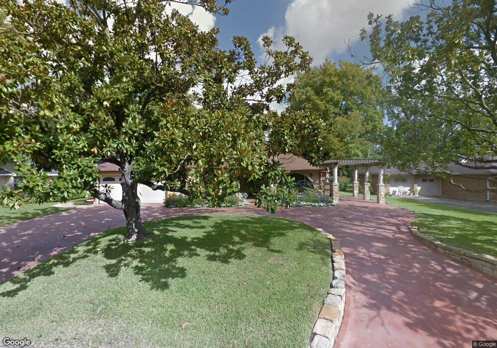
8702 Lanell Ln Houston, TX 77055
Spring Valley NeighborhoodEstimated Value: $1,757,626 - $1,940,000
5
Beds
4
Baths
4,806
Sq Ft
$389/Sq Ft
Est. Value
About This Home
This home is located at 8702 Lanell Ln, Houston, TX 77055 and is currently estimated at $1,871,657, approximately $389 per square foot. 8702 Lanell Ln is a home located in Harris County with nearby schools including Valley Oaks Elementary School, Spring Branch Middle School, and Memorial High School.
Ownership History
Date
Name
Owned For
Owner Type
Purchase Details
Closed on
Aug 28, 1998
Sold by
The Raymond A Mclendon Family Prtnrshp L
Bought by
Brennan Michael E
Current Estimated Value
Home Financials for this Owner
Home Financials are based on the most recent Mortgage that was taken out on this home.
Original Mortgage
$171,000
Outstanding Balance
$35,736
Interest Rate
6.94%
Mortgage Type
Purchase Money Mortgage
Estimated Equity
$1,835,921
Purchase Details
Closed on
Jun 16, 1997
Sold by
Mclendon Raymond A
Bought by
The Raymond A Mclendon Family Prtnrshp L
Create a Home Valuation Report for This Property
The Home Valuation Report is an in-depth analysis detailing your home's value as well as a comparison with similar homes in the area
Home Values in the Area
Average Home Value in this Area
Purchase History
| Date | Buyer | Sale Price | Title Company |
|---|---|---|---|
| Brennan Michael E | -- | First American Title | |
| The Raymond A Mclendon Family Prtnrshp L | -- | -- |
Source: Public Records
Mortgage History
| Date | Status | Borrower | Loan Amount |
|---|---|---|---|
| Open | Brennan Michael E | $171,000 |
Source: Public Records
Tax History Compared to Growth
Tax History
| Year | Tax Paid | Tax Assessment Tax Assessment Total Assessment is a certain percentage of the fair market value that is determined by local assessors to be the total taxable value of land and additions on the property. | Land | Improvement |
|---|---|---|---|---|
| 2025 | $33,010 | $1,760,131 | $1,008,313 | $751,818 |
| 2024 | $33,010 | $1,656,780 | $961,775 | $695,005 |
| 2023 | $33,010 | $1,626,281 | $899,725 | $726,556 |
| 2022 | $32,685 | $1,479,431 | $853,188 | $626,243 |
| 2021 | $31,466 | $1,364,730 | $814,406 | $550,324 |
| 2020 | $31,476 | $1,332,222 | $786,109 | $546,113 |
| 2019 | $34,780 | $1,414,000 | $786,109 | $627,891 |
| 2018 | $5,839 | $1,288,000 | $786,109 | $501,891 |
| 2017 | $25,732 | $1,361,600 | $786,109 | $575,491 |
| 2016 | $23,392 | $1,306,000 | $786,109 | $519,891 |
| 2015 | $15,603 | $1,306,000 | $786,109 | $519,891 |
| 2014 | $15,603 | $1,000,000 | $613,914 | $386,086 |
Source: Public Records
Map
Nearby Homes
- 1441 Bingle Rd
- 8606 Westview Dr
- 1506 Longacre Dr
- 1510 Longacre Dr
- 1526 Ojeman Rd Unit A
- 1314 Caudle Dr
- 1328 Bingle Rd
- 1614 Ojeman Rd Unit E
- 1614 Ojeman Rd Unit J
- 1324 Bingle Rd
- 8706 Strongoak Ln
- 8830 Merlin Dr
- 1607 W Rose Terrace Ln
- 8610 Cedarbrake Dr
- 8521 Merlin Dr
- 1653 Bingle Rd
- 8619 Cedarbrake Dr
- 1720 Sedola Ln
- 1705 Bologna Ln
- 8603 Costmary Ln
- 8706 Lanell Ln
- 8622 Lanell Ln
- 8618 Lanell Ln
- 8710 Lanell Ln
- 8714 Lanell Ln
- 8701 Lanell Ln
- 8616 Lanell Ln
- 8705 Lanell Ln
- 8621 Lanell Ln
- 1500 Longacre Dr
- 8709 Lanell Ln
- 8617 Lanell Ln
- 8717 Tollis St
- 8713 Lanell Ln
- 1501 Ojeman Rd
- 8718 Lanell Ln
- 8721 Tollis St
- 8717 Lanell Ln
- 8702 Cedardale Dr
- 8612 Lanell Ln