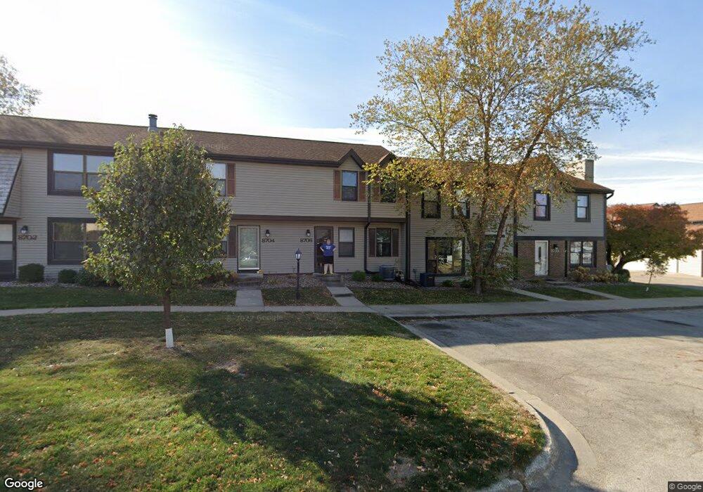
8706 Alpine Dr Unit C Urbandale, IA 50322
Estimated Value: $173,942 - $202,000
2
Beds
2
Baths
1,080
Sq Ft
$169/Sq Ft
Est. Value
About This Home
This home is located at 8706 Alpine Dr Unit C, Urbandale, IA 50322 and is currently estimated at $182,736, approximately $169 per square foot. 8706 Alpine Dr Unit C is a home located in Polk County with nearby schools including Urbandale Middle School, Urbandale High School, and St Pius X School.
Ownership History
Date
Name
Owned For
Owner Type
Purchase Details
Closed on
Jun 25, 2008
Sold by
Sites Jason R and Sites Colleen B
Bought by
Anderson Timothy and Anderson Victoria
Current Estimated Value
Purchase Details
Closed on
May 24, 2001
Sold by
Herteen Patrick J and Herteen Lana R
Bought by
Eads Colleen B and Sites Jason R
Home Financials for this Owner
Home Financials are based on the most recent Mortgage that was taken out on this home.
Original Mortgage
$95,050
Interest Rate
7.23%
Mortgage Type
FHA
Purchase Details
Closed on
Jul 31, 1997
Sold by
Sampson Mary Jane
Bought by
Herteen Patrick J and Herteen Lana R
Home Financials for this Owner
Home Financials are based on the most recent Mortgage that was taken out on this home.
Original Mortgage
$71,250
Interest Rate
7.71%
Create a Home Valuation Report for This Property
The Home Valuation Report is an in-depth analysis detailing your home's value as well as a comparison with similar homes in the area
Home Values in the Area
Average Home Value in this Area
Purchase History
| Date | Buyer | Sale Price | Title Company |
|---|---|---|---|
| Anderson Timothy | $119,500 | None Available | |
| Eads Colleen B | $97,500 | -- | |
| Herteen Patrick J | $74,500 | -- |
Source: Public Records
Mortgage History
| Date | Status | Borrower | Loan Amount |
|---|---|---|---|
| Previous Owner | Eads Colleen B | $95,050 | |
| Previous Owner | Herteen Patrick J | $71,250 |
Source: Public Records
Tax History Compared to Growth
Tax History
| Year | Tax Paid | Tax Assessment Tax Assessment Total Assessment is a certain percentage of the fair market value that is determined by local assessors to be the total taxable value of land and additions on the property. | Land | Improvement |
|---|---|---|---|---|
| 2025 | $2,546 | $163,800 | $21,300 | $142,500 |
| 2024 | $2,546 | $154,400 | $19,800 | $134,600 |
| 2023 | $2,496 | $154,400 | $19,800 | $134,600 |
| 2022 | $2,014 | $128,000 | $16,900 | $111,100 |
| 2021 | $2,048 | $128,000 | $16,900 | $111,100 |
| 2020 | $2,352 | $123,000 | $17,100 | $105,900 |
| 2019 | $2,096 | $123,000 | $17,100 | $105,900 |
| 2018 | $2,008 | $106,400 | $15,800 | $90,600 |
| 2017 | $1,526 | $106,400 | $15,800 | $90,600 |
| 2016 | $1,920 | $98,700 | $15,600 | $83,100 |
| 2015 | $1,920 | $98,700 | $15,600 | $83,100 |
| 2014 | $1,200 | $101,700 | $18,400 | $83,300 |
Source: Public Records
Map
Nearby Homes
- 8626 Alpine Dr Unit D
- 4480 87th St Unit 10
- 8641 Alpine Dr Unit E
- 4473 89th St
- 4460 90th St
- 4221 90th St
- 9107 Tanglewood Dr
- 8220 Twana Dr
- 4529 91st St
- 8914 Valdez Dr
- 4608 83rd St
- 4708 89th St
- Danbury Plan at Oakwood Haven
- Carson Plan at Oakwood Haven
- Gilmore Plan at Oakwood Haven
- Emerson Plan at Oakwood Haven
- Brighton Plan at Oakwood Haven
- Cambridge Plan at Oakwood Haven
- Aurora Plan at Oakwood Haven
- Fairfield Plan at Oakwood Haven
- 8710 Alpine Dr Unit A
- 8616 Alpine Dr Unit C
- 8632 Alpine Dr Unit A
- 8701 Townsend Ave Unit F
- 8708 Alpine Dr Unit B
- 8622 Alpine Dr Unit F
- 4474 87th St
- 8618 Alpine Dr Unit B
- 4476 87th St Unit 12
- 8620 Alpine Dr Unit A
- 4485 88th St
- 4478 87th St
- 4475 88th St Unit 19
- 4477 88th St Unit 18
- 4479 88th St
- 4484 86th St
- 4483 88th St Unit 15
- 8705 Townsend Ave Unit D
- 8624 Alpine Dr Unit E
- 8707 Townsend Ave Unit C