Estimated Value: $228,000 - $365,000
3
Beds
2
Baths
2,688
Sq Ft
$104/Sq Ft
Est. Value
About This Home
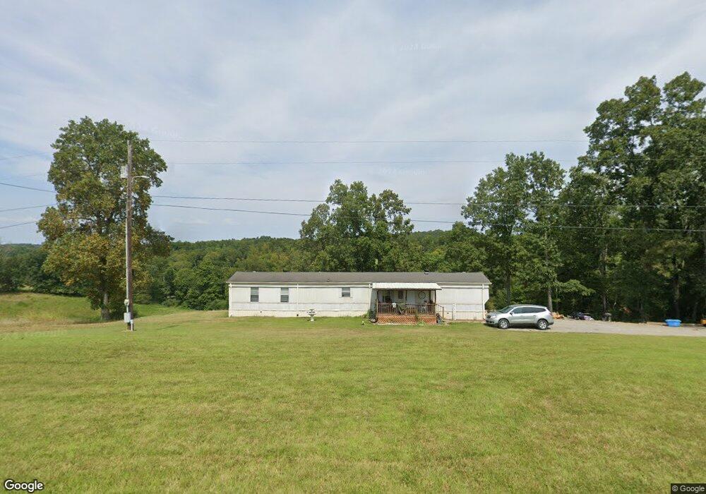
This home is located at 871 Center Point Rd, Dover, TN 37058 and is currently estimated at $279,807, approximately $104 per square foot. 871 Center Point Rd is a home located in Stewart County with nearby schools including Dover Elementary School, Stewart County Middle School, and Stewart County High School.
Ownership History
Date
Name
Owned For
Owner Type
Purchase Details
Closed on
Aug 31, 2018
Sold by
Cheatham Michael
Bought by
Oneal Desiree Page and Oneal Loagn Taylor
Current Estimated Value
Home Financials for this Owner
Home Financials are based on the most recent Mortgage that was taken out on this home.
Original Mortgage
$130,000
Outstanding Balance
$113,378
Interest Rate
4.6%
Mortgage Type
New Conventional
Estimated Equity
$166,429
Purchase Details
Closed on
Oct 10, 2008
Sold by
Bryant David E
Bought by
Cheatham Michal
Home Financials for this Owner
Home Financials are based on the most recent Mortgage that was taken out on this home.
Original Mortgage
$122,550
Interest Rate
5.96%
Mortgage Type
Cash
Purchase Details
Closed on
Apr 4, 1995
Bought by
Bryant David E Wallace Melissa
Purchase Details
Closed on
Mar 18, 1991
Bought by
Henson Patrick J
Purchase Details
Closed on
Jun 6, 1988
Bought by
Henson Patrick J and Henson Norma G
Purchase Details
Closed on
Jan 1, 1980
Create a Home Valuation Report for This Property
The Home Valuation Report is an in-depth analysis detailing your home's value as well as a comparison with similar homes in the area
Home Values in the Area
Average Home Value in this Area
Purchase History
| Date | Buyer | Sale Price | Title Company |
|---|---|---|---|
| Oneal Desiree Page | $128,700 | -- | |
| Cheatham Michal | $129,000 | -- | |
| Bryant David E Wallace Melissa | $42,000 | -- | |
| Henson Patrick J | -- | -- | |
| Henson Patrick J | -- | -- | |
| -- | $30,000 | -- |
Source: Public Records
Mortgage History
| Date | Status | Borrower | Loan Amount |
|---|---|---|---|
| Open | Oneal Desiree Page | $130,000 | |
| Previous Owner | Not Available | $122,550 |
Source: Public Records
Tax History Compared to Growth
Tax History
| Year | Tax Paid | Tax Assessment Tax Assessment Total Assessment is a certain percentage of the fair market value that is determined by local assessors to be the total taxable value of land and additions on the property. | Land | Improvement |
|---|---|---|---|---|
| 2024 | $951 | $64,000 | $5,600 | $58,400 |
| 2023 | $879 | $38,525 | $3,750 | $34,775 |
| 2022 | $879 | $37,225 | $3,750 | $33,475 |
| 2021 | $879 | $37,225 | $3,750 | $33,475 |
| 2020 | $820 | $37,225 | $3,750 | $33,475 |
| 2019 | $820 | $32,175 | $3,750 | $28,425 |
| 2018 | $820 | $32,175 | $3,750 | $28,425 |
| 2017 | $786 | $32,175 | $3,750 | $28,425 |
| 2016 | $786 | $30,825 | $3,750 | $27,075 |
| 2015 | $761 | $30,825 | $3,750 | $27,075 |
| 2014 | $811 | $30,825 | $3,750 | $27,075 |
| 2013 | $811 | $32,823 | $0 | $0 |
Source: Public Records
Map
Nearby Homes
- 1077 Bumpus Mills Rd
- 234 Bazzie Dock Rd
- 330 Durwachter Rd
- 135 Bagsby Hill Ln
- 164 Lewis Cir
- 129 Bagsby Hill Ln
- 0 River Rd
- 211 Lewis Cir
- 111 Mud Hill Rd
- 154 Crains Landing Rd
- 909 Old Highway 79
- 124 Hayes Fork Creek Rd
- 434 Hickman Shores Rd
- 242 Barn Circle Rd
- 554 Hickman Shores Rd
- 376 Joiner Hollow Rd
- 145 Rose Dr
- 0 Stimson Rd Unit 24207833
- 0 Stimson Rd Unit RTC2944698
- 108 Petty St
- 877 Center Point Rd
- 886 Center Point Rd
- 874 Center Point Rd
- 854 Center Point Rd
- 905 Center Point Rd
- 836 Center Point Rd
- 314 Robertson Hill Rd
- 741 Bumpus Mills Rd
- 829 Center Point Rd Unit 827
- 667 Bumpus Mills Rd
- 814 Center Point Rd
- 715 Bumpus Mills Rd
- 742 Bumpus Mills Rd
- 823 Bumpus Mills Rd
- 822 Bumpus Mills Rd
- 655 Bumpus Mills Rd
- 0 Bumpus Mills Rd Unit RTC2361069
- 629 Bumpus Mills Rd
- 838 Bumpus Mills Rd