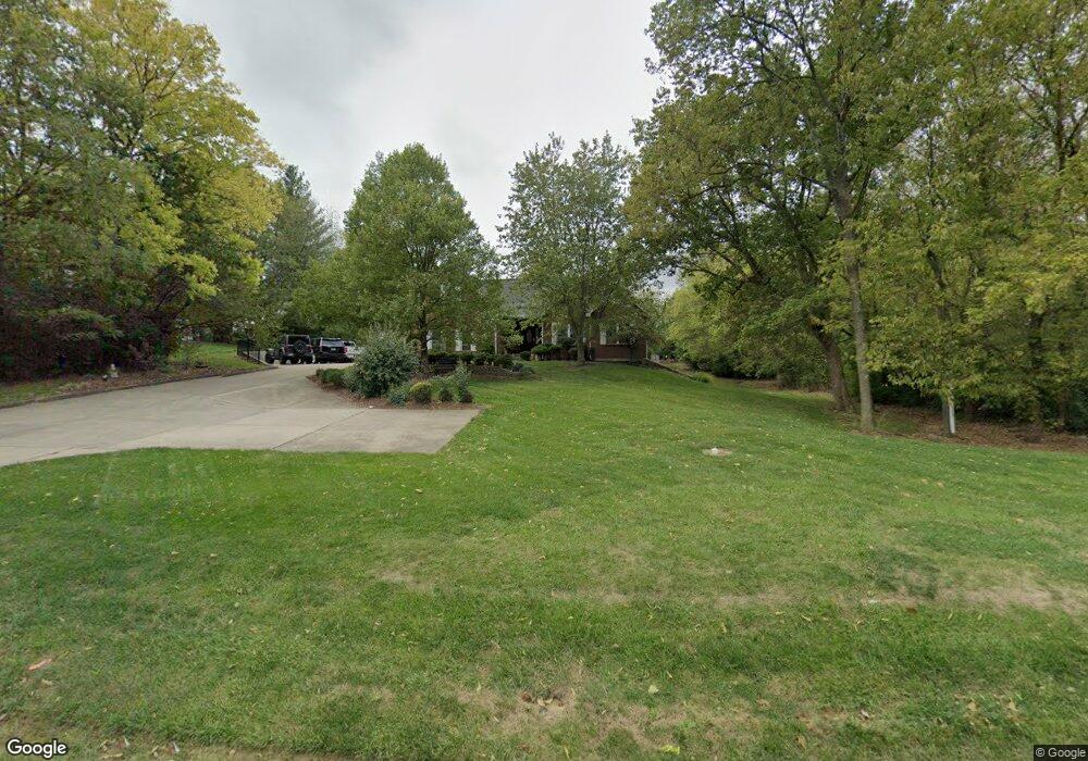
871 Independence Station Rd Independence, KY 41051
Estimated Value: $305,000 - $375,000
4
Beds
3
Baths
1,699
Sq Ft
$199/Sq Ft
Est. Value
About This Home
This home is located at 871 Independence Station Rd, Independence, KY 41051 and is currently estimated at $338,521, approximately $199 per square foot. 871 Independence Station Rd is a home located in Kenton County with nearby schools including Beechgrove Elementary School, Simon Kenton High School, and Zion Christian Academy.
Ownership History
Date
Name
Owned For
Owner Type
Purchase Details
Closed on
Sep 23, 2003
Sold by
Nance Ronald E and Nance Carol Sue
Bought by
Poe Daniel W and Poe Deborah
Current Estimated Value
Home Financials for this Owner
Home Financials are based on the most recent Mortgage that was taken out on this home.
Original Mortgage
$195,000
Outstanding Balance
$90,461
Interest Rate
6.24%
Mortgage Type
Purchase Money Mortgage
Estimated Equity
$248,060
Purchase Details
Closed on
Jul 5, 2000
Sold by
Darby George G
Bought by
Robinson Christopher B and Robinson Donna R
Home Financials for this Owner
Home Financials are based on the most recent Mortgage that was taken out on this home.
Original Mortgage
$15,000
Interest Rate
8.63%
Mortgage Type
New Conventional
Purchase Details
Closed on
Jan 30, 1998
Sold by
Stein Thelma
Bought by
Nance Ronald E and Nance Carol S
Create a Home Valuation Report for This Property
The Home Valuation Report is an in-depth analysis detailing your home's value as well as a comparison with similar homes in the area
Home Values in the Area
Average Home Value in this Area
Purchase History
| Date | Buyer | Sale Price | Title Company |
|---|---|---|---|
| Poe Daniel W | $245,000 | -- | |
| Robinson Christopher B | $20,000 | -- | |
| Nance Ronald E | $28,000 | -- |
Source: Public Records
Mortgage History
| Date | Status | Borrower | Loan Amount |
|---|---|---|---|
| Open | Poe Daniel W | $195,000 | |
| Previous Owner | Robinson Christopher B | $15,000 |
Source: Public Records
Tax History Compared to Growth
Tax History
| Year | Tax Paid | Tax Assessment Tax Assessment Total Assessment is a certain percentage of the fair market value that is determined by local assessors to be the total taxable value of land and additions on the property. | Land | Improvement |
|---|---|---|---|---|
| 2024 | $2,966 | $288,500 | $35,000 | $253,500 |
| 2023 | $3,055 | $288,500 | $35,000 | $253,500 |
| 2022 | $3,186 | $288,500 | $35,000 | $253,500 |
| 2021 | $3,233 | $288,500 | $35,000 | $253,500 |
| 2020 | $3,001 | $264,200 | $35,000 | $229,200 |
| 2019 | $3,522 | $264,200 | $35,000 | $229,200 |
| 2018 | $3,541 | $264,200 | $35,000 | $229,200 |
| 2017 | $3,443 | $264,200 | $35,000 | $229,200 |
| 2015 | $3,350 | $264,200 | $30,000 | $234,200 |
| 2014 | $3,303 | $264,200 | $30,000 | $234,200 |
Source: Public Records
Map
Nearby Homes
- 4109 Willowview Dr
- 4101 Willowview Dr
- 4106 Willowview Dr
- 4102 Willowview Dr
- 4079 Elizabeth Dr
- 4071 Elizabeth Dr
- 1056 Oakwood Ct Unit 3
- 4187 Elder Ct Unit 5
- 4320 Cobblewood Ct
- 9831 Codyview Dr
- 1079 Birch Tree Ln
- 3913 Hunters Green Dr
- 4245 Briarwood Dr Unit 1
- 3947 Woodchase Dr
- 4014 List Ct
- NAPLES Plan at Southwick - The Villas
- HIALEAH Plan at Southwick - The Villas
- SARASOTA Plan at Southwick - The Villas
- BEACHWOOD Plan at Southwick - The Villas
- KENAI Plan at Southwick - The Villas
- 871 Indep-Station
- 867 C Indp Station
- 867 A Indp Station
- 867 Independence Station Rd
- 883 Independence Station Rd
- 1035 Fox Run Dr
- 1039 Fox Run Dr
- 863 Independence Station Rd
- 1031 Fox Run Dr
- 1031 Fox Run Dr Unit 13
- 874 Independence Station Rd
- 1043 Fox Run Dr
- 1043 Fox Run Dr Unit 10
- 876 Independence Station Rd
- 1019 Fox Run Dr
- 1019 Fox Run Dr Unit 16
- 866 Independence Station Rd
- 870 Independence Station Rd
- 1027 Fox Run Dr
- 1047 Fox Run Dr