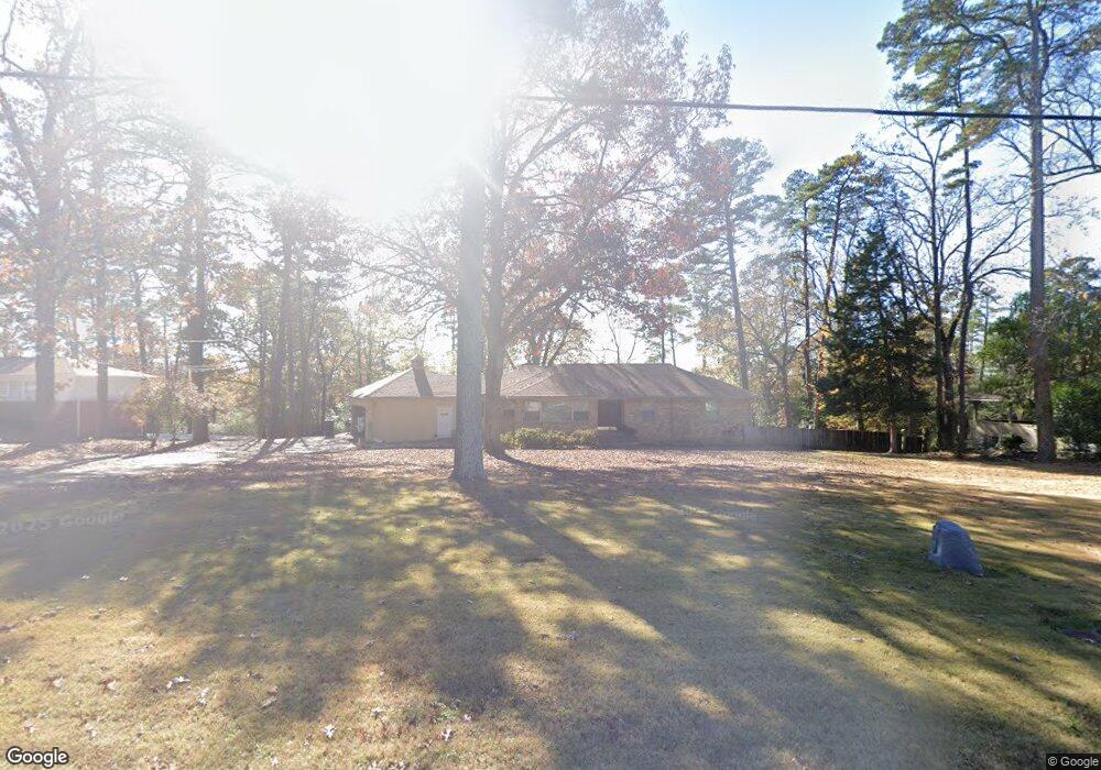
8715 Cantrell Rd Little Rock, AR 72227
Reservoir NeighborhoodEstimated Value: $324,000 - $400,000
--
Bed
3
Baths
3,341
Sq Ft
$109/Sq Ft
Est. Value
About This Home
This home is located at 8715 Cantrell Rd, Little Rock, AR 72227 and is currently estimated at $364,968, approximately $109 per square foot. 8715 Cantrell Rd is a home located in Pulaski County with nearby schools including McDermott Elementary School, J.A. Fair K8 Preparatory School, and Henderson Middle School.
Ownership History
Date
Name
Owned For
Owner Type
Purchase Details
Closed on
Sep 14, 2020
Sold by
Wilkins Jeffrey and Estate Of John Wilkins
Bought by
Wilkins Jeffrey
Current Estimated Value
Purchase Details
Closed on
May 7, 2004
Sold by
Davison Deborah A
Bought by
Wilkins John W
Home Financials for this Owner
Home Financials are based on the most recent Mortgage that was taken out on this home.
Original Mortgage
$155,000
Interest Rate
4.87%
Mortgage Type
Purchase Money Mortgage
Purchase Details
Closed on
Nov 3, 1999
Sold by
Evans Carl R and Evans Patricia A
Bought by
Davison Deborah A
Home Financials for this Owner
Home Financials are based on the most recent Mortgage that was taken out on this home.
Original Mortgage
$140,165
Interest Rate
7.73%
Mortgage Type
Purchase Money Mortgage
Create a Home Valuation Report for This Property
The Home Valuation Report is an in-depth analysis detailing your home's value as well as a comparison with similar homes in the area
Home Values in the Area
Average Home Value in this Area
Purchase History
| Date | Buyer | Sale Price | Title Company |
|---|---|---|---|
| Wilkins Jeffrey | -- | None Available | |
| Wilkins John W | $205,000 | Lenders Title Co | |
| Davison Deborah A | $165,000 | Stewart Title |
Source: Public Records
Mortgage History
| Date | Status | Borrower | Loan Amount |
|---|---|---|---|
| Closed | Wilkins John W | $155,000 | |
| Previous Owner | Davison Deborah A | $140,165 |
Source: Public Records
Tax History Compared to Growth
Tax History
| Year | Tax Paid | Tax Assessment Tax Assessment Total Assessment is a certain percentage of the fair market value that is determined by local assessors to be the total taxable value of land and additions on the property. | Land | Improvement |
|---|---|---|---|---|
| 2025 | $2,387 | $63,853 | $9,600 | $54,253 |
| 2024 | $2,217 | $63,853 | $9,600 | $54,253 |
| 2023 | $2,217 | $63,853 | $9,600 | $54,253 |
| 2022 | $2,133 | $63,853 | $9,600 | $54,253 |
| 2021 | $3,752 | $53,220 | $15,300 | $37,920 |
| 2020 | $1,862 | $53,220 | $15,300 | $37,920 |
| 2019 | $1,317 | $53,220 | $15,300 | $37,920 |
| 2018 | $1,342 | $53,220 | $15,300 | $37,920 |
| 2017 | $1,342 | $53,220 | $15,300 | $37,920 |
| 2016 | $1,342 | $53,460 | $14,950 | $38,510 |
| 2015 | $1,695 | $24,178 | $14,950 | $9,228 |
| 2014 | $1,695 | $24,178 | $14,950 | $9,228 |
Source: Public Records
Map
Nearby Homes
- 107 Claremore Ct
- 9 Misty Ct
- 4 Robinwood Dr
- 4 Hillandale Dr
- 5 Berwyn Dr
- 2714 Charter Oak Dr
- 72 Robinwood Dr
- 2908 Breckenridge Dr
- 32 Old Forge Ct
- 2 Wellington Ct
- 9925 Echo Valley Ct
- 2309 Clapboard Hill Rd
- 3 Ludington Cove
- 2001 Reservoir Rd
- 5 Ludington Cove
- 26 Foxcroft Village Dr
- 2209 Breckenridge Dr
- 27 River Ridge Ct
- 28 River Ridge Cir
- 2200 Andover Ct
- 8711 Cantrell Rd
- 8811 Cantrell Rd
- 2925 Reservoir Rd
- 2913 Reservoir Rd
- 8615 Cantrell Rd
- 8823 Cantrell Rd
- 2901 Reservoir Rd
- 3012 Reservoir Rd
- 3100 Reservoir Rd
- 8601 Cantrell Rd
- 3000 Reservoir Rd
- 2912 Reservoir Rd
- 2912 Reservoir Rd
- 2910 Reservoir Rd
- 8600 Cantrell Rd
- 8527 Cantrell Rd
- 1 Robinwood Dr
- 21 Misty Ct
- 109 Claremore Ct
- 103 Claremore Ct