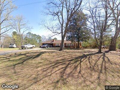
872 Elliott Rd McDonough, GA 30252
Estimated Value: $346,000 - $390,414
3
Beds
2
Baths
1,371
Sq Ft
$273/Sq Ft
Est. Value
About This Home
This home is located at 872 Elliott Rd, McDonough, GA 30252 and is currently estimated at $374,104, approximately $272 per square foot. 872 Elliott Rd is a home located in Henry County with nearby schools including East Lake Elementary School, Union Grove Middle School, and Union Grove High School.
Ownership History
Date
Name
Owned For
Owner Type
Purchase Details
Closed on
Jun 27, 2019
Sold by
Patterson Nancy Carol
Bought by
Tep Allen and Tep Leng B
Current Estimated Value
Home Financials for this Owner
Home Financials are based on the most recent Mortgage that was taken out on this home.
Original Mortgage
$208,000
Outstanding Balance
$185,205
Interest Rate
3.9%
Mortgage Type
New Conventional
Estimated Equity
$186,827
Purchase Details
Closed on
Mar 12, 2014
Sold by
Knight Edna E
Bought by
Patterson Nancy Carol and Edna H Knight I William H
Create a Home Valuation Report for This Property
The Home Valuation Report is an in-depth analysis detailing your home's value as well as a comparison with similar homes in the area
Home Values in the Area
Average Home Value in this Area
Purchase History
| Date | Buyer | Sale Price | Title Company |
|---|---|---|---|
| Tep Allen | $260,000 | -- | |
| Patterson Nancy Carol | $280,000 | -- | |
| Patterson Nancy Carol | -- | -- |
Source: Public Records
Mortgage History
| Date | Status | Borrower | Loan Amount |
|---|---|---|---|
| Open | Tep Allen | $208,000 |
Source: Public Records
Tax History Compared to Growth
Tax History
| Year | Tax Paid | Tax Assessment Tax Assessment Total Assessment is a certain percentage of the fair market value that is determined by local assessors to be the total taxable value of land and additions on the property. | Land | Improvement |
|---|---|---|---|---|
| 2024 | $3,274 | $151,600 | $80,880 | $70,720 |
| 2023 | $3,024 | $145,440 | $77,960 | $67,480 |
| 2022 | $2,578 | $128,440 | $72,080 | $56,360 |
| 2021 | $2,121 | $107,360 | $62,080 | $45,280 |
| 2020 | $3,871 | $99,880 | $58,520 | $41,360 |
| 2019 | $1,801 | $93,280 | $55,600 | $37,680 |
| 2018 | $1,631 | $85,120 | $51,480 | $33,640 |
| 2016 | $211 | $79,120 | $51,600 | $27,520 |
| 2015 | $160 | $78,680 | $59,440 | $19,240 |
| 2014 | -- | $75,960 | $59,440 | $16,520 |
Source: Public Records
Map
Nearby Homes
- 330 Noah Place
- 1650 Campground Rd
- 557 Saltbox Ln
- 265 Enfield Ln
- 565 Elliott Rd
- 1507 Smithfield Dr
- 25 Bryans Dr
- 204 Overland Trail
- 239 Overland Trail
- 119 Crown Springs Dr
- 482 E Lake Rd
- 305 Spooner Dr
- 220 Fannin Ln
- 4041 Andover Cir
- 4038 Andover Cir
- 4045 Andover Cir
- 4044 Andover Cir
- 4032 Andover Cir
- 1585 Elliott Rd
- 872 Elliott Rd
- 902 Elliott Rd
- 842 Elliott Rd
- 893 Elliott Rd
- 1693 Campground Rd
- 897 Elliott Rd
- 930 Elliott Rd
- 926 Elliott Rd
- 1663 Campground Rd
- 1697 Campground Rd
- 400 W Knight Rd
- 934 Elliott Rd
- 1681 Campground Rd
- 790 Elliott Rd
- 386 W Knight Rd
- 914 Elliott Rd
- 812 Elliott Rd
- 773 Elliott Rd
- 1659 Campground Rd
- 772 Elliott Rd