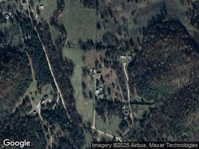
Estimated Value: $228,738 - $534,000
--
Bed
--
Bath
1,630
Sq Ft
$221/Sq Ft
Est. Value
About This Home
This home is located at 872 Gibbs Ln, Noel, MO 64854 and is currently estimated at $359,579, approximately $220 per square foot. 872 Gibbs Ln is a home with nearby schools including McDonald County High School.
Ownership History
Date
Name
Owned For
Owner Type
Purchase Details
Closed on
Dec 18, 2021
Sold by
Hyatt Amanda C
Bought by
Gibbs Harley G
Current Estimated Value
Home Financials for this Owner
Home Financials are based on the most recent Mortgage that was taken out on this home.
Original Mortgage
$95,000
Outstanding Balance
$78,094
Interest Rate
2.34%
Mortgage Type
New Conventional
Estimated Equity
$222,217
Purchase Details
Closed on
Dec 16, 2009
Sold by
First Community Bank
Bought by
Gibbs Harley G and Gibbs Amanda C
Home Financials for this Owner
Home Financials are based on the most recent Mortgage that was taken out on this home.
Original Mortgage
$133,156
Interest Rate
4.9%
Mortgage Type
Seller Take Back
Create a Home Valuation Report for This Property
The Home Valuation Report is an in-depth analysis detailing your home's value as well as a comparison with similar homes in the area
Home Values in the Area
Average Home Value in this Area
Purchase History
| Date | Buyer | Sale Price | Title Company |
|---|---|---|---|
| Gibbs Harley G | -- | None Listed On Document | |
| Gibbs Harley G | -- | None Available |
Source: Public Records
Mortgage History
| Date | Status | Borrower | Loan Amount |
|---|---|---|---|
| Open | Gibbs Harley G | $95,000 | |
| Previous Owner | Gibbs Harley G | $133,156 |
Source: Public Records
Tax History Compared to Growth
Tax History
| Year | Tax Paid | Tax Assessment Tax Assessment Total Assessment is a certain percentage of the fair market value that is determined by local assessors to be the total taxable value of land and additions on the property. | Land | Improvement |
|---|---|---|---|---|
| 2024 | $670 | $15,710 | $0 | $0 |
| 2023 | $670 | $15,710 | $0 | $0 |
| 2022 | $670 | $15,710 | $0 | $0 |
| 2021 | $670 | $15,710 | $0 | $0 |
| 2020 | $592 | $13,850 | $0 | $0 |
| 2019 | $592 | $13,860 | $0 | $0 |
| 2018 | $550 | $13,810 | $0 | $0 |
| 2017 | $550 | $13,810 | $0 | $0 |
| 2016 | $527 | $13,240 | $0 | $0 |
| 2015 | -- | $13,240 | $0 | $0 |
| 2014 | -- | $13,290 | $0 | $0 |
Source: Public Records
Map
Nearby Homes
- 12 S Oakwood Trail
- Lot 1 Oriole Ln
- 132 Nature Trail Ln
- 81 Nature Trail Ln
- 0 Hwy 71 & Hwy 90 Unit 1309809
- Xx Miser Rd
- Tbd Miser Hollow Rd
- 0 Brush Creek Rd Unit 1304431
- Xxx Us 71 Hwy
- 000 State Highway 90
- 000 Brush Creek Rd
- 1143 Pendergraft Rd
- 327 Pendergraft Rd
- 660 & 662 Pendergraft Rd
- 662 & 660 Pendergraft Rd
- 660 Pendergraft Rd
- 418 Sophia Jane Ln
- 0 Peebles Cir Unit 1311170
- 0 Peebles Cir Unit 1311171
- 0 Peebles Cir Unit 1305460
