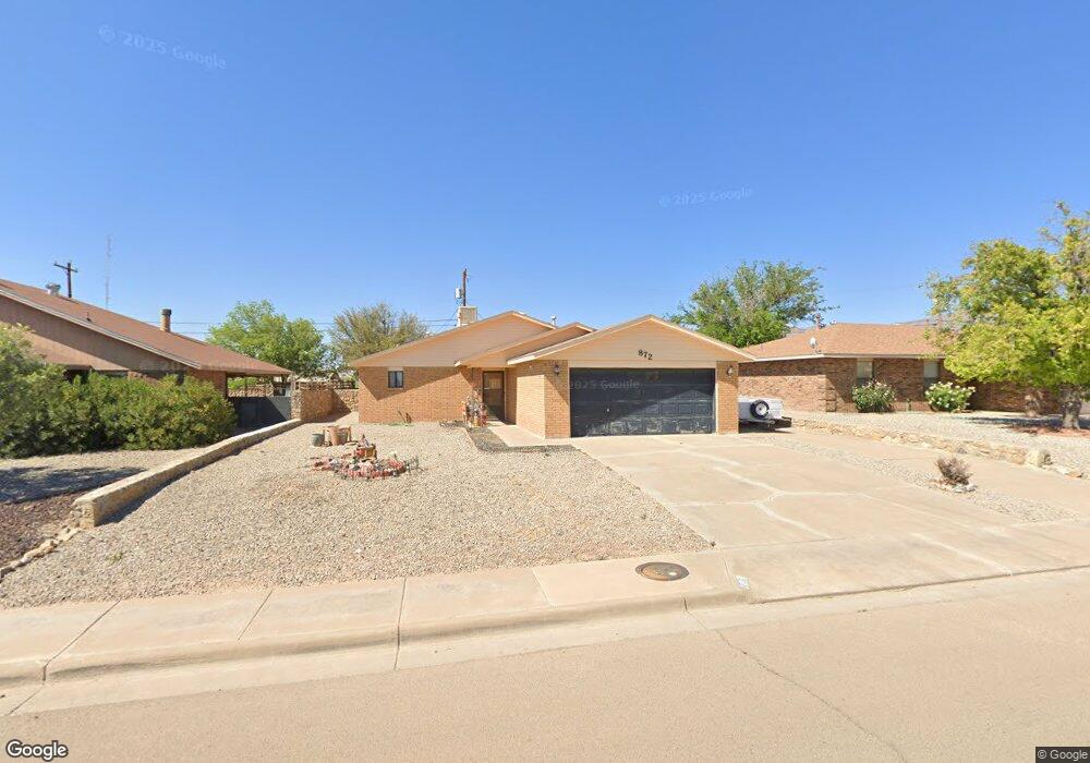
872 Sherwood Dr Alamogordo, NM 88310
Estimated Value: $171,000 - $213,000
3
Beds
2
Baths
1,067
Sq Ft
$180/Sq Ft
Est. Value
About This Home
This home is located at 872 Sherwood Dr, Alamogordo, NM 88310 and is currently estimated at $192,229, approximately $180 per square foot. 872 Sherwood Dr is a home located in Otero County with nearby schools including Yucca Elementary School, Desert Star Elementary School, and Mountain View Middle School.
Ownership History
Date
Name
Owned For
Owner Type
Purchase Details
Closed on
Nov 20, 2008
Sold by
Barela Benny P
Bought by
Barela Benny P and Barela Martha
Current Estimated Value
Home Financials for this Owner
Home Financials are based on the most recent Mortgage that was taken out on this home.
Original Mortgage
$113,114
Outstanding Balance
$55,956
Interest Rate
5.99%
Mortgage Type
FHA
Estimated Equity
$136,273
Purchase Details
Closed on
Apr 24, 2007
Sold by
Tu Victor
Bought by
Barela Benny P
Home Financials for this Owner
Home Financials are based on the most recent Mortgage that was taken out on this home.
Original Mortgage
$108,202
Interest Rate
6.1%
Mortgage Type
FHA
Create a Home Valuation Report for This Property
The Home Valuation Report is an in-depth analysis detailing your home's value as well as a comparison with similar homes in the area
Home Values in the Area
Average Home Value in this Area
Purchase History
| Date | Buyer | Sale Price | Title Company |
|---|---|---|---|
| Barela Benny P | -- | None Available | |
| Barela Benny P | -- | None Available |
Source: Public Records
Mortgage History
| Date | Status | Borrower | Loan Amount |
|---|---|---|---|
| Open | Barela Benny P | $113,114 | |
| Closed | Barela Benny P | $108,202 |
Source: Public Records
Tax History Compared to Growth
Tax History
| Year | Tax Paid | Tax Assessment Tax Assessment Total Assessment is a certain percentage of the fair market value that is determined by local assessors to be the total taxable value of land and additions on the property. | Land | Improvement |
|---|---|---|---|---|
| 2025 | $1,081 | $44,356 | $5,151 | $39,205 |
| 2024 | $1,043 | $43,064 | $5,151 | $37,913 |
| 2023 | $1,029 | $41,810 | $5,151 | $36,659 |
| 2022 | $1,005 | $40,592 | $5,151 | $35,441 |
| 2021 | $1,011 | $40,376 | $5,151 | $35,225 |
| 2020 | $1,011 | $40,376 | $5,151 | $35,225 |
| 2019 | $996 | $39,584 | $5,050 | $34,534 |
| 2018 | $969 | $39,192 | $4,640 | $34,549 |
| 2017 | $891 | $38,424 | $4,549 | $33,871 |
| 2016 | $866 | $37,670 | $0 | $0 |
| 2015 | $847 | $36,931 | $0 | $0 |
| 2014 | -- | $36,208 | $4,287 | $31,921 |
Source: Public Records
Map
Nearby Homes
- 607 Coronado Dr
- 761 Candlewood Ct
- 713 Montwood Ct
- 510 Plainview Dr
- 509 Maricopa Trail
- 505 Maricopa Trail
- 507 Maricopa Trail
- 503 Maricopa Trail
- 501 Maricopa Trail
- 309 Santa fe Dr
- 857 Valencia
- 305 Santa fe Dr
- 1113 San Miguel
- 1076 San Cristo St
- 43 Rose Ave Unit 18-20
- 814 Larkspur St
- 802 1/2 Larkspur St
- 1120 San Carlos St
- 501 Kingston Dr
- 1200 S Florida Ave
- 862 Sherwood Dr
- 882 Sherwood Dr
- 892 Sherwood Dr
- 814 Santa Cruz Dr
- 816 Santa Cruz Dr
- 812 Santa Cruz Dr
- 769 Candlewood Ct
- 900 Santa Cruz Dr
- 770 Candlewood Ct
- 902 Sherwood Dr
- 842 Sherwood Dr
- 810 Santa Cruz Dr
- 765 Candlewood Ct
- 703 Candlewood Ct
- 902 Santa Cruz Dr
- 766 Candlewood Ct
- 912 Sherwood Dr
- 808 Santa Cruz Dr
- 606 Coronado Dr
- 705 Candlewood Ct