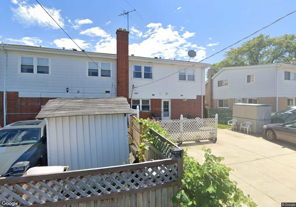
8720 N Shermer Rd Niles, IL 60714
Chesterfield Gardens NeighborhoodEstimated Value: $376,000 - $398,000
4
Beds
4
Baths
1,608
Sq Ft
$240/Sq Ft
Est. Value
About This Home
This home is located at 8720 N Shermer Rd, Niles, IL 60714 and is currently estimated at $385,674, approximately $239 per square foot. 8720 N Shermer Rd is a home located in Cook County with nearby schools including Hynes Elementary School, Golf Middle School, and Niles North High School.
Ownership History
Date
Name
Owned For
Owner Type
Purchase Details
Closed on
Sep 5, 2000
Sold by
Feingold Doris
Bought by
Talya Toma T and Talya Elchwa Y
Current Estimated Value
Home Financials for this Owner
Home Financials are based on the most recent Mortgage that was taken out on this home.
Original Mortgage
$80,000
Interest Rate
7.96%
Purchase Details
Closed on
Nov 3, 1998
Sold by
Feingold Doris
Bought by
Feingold Doris and Doris Feingold Trust
Create a Home Valuation Report for This Property
The Home Valuation Report is an in-depth analysis detailing your home's value as well as a comparison with similar homes in the area
Home Values in the Area
Average Home Value in this Area
Purchase History
| Date | Buyer | Sale Price | Title Company |
|---|---|---|---|
| Talya Toma T | $197,500 | -- | |
| Feingold Doris | -- | -- |
Source: Public Records
Mortgage History
| Date | Status | Borrower | Loan Amount |
|---|---|---|---|
| Previous Owner | Talya Toma T | $80,000 |
Source: Public Records
Tax History Compared to Growth
Tax History
| Year | Tax Paid | Tax Assessment Tax Assessment Total Assessment is a certain percentage of the fair market value that is determined by local assessors to be the total taxable value of land and additions on the property. | Land | Improvement |
|---|---|---|---|---|
| 2024 | $6,225 | $30,000 | $4,000 | $26,000 |
| 2023 | $5,812 | $30,000 | $4,000 | $26,000 |
| 2022 | $5,812 | $30,000 | $4,000 | $26,000 |
| 2021 | $3,215 | $22,539 | $2,785 | $19,754 |
| 2020 | $2,862 | $22,539 | $2,785 | $19,754 |
| 2019 | $2,854 | $25,044 | $2,785 | $22,259 |
| 2018 | $4,380 | $24,078 | $2,418 | $21,660 |
| 2017 | $2,970 | $24,078 | $2,418 | $21,660 |
| 2016 | $5,033 | $24,078 | $2,418 | $21,660 |
| 2015 | $4,247 | $19,767 | $2,052 | $17,715 |
| 2014 | $3,945 | $19,767 | $2,052 | $17,715 |
| 2013 | $4,376 | $19,767 | $2,052 | $17,715 |
Source: Public Records
Map
Nearby Homes
- 8661 N National Ave
- 7226 W Greenleaf St
- 8836 Sayre Ave
- 8630 Waukegan Rd Unit 316
- 8620 Waukegan Rd Unit 308
- 8927 Belleforte Ave
- 7349 W Crain St
- 8760 N Oketo Ave
- 7343 Lake St
- 7332 Davis St
- 7207 Church St
- 8616 N Oleander Ave
- 7401 W Main St
- 7415 W Main St
- 7014 Church St
- 7446 Lake St
- 6901 Church St
- 8929 Cherry Ave
- 8556 N Oriole Ave
- 7215 Beckwith Rd
- 8718 N Shermer Rd
- 8722 N Shermer Rd
- 8716 N Shermer Rd
- 8708 N Shermer Rd
- 8704 N Shermer Rd
- 8742 N Shermer Rd Unit 46
- 8742 N Shermer Rd
- 8700 N Shermer Rd
- 8744 N Shermer Rd
- 8712 N Shermer Rd
- 7136 W Carol Ct
- 7132 W Carol Ct
- 7130 W Carol Ct
- 7138 W Carol Ct
- 7128 W Carol Ct
- 7126 W Carol Ct
- 7112 W Carol Ct
- 7140 W Carol Ct
- 7110 W Carol Ct Unit 3
- 8729 N Shermer Rd