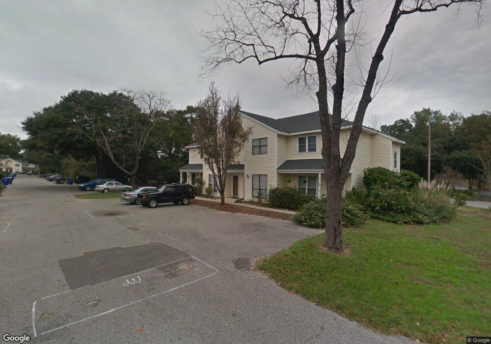
873 Sedge Ct Charleston, SC 29412
James Island NeighborhoodEstimated Value: $260,000 - $313,000
2
Beds
1
Bath
992
Sq Ft
$286/Sq Ft
Est. Value
About This Home
This home is located at 873 Sedge Ct, Charleston, SC 29412 and is currently estimated at $283,797, approximately $286 per square foot. 873 Sedge Ct is a home located in Charleston County with nearby schools including Harbor View Elementary School, Camp Road Middle, and James Island Charter High School.
Ownership History
Date
Name
Owned For
Owner Type
Purchase Details
Closed on
Aug 27, 2020
Sold by
360 West Indian Llc
Bought by
Rousse Christopher T
Current Estimated Value
Home Financials for this Owner
Home Financials are based on the most recent Mortgage that was taken out on this home.
Original Mortgage
$148,830
Interest Rate
2.9%
Mortgage Type
New Conventional
Purchase Details
Closed on
May 6, 2015
Sold by
306 West Indian Llc
Bought by
Unsworth Stephen A
Home Financials for this Owner
Home Financials are based on the most recent Mortgage that was taken out on this home.
Original Mortgage
$603,000
Interest Rate
3.92%
Mortgage Type
New Conventional
Purchase Details
Closed on
Oct 15, 2014
Sold by
Wichmann Corporation
Bought by
306 West Indian Llc
Create a Home Valuation Report for This Property
The Home Valuation Report is an in-depth analysis detailing your home's value as well as a comparison with similar homes in the area
Home Values in the Area
Average Home Value in this Area
Purchase History
| Date | Buyer | Sale Price | Title Company |
|---|---|---|---|
| Rousse Christopher T | $154,000 | Cooperative Title Llc | |
| Unsworth Stephen A | -- | -- | |
| 306 West Indian Llc | $535,000 | -- |
Source: Public Records
Mortgage History
| Date | Status | Borrower | Loan Amount |
|---|---|---|---|
| Previous Owner | Rousse Christopher T | $148,830 | |
| Previous Owner | Unsworth Stephen A | $603,000 |
Source: Public Records
Tax History Compared to Growth
Tax History
| Year | Tax Paid | Tax Assessment Tax Assessment Total Assessment is a certain percentage of the fair market value that is determined by local assessors to be the total taxable value of land and additions on the property. | Land | Improvement |
|---|---|---|---|---|
| 2024 | $910 | $6,160 | $0 | $0 |
| 2023 | $910 | $6,160 | $0 | $0 |
| 2022 | $821 | $6,160 | $0 | $0 |
| 2021 | $2,508 | $9,240 | $0 | $0 |
| 2020 | $1,706 | $6,210 | $0 | $0 |
| 2019 | $1,566 | $5,400 | $0 | $0 |
| 2017 | $1,499 | $5,400 | $0 | $0 |
| 2016 | $1,453 | $5,400 | $0 | $0 |
| 2015 | $1,390 | $5,400 | $0 | $0 |
| 2014 | $1,341 | $0 | $0 | $0 |
| 2011 | -- | $0 | $0 | $0 |
Source: Public Records
Map
Nearby Homes
- 1418 Kentwood Cir
- 1453 Camp Rd
- 1402 Camp Rd Unit 5E
- 1402 Camp Rd Unit 6E
- 1402 Camp Rd Unit 1H
- 1402 Camp Rd Unit 8B
- 1402 Camp Rd Unit 9C
- 1402 Camp Rd Unit 12F
- 17 S Anderson Ave Unit A,B,C, D
- 1 S Anderson Ave
- 27 Brockman Dr Unit 27B
- 27 Brockman Dr Unit 27C
- 1 Maplecrest Dr
- 14 Maplecrest Dr
- 1014 Arborwood Dr
- 1359 White House Blvd
- 9 Maplecrest Dr
- 1 Willingham Ct
- 50 Held Cir Unit C
- 1336 Briarfield Ave
- 873 Sedge Ct
- 873 Sedge Ct Unit 29
- 873 Sedge Ct Unit B
- 873 Sedge Ct Unit D
- 873 Sedge Ct Unit A
- 873 Sedge Ct Unit 30
- 1406 Dove Run Dr
- 1406 Dove Run Dr Unit 26
- 1406 Dove Run Dr Unit 28
- 1406 Dove Run Dr Unit D
- 1406 Dove Run Dr Unit 27
- 1406 Dove Run Dr Unit C
- 1406 Dove Run Dr Unit B
- 1406 Dove Run Dr Unit A
- 1410 Dove Run Dr Unit 23
- 1410 Dove Run Dr
- 1410 Dove Run Dr Unit 21
- 1410 Dove Run Dr
- 1410 Dove Run Dr Unit C
- 1410 Dove Run Dr Unit A