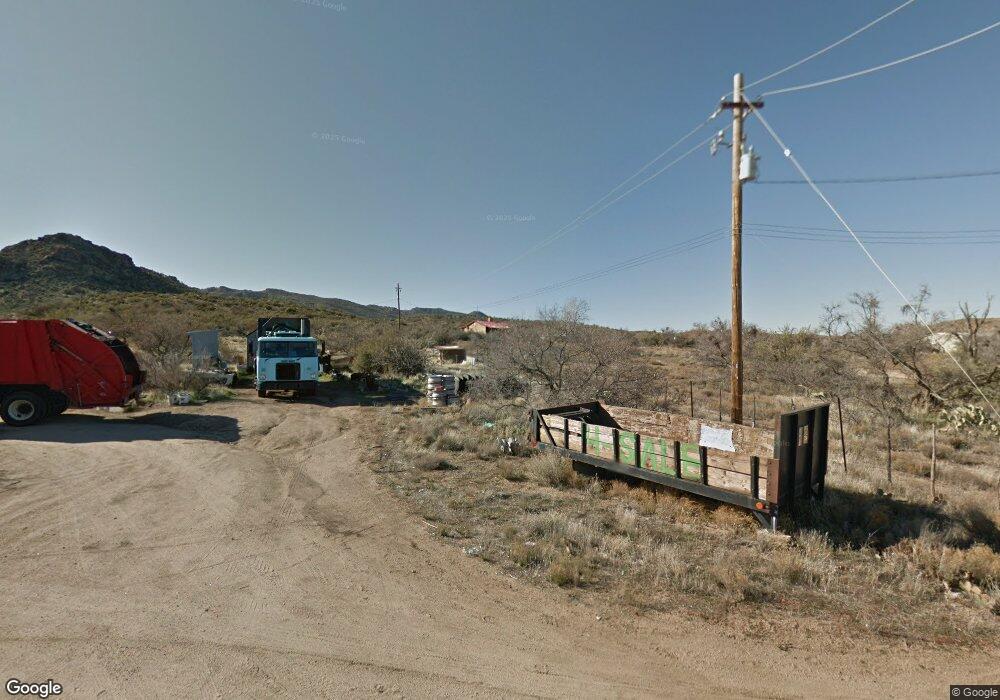
8730 S Carson Rd Kirkland, AZ 86332
Estimated Value: $250,000 - $406,000
--
Bed
--
Bath
1,238
Sq Ft
$254/Sq Ft
Est. Value
About This Home
This home is located at 8730 S Carson Rd, Kirkland, AZ 86332 and is currently estimated at $314,333, approximately $253 per square foot. 8730 S Carson Rd is a home with nearby schools including Hillside Elementary School.
Ownership History
Date
Name
Owned For
Owner Type
Purchase Details
Closed on
Sep 21, 2020
Sold by
Ann Johnson Charlotte
Bought by
Blackmore Trey J and Sherwood Cheyenne
Current Estimated Value
Home Financials for this Owner
Home Financials are based on the most recent Mortgage that was taken out on this home.
Original Mortgage
$171,830
Outstanding Balance
$152,488
Interest Rate
2.9%
Mortgage Type
FHA
Estimated Equity
$161,845
Purchase Details
Closed on
Aug 28, 2019
Sold by
Johnson Thomas Waldroup
Bought by
Johnson Charlotte Ann
Create a Home Valuation Report for This Property
The Home Valuation Report is an in-depth analysis detailing your home's value as well as a comparison with similar homes in the area
Home Values in the Area
Average Home Value in this Area
Purchase History
| Date | Buyer | Sale Price | Title Company |
|---|---|---|---|
| Blackmore Trey J | $175,000 | Pioneer Title Agency | |
| Johnson Charlotte Ann | -- | None Available |
Source: Public Records
Mortgage History
| Date | Status | Borrower | Loan Amount |
|---|---|---|---|
| Open | Blackmore Trey J | $171,830 |
Source: Public Records
Tax History Compared to Growth
Tax History
| Year | Tax Paid | Tax Assessment Tax Assessment Total Assessment is a certain percentage of the fair market value that is determined by local assessors to be the total taxable value of land and additions on the property. | Land | Improvement |
|---|---|---|---|---|
| 2026 | $878 | $23,463 | -- | -- |
| 2024 | $790 | $22,190 | -- | -- |
| 2023 | $857 | $19,341 | $2,172 | $17,169 |
| 2022 | $790 | $14,767 | $2,144 | $12,623 |
| 2021 | $817 | $14,860 | $1,772 | $13,088 |
| 2020 | $808 | $0 | $0 | $0 |
| 2019 | $856 | $0 | $0 | $0 |
| 2018 | $832 | $0 | $0 | $0 |
| 2017 | $800 | $0 | $0 | $0 |
| 2016 | $727 | $0 | $0 | $0 |
| 2015 | -- | $0 | $0 | $0 |
| 2014 | -- | $0 | $0 | $0 |
Source: Public Records
Map
Nearby Homes
- 25960 W Old Granthams Rd
- 0000 S Monica Mine Rd
- 0000 S Monica Mine Rd Unit 5
- 0 S Bent Spur Rd Unit PAR1064097
- 0 S Bent Spur Rd Unit 69-B 6699080
- 44a W Traveler Way
- 44 W Traveler Way
- 44c W Traveler Way
- 44b W Traveler Way
- 44C Traveler Way Unit 44C
- 44B Traveler Way Unit 44B
- 44A Traveler Way Unit 44A
- 44 Traveler Way Unit 44
- 0 W Traveler Way Unit PAR1069656
- 0 W Traveler Way Unit PAR1069655
- 0 W Traveler Way Unit 50C 6801260
- 0 W Traveler Way Unit PAR1069654
- 0 W Traveler Way Unit 50B 6801255
- 0 W Traveler Way Unit 50A 6801249
- 0 W Traveler Way Unit PAR1069595
- 26162 Pecks Peak Rd
- 26162 W Pecks Peak Rd
- 26595 W Portis Rd
- 26080 W Pecks Peak Rd
- 0 Wavy Mane Rd Unit 73 5067143
- 0 Wavy Mane Rd Unit 976042
- 26175 W Pecks Peak Rd
- 26235 W Portis Rd
- 8990 Date Creek Rd
- 8875 S Date Creek Rd
- 25960 W Old Granthams Rd
- 8945 S Date
- 8630 S Date Creek Rd
- 25995 W Portis Rd
- 8550 S Date Creek Rd
- 7 Date Creek Rd
- 8755 S Date Creek Rd
- 0 Date Creek Rd Unit PAR903846
- 0 Date Creek Rd Unit PAR914138
- 0 Date Creek Rd Unit PAR914134
