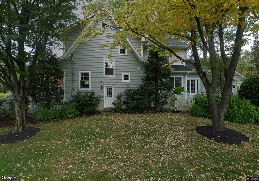
874 Dorian Rd Westfield, NJ 07090
Estimated Value: $1,146,000 - $1,528,000
--
Bed
--
Bath
2,870
Sq Ft
$487/Sq Ft
Est. Value
About This Home
This home is located at 874 Dorian Rd, Westfield, NJ 07090 and is currently estimated at $1,399,065, approximately $487 per square foot. 874 Dorian Rd is a home located in Union County with nearby schools including McKinley Elementary School, Westfield Senior High School, and Holy Trinity School.
Ownership History
Date
Name
Owned For
Owner Type
Purchase Details
Closed on
Jun 24, 2021
Sold by
Seligmann Maxwell and Seligmann Jacqueline
Bought by
Desimone Christopher Frank and Desimone Chelsea Marie
Current Estimated Value
Home Financials for this Owner
Home Financials are based on the most recent Mortgage that was taken out on this home.
Original Mortgage
$825,000
Outstanding Balance
$746,935
Interest Rate
2.9%
Mortgage Type
New Conventional
Estimated Equity
$652,130
Purchase Details
Closed on
Apr 13, 2018
Sold by
Milstein Alan and Johnson Heather
Bought by
Seligann Maxwell and Giles Jacqueline
Home Financials for this Owner
Home Financials are based on the most recent Mortgage that was taken out on this home.
Original Mortgage
$700,000
Interest Rate
4.25%
Mortgage Type
Adjustable Rate Mortgage/ARM
Purchase Details
Closed on
Jan 11, 2001
Sold by
Bentley Carole L
Bought by
Milstein Alan and Johnson Heather
Home Financials for this Owner
Home Financials are based on the most recent Mortgage that was taken out on this home.
Original Mortgage
$33,400
Interest Rate
7.52%
Mortgage Type
Credit Line Revolving
Create a Home Valuation Report for This Property
The Home Valuation Report is an in-depth analysis detailing your home's value as well as a comparison with similar homes in the area
Home Values in the Area
Average Home Value in this Area
Purchase History
| Date | Buyer | Sale Price | Title Company |
|---|---|---|---|
| Desimone Christopher Frank | $1,100,000 | Acres Land Title Agency Inc | |
| Seligann Maxwell | $985,000 | Old Rpeublic Natl Title Ins | |
| Milstein Alan | $326,000 | -- |
Source: Public Records
Mortgage History
| Date | Status | Borrower | Loan Amount |
|---|---|---|---|
| Open | Desimone Christopher Frank | $825,000 | |
| Previous Owner | Seligann Maxwell | $700,000 | |
| Previous Owner | Milstein Alan | $33,400 |
Source: Public Records
Tax History Compared to Growth
Tax History
| Year | Tax Paid | Tax Assessment Tax Assessment Total Assessment is a certain percentage of the fair market value that is determined by local assessors to be the total taxable value of land and additions on the property. | Land | Improvement |
|---|---|---|---|---|
| 2025 | $21,489 | $954,200 | $529,900 | $424,300 |
| 2024 | $21,050 | $954,200 | $529,900 | $424,300 |
| 2023 | $21,050 | $954,200 | $529,900 | $424,300 |
| 2022 | $20,611 | $954,200 | $529,900 | $424,300 |
| 2021 | $20,639 | $954,200 | $529,900 | $424,300 |
| 2020 | $20,592 | $954,200 | $529,900 | $424,300 |
| 2019 | $20,515 | $954,200 | $529,900 | $424,300 |
| 2018 | $15,972 | $171,800 | $65,500 | $106,300 |
| 2017 | $15,885 | $171,800 | $65,500 | $106,300 |
| 2016 | $14,943 | $165,500 | $65,500 | $100,000 |
| 2015 | $14,645 | $165,500 | $65,500 | $100,000 |
| 2014 | $14,162 | $165,500 | $65,500 | $100,000 |
Source: Public Records
Map
Nearby Homes
- 1466 Lamberts Mill Rd
- 314 Highgate Ave
- 119 Lamberts Mill Rd
- 2154 W Broad St
- 525 Edgar Rd
- 524 Edgar Rd
- 2 Brookside Ct
- 614 Dorian Rd
- 676 Vermont St
- 2116 Newark Ave
- 1933 W Broad St
- 2 Dutch Ln
- 724 South Ave W Unit 724A
- 538 Westfield Ave
- 1933 Mary Ellen Ln
- 522 Boulevard
- 834 Tice Place
- 350 W Dudley Ave
- 57 Rambling Dr
- 814 Summit Ave
- 321 Lamberts Mill Rd
- 866 Dorian Rd
- 884 Dorian Rd
- 310 Saint Johns Place
- 321 Saint Johns Place
- 862 Dorian Rd
- 311 Lamberts Mill Rd
- 858 Dorian Rd
- 771 Warren St
- 871 Dorian Rd
- 869 Dorian Rd
- 765 Warren St
- 777 Warren St
- 867 Dorian Rd
- 320 Highgate Ave
- 759 Warren St
- 881 Dorian Rd
- 856 Dorian Rd
- 1466 Lamberts Mill Rd Unit 1
- 785 Warren St