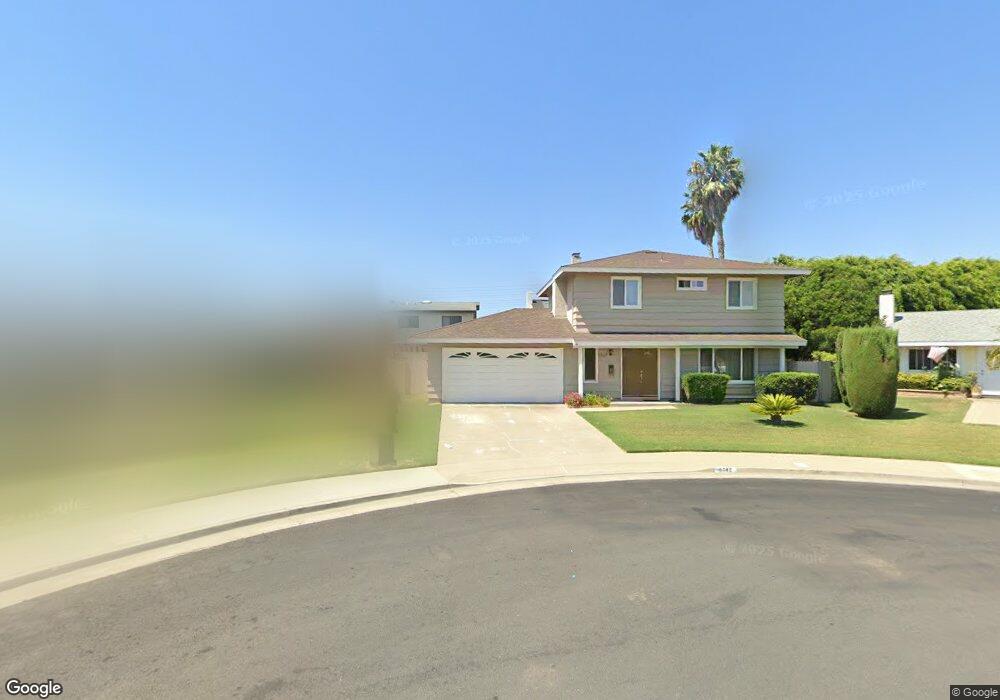
8742 Lanark Cir Huntington Beach, CA 92646
Estimated Value: $1,273,000 - $1,412,000
4
Beds
3
Baths
1,624
Sq Ft
$826/Sq Ft
Est. Value
About This Home
This home is located at 8742 Lanark Cir, Huntington Beach, CA 92646 and is currently estimated at $1,341,989, approximately $826 per square foot. 8742 Lanark Cir is a home located in Orange County with nearby schools including William T. Newland Elementary, Talbert Middle School, and Huntington Beach High School.
Ownership History
Date
Name
Owned For
Owner Type
Purchase Details
Closed on
Oct 26, 2022
Sold by
Arakaki Family Trust
Bought by
Arakaki Jennie N and Arakaki Ryan G
Current Estimated Value
Home Financials for this Owner
Home Financials are based on the most recent Mortgage that was taken out on this home.
Original Mortgage
$475,000
Outstanding Balance
$460,190
Interest Rate
6.92%
Mortgage Type
New Conventional
Estimated Equity
$881,799
Create a Home Valuation Report for This Property
The Home Valuation Report is an in-depth analysis detailing your home's value as well as a comparison with similar homes in the area
Home Values in the Area
Average Home Value in this Area
Purchase History
| Date | Buyer | Sale Price | Title Company |
|---|---|---|---|
| Arakaki Jennie N | -- | Lawyers Title |
Source: Public Records
Mortgage History
| Date | Status | Borrower | Loan Amount |
|---|---|---|---|
| Open | Arakaki Jennie N | $475,000 |
Source: Public Records
Tax History Compared to Growth
Tax History
| Year | Tax Paid | Tax Assessment Tax Assessment Total Assessment is a certain percentage of the fair market value that is determined by local assessors to be the total taxable value of land and additions on the property. | Land | Improvement |
|---|---|---|---|---|
| 2025 | $3,529 | $331,697 | $130,125 | $201,572 |
| 2024 | $3,529 | $287,077 | $127,573 | $159,504 |
| 2023 | $2,895 | $238,004 | $125,071 | $112,933 |
| 2022 | $2,848 | $233,338 | $122,619 | $110,719 |
| 2021 | $2,793 | $228,763 | $120,214 | $108,549 |
| 2020 | $2,775 | $226,418 | $118,982 | $107,436 |
| 2019 | $2,721 | $221,979 | $116,649 | $105,330 |
| 2018 | $2,669 | $217,627 | $114,362 | $103,265 |
| 2017 | $2,626 | $213,360 | $112,119 | $101,241 |
| 2016 | $2,519 | $209,177 | $109,921 | $99,256 |
| 2015 | $2,480 | $206,035 | $108,269 | $97,766 |
| 2014 | $2,430 | $202,000 | $106,149 | $95,851 |
Source: Public Records
Map
Nearby Homes
- 19352 Sailwind Ln
- 19051 Randi Ln
- 18621 Santa Ramona St
- 8801 Albatross Dr
- 18566 Santa Andrea St
- 19202 Hickory Ln
- 8582 Salt Lake Dr
- 18601 Newland St Unit 12
- 18601 Newland St Unit 71
- 18601 Newland St Unit 59
- 18601 Newland St Unit 97
- 18862 Carolyn Ln
- 8291 Polk Cir
- 19111 Colchester Ln
- 18785 Heavenwood Cir Unit C171
- 8120 Islandview Cir Unit C
- 18683 Applewood Cir Unit 16
- 18815 Thornwood Cir Unit 32
- 9172 Veronica Dr
- 19110 Beachcrest Ln Unit E
- 8751 Lanark Cir
- 8752 Lanark Cir
- 19042 Homestead Ln
- 19052 Homestead Ln
- 19032 Homestead Ln
- 8761 Lanark Cir
- 8762 Lanark Cir
- 19062 Homestead Ln
- 8752 Garfield Ave
- 8751 Lauder Cir
- 8762 Garfield Ave
- 8781 Lanark Cir
- 8712 Garfield Ave
- 8782 Lanark Cir
- 19082 Homestead Ln
- 8761 Lauder Cir
- 8742 Garfield Ave
- 8722 Garfield Ave
- 8782 Garfield Ave
- 8742 Lauder Cir