Estimated Value: $163,000 - $184,020
3
Beds
1
Bath
999
Sq Ft
$175/Sq Ft
Est. Value
About This Home
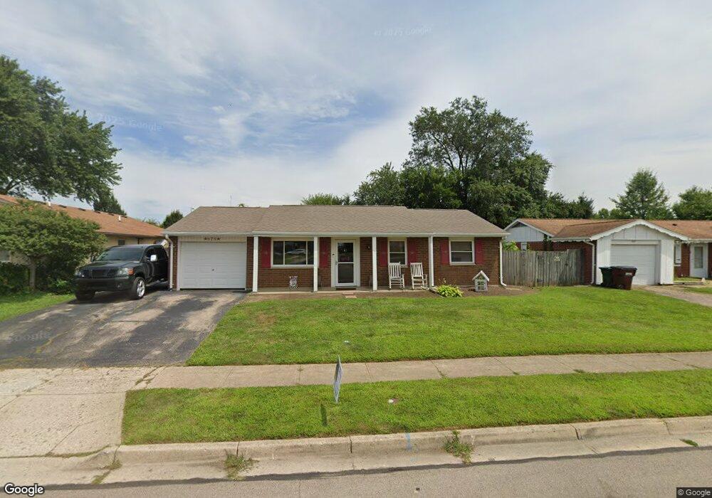
This home is located at 875 Colorado Dr, Xenia, OH 45385 and is currently estimated at $175,005, approximately $175 per square foot. 875 Colorado Dr is a home located in Greene County with nearby schools including Xenia High School and Summit Academy Community School for Alternative Learners - Xenia.
Ownership History
Date
Name
Owned For
Owner Type
Purchase Details
Closed on
Nov 29, 2012
Sold by
Manns Eric R and Manns Jean E
Bought by
Ault Mollie L
Current Estimated Value
Home Financials for this Owner
Home Financials are based on the most recent Mortgage that was taken out on this home.
Original Mortgage
$64,313
Outstanding Balance
$44,306
Interest Rate
3.25%
Mortgage Type
FHA
Estimated Equity
$130,699
Purchase Details
Closed on
Mar 15, 1999
Sold by
Manns Leroy R
Bought by
Manns Eric R and Manns Jean E
Create a Home Valuation Report for This Property
The Home Valuation Report is an in-depth analysis detailing your home's value as well as a comparison with similar homes in the area
Home Values in the Area
Average Home Value in this Area
Purchase History
| Date | Buyer | Sale Price | Title Company |
|---|---|---|---|
| Ault Mollie L | $65,500 | None Available | |
| Manns Eric R | -- | -- |
Source: Public Records
Mortgage History
| Date | Status | Borrower | Loan Amount |
|---|---|---|---|
| Open | Ault Mollie L | $64,313 |
Source: Public Records
Tax History Compared to Growth
Tax History
| Year | Tax Paid | Tax Assessment Tax Assessment Total Assessment is a certain percentage of the fair market value that is determined by local assessors to be the total taxable value of land and additions on the property. | Land | Improvement |
|---|---|---|---|---|
| 2024 | $1,842 | $44,180 | $10,680 | $33,500 |
| 2023 | $1,842 | $44,180 | $10,680 | $33,500 |
| 2022 | $1,529 | $31,260 | $6,280 | $24,980 |
| 2021 | $1,549 | $31,260 | $6,280 | $24,980 |
| 2020 | $1,483 | $31,260 | $6,280 | $24,980 |
| 2019 | $1,308 | $25,960 | $6,240 | $19,720 |
| 2018 | $1,313 | $25,960 | $6,240 | $19,720 |
| 2017 | $1,199 | $25,960 | $6,240 | $19,720 |
| 2016 | $1,200 | $23,280 | $6,240 | $17,040 |
| 2015 | $1,203 | $23,280 | $6,240 | $17,040 |
| 2014 | $1,151 | $23,280 | $6,240 | $17,040 |
Source: Public Records
Map
Nearby Homes
- 1829 Gayhart Dr
- 1908 Whitt St
- 2257 Maryland Dr
- 1769 Gayhart Dr
- 1107 Arkansas Dr
- 1255 Colorado Dr
- 2142 Michigan Dr
- 1403 Texas Dr
- 2345 Tennessee Dr
- 1866 Roxbury Dr
- 2545 Harmony Dr
- 2499 Jenny Marie Dr
- 414 Whisper Ln
- 1653 Seneca Dr
- 1778 Arapaho Dr
- 2421 Louisiana Dr
- 2540 Jenny Marie Dr
- 1618 Navajo Dr
- 2758 Wyoming Dr
- 2540 Cornwall Dr
- 861 Colorado Dr
- 887 Colorado Dr
- 849 Colorado Dr
- 903 Colorado Dr
- 2068 Carolina Dr
- 2071 Carolina Dr
- 921 Colorado Dr
- 837 Colorado Dr
- 2084 Carolina Dr
- 933 Colorado Dr
- 2069 Alabama Dr
- 2072 Virginia Dr
- 2095 Carolina Dr
- 2083 Alabama Dr
- 2110 Carolina Dr
- 949 Colorado Dr
- 2092 Virginia Dr
- 2113 Carolina Dr
- 2099 Alabama Dr
- 2122 Carolina Dr