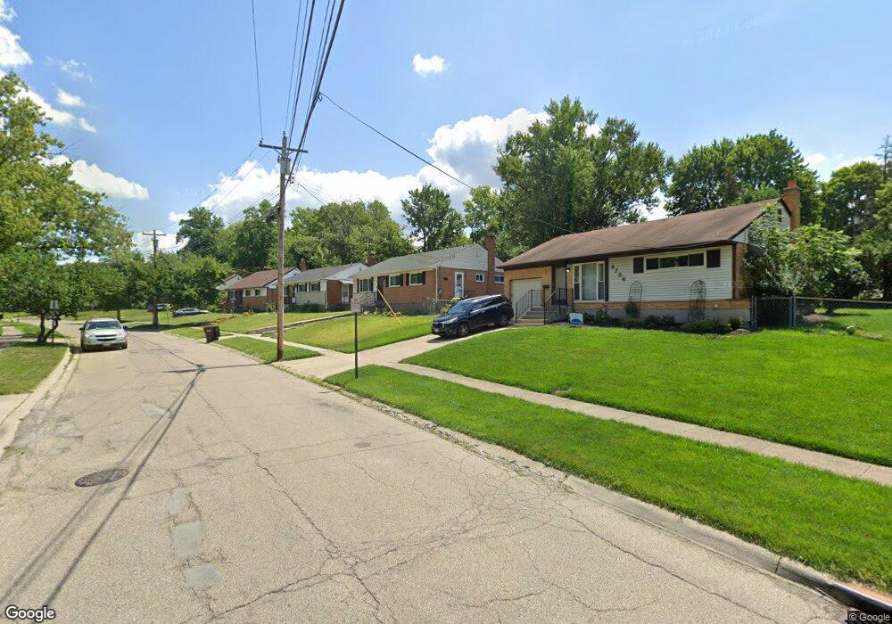
8768 Mockingbird Ln Cincinnati, OH 45231
Finneytown NeighborhoodEstimated Value: $233,000 - $248,000
3
Beds
2
Baths
1,760
Sq Ft
$136/Sq Ft
Est. Value
About This Home
This home is located at 8768 Mockingbird Ln, Cincinnati, OH 45231 and is currently estimated at $239,650, approximately $136 per square foot. 8768 Mockingbird Ln is a home located in Hamilton County with nearby schools including Finneytown Elementary School, Finneytown Secondary Campus, and Northside Preparatory Academy.
Ownership History
Date
Name
Owned For
Owner Type
Purchase Details
Closed on
Aug 16, 2021
Sold by
Bates Deanna T and Hawkins Eddie
Bought by
Johnson Linda Diane
Current Estimated Value
Home Financials for this Owner
Home Financials are based on the most recent Mortgage that was taken out on this home.
Original Mortgage
$186,558
Outstanding Balance
$167,893
Interest Rate
2.8%
Mortgage Type
FHA
Estimated Equity
$71,757
Purchase Details
Closed on
May 27, 1999
Sold by
Simpson Darin S and Simpson Amy S
Bought by
Bates Deanna T
Home Financials for this Owner
Home Financials are based on the most recent Mortgage that was taken out on this home.
Original Mortgage
$69,375
Interest Rate
6.94%
Purchase Details
Closed on
Dec 30, 1993
Sold by
Haag David E and Haag Mindy G
Bought by
Simpson Darin S and Simpson Amy S
Home Financials for this Owner
Home Financials are based on the most recent Mortgage that was taken out on this home.
Original Mortgage
$73,200
Interest Rate
7.35%
Create a Home Valuation Report for This Property
The Home Valuation Report is an in-depth analysis detailing your home's value as well as a comparison with similar homes in the area
Home Values in the Area
Average Home Value in this Area
Purchase History
| Date | Buyer | Sale Price | Title Company |
|---|---|---|---|
| Johnson Linda Diane | $190,000 | None Available | |
| Bates Deanna T | $93,500 | Titlequest Agency Inc | |
| Simpson Darin S | -- | Midland Title Security Inc |
Source: Public Records
Mortgage History
| Date | Status | Borrower | Loan Amount |
|---|---|---|---|
| Open | Johnson Linda Diane | $186,558 | |
| Previous Owner | Bates Deanna T | $69,375 | |
| Previous Owner | Simpson Darin S | $73,200 | |
| Closed | Bates Deanna T | $24,250 |
Source: Public Records
Tax History
| Year | Tax Paid | Tax Assessment Tax Assessment Total Assessment is a certain percentage of the fair market value that is determined by local assessors to be the total taxable value of land and additions on the property. | Land | Improvement |
|---|---|---|---|---|
| 2025 | $4,635 | $66,501 | $10,308 | $56,193 |
| 2024 | $4,528 | $66,501 | $10,308 | $56,193 |
| 2023 | $4,452 | $66,501 | $10,308 | $56,193 |
| 2022 | $3,093 | $33,502 | $10,171 | $23,331 |
| 2021 | $3,035 | $33,502 | $10,171 | $23,331 |
| 2020 | $3,084 | $33,502 | $10,171 | $23,331 |
| 2019 | $2,832 | $28,393 | $8,621 | $19,772 |
| 2018 | $2,615 | $28,393 | $8,621 | $19,772 |
| 2017 | $2,491 | $28,393 | $8,621 | $19,772 |
| 2016 | $2,620 | $29,348 | $8,904 | $20,444 |
| 2015 | $2,636 | $29,348 | $8,904 | $20,444 |
| 2014 | $2,638 | $29,348 | $8,904 | $20,444 |
| 2013 | $2,687 | $30,891 | $9,373 | $21,518 |
Source: Public Records
Map
Nearby Homes
- 8829 Mockingbird Ln
- 8628 Mockingbird Ln
- 1116 Madeleine Cir
- 1101 Meadowind Ct
- 1055 Hempstead Dr
- 8754 Monsanto Dr
- 958 Hollytree Dr
- 1144 Hempstead Dr
- 9137 Fontainebleau Terrace
- 8943 Monsanto Dr
- 1115 Compton Rd
- 1123 Compton Rd
- 8609 Balboa Dr
- 1006 Hearthstone Dr
- 1297 Landis Ln
- 8719 Hood Ct
- 816 Sabino Ct
- 8771 Desoto Dr
- 7352 Clovernook Ave
- 8491 Daly Rd
- 8756 Mockingbird Ln
- 8772 Mockingbird Ln
- 1041 Jonquil Ln
- 1037 Jonquil Ln
- 8782 Mockingbird Ln
- 8767 Mockingbird Ln
- 8775 Mockingbird Ln
- 8788 Mockingbird Ln
- 1033 Jonquil Ln
- 8785 Mockingbird Ln
- 8738 Mockingbird Ln
- 1042 Jonquil Ln
- 1046 Jonquil Ln
- 8745 Mockingbird Ln
- 1038 Jonquil Ln
- 1029 Jonquil Ln
- 1041 Hollytree Dr
- 1045 Hollytree Dr
- 8796 Mockingbird Ln
- 8793 Mockingbird Ln
Your Personal Tour Guide
Ask me questions while you tour the home.