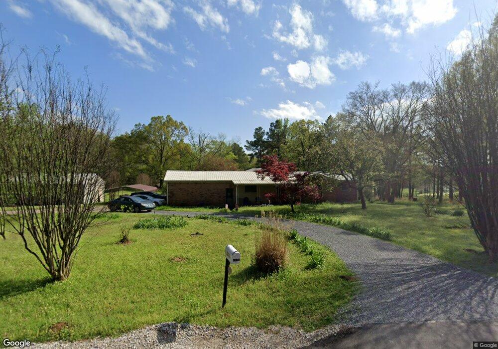
8771 Cole Rd Olive Branch, MS 38654
Lewisburg NeighborhoodEstimated Value: $294,614 - $369,000
4
Beds
--
Bath
2,170
Sq Ft
$153/Sq Ft
Est. Value
About This Home
This home is located at 8771 Cole Rd, Olive Branch, MS 38654 and is currently estimated at $331,807, approximately $152 per square foot. 8771 Cole Rd is a home located in DeSoto County with nearby schools including Lewisburg Primary School, Lewisburg Elementary School, and Lewisburg Middle School.
Ownership History
Date
Name
Owned For
Owner Type
Purchase Details
Closed on
Dec 11, 2020
Sold by
Henson Betty J
Bought by
Washington Robert N and Washington Norma
Current Estimated Value
Home Financials for this Owner
Home Financials are based on the most recent Mortgage that was taken out on this home.
Original Mortgage
$174,000
Outstanding Balance
$155,188
Interest Rate
2.8%
Mortgage Type
New Conventional
Estimated Equity
$176,619
Create a Home Valuation Report for This Property
The Home Valuation Report is an in-depth analysis detailing your home's value as well as a comparison with similar homes in the area
Home Values in the Area
Average Home Value in this Area
Purchase History
| Date | Buyer | Sale Price | Title Company |
|---|---|---|---|
| Washington Robert N | -- | None Available |
Source: Public Records
Mortgage History
| Date | Status | Borrower | Loan Amount |
|---|---|---|---|
| Open | Washington Robert N | $174,000 |
Source: Public Records
Tax History Compared to Growth
Tax History
| Year | Tax Paid | Tax Assessment Tax Assessment Total Assessment is a certain percentage of the fair market value that is determined by local assessors to be the total taxable value of land and additions on the property. | Land | Improvement |
|---|---|---|---|---|
| 2024 | $799 | $9,877 | $2,150 | $7,727 |
| 2023 | $799 | $9,877 | $0 | $0 |
| 2022 | $799 | $9,877 | $2,150 | $7,727 |
| 2021 | $799 | $9,877 | $2,150 | $7,727 |
| 2020 | $159 | $9,077 | $2,150 | $6,927 |
| 2019 | $159 | $9,077 | $2,150 | $6,927 |
| 2017 | $140 | $15,610 | $8,880 | $6,730 |
| 2016 | $121 | $8,686 | $2,150 | $6,536 |
| 2015 | $883 | $15,222 | $8,686 | $6,536 |
| 2014 | $121 | $8,686 | $0 | $0 |
| 2013 | $105 | $8,686 | $0 | $0 |
Source: Public Records
Map
Nearby Homes
- 1615 Highway 305 N
- 0 Bethel Rd Unit 4096893
- 9278 Bethel Rd
- 2275 Highway 305 N
- 9100 E Broadway Rd
- 8900 Elizabeth Cove
- 8785 Robertson Ln N
- 443 Highway 305 N
- 1970 Planter's Dr
- 2763 Fall Spring Dr
- 5293 Borden Creek Dr
- 5291 Borden Creek Dr
- 268 Bonnie Blue Cove
- 9278 Woolsey Rd
- 7198 Harrier Dr E
- 7189 Bethel Rd
- 8279 Dunn Ln E
- 7072 Bethel Rd
- 252 Shinpoch Ln
- 10203 Woolsey Rd