Estimated Value: $688,000 - $733,122
3
Beds
2
Baths
3,783
Sq Ft
$186/Sq Ft
Est. Value
About This Home
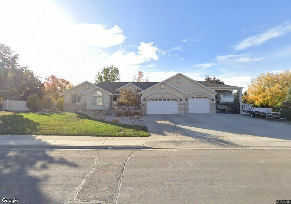
This home is located at 878 S 650 W, Salem, UT 84653 and is currently estimated at $704,531, approximately $186 per square foot. 878 S 650 W is a home located in Utah County with nearby schools including Mt. Loafer Elementary School, Salem Junior High School, and Valley View Middle School.
Ownership History
Date
Name
Owned For
Owner Type
Purchase Details
Closed on
Jun 11, 2025
Sold by
Lytle Tamara M and Lytle Carter S
Bought by
Carter And Tamara Lytle Revocable Trust and Lytle
Current Estimated Value
Home Financials for this Owner
Home Financials are based on the most recent Mortgage that was taken out on this home.
Original Mortgage
$160,000
Outstanding Balance
$159,585
Interest Rate
6.76%
Mortgage Type
Credit Line Revolving
Estimated Equity
$544,946
Purchase Details
Closed on
Dec 3, 2019
Sold by
Lytle Carter S and Lytle Tamara M
Bought by
Lytle Carter S and Lytle Tamara M
Purchase Details
Closed on
Dec 12, 1997
Sold by
Knight Wayne
Bought by
Lytle Carter S and Lytle Tamara M
Home Financials for this Owner
Home Financials are based on the most recent Mortgage that was taken out on this home.
Original Mortgage
$199,600
Interest Rate
7.19%
Purchase Details
Closed on
Jan 22, 1997
Sold by
Swapp Gordon B
Bought by
Knight Wayne
Home Financials for this Owner
Home Financials are based on the most recent Mortgage that was taken out on this home.
Original Mortgage
$176,250
Interest Rate
7.62%
Create a Home Valuation Report for This Property
The Home Valuation Report is an in-depth analysis detailing your home's value as well as a comparison with similar homes in the area
Home Values in the Area
Average Home Value in this Area
Purchase History
| Date | Buyer | Sale Price | Title Company |
|---|---|---|---|
| Carter And Tamara Lytle Revocable Trust | -- | Meridian Title | |
| Lytle Tamara M | -- | Meridian Title | |
| Lytle Carter S | -- | None Available | |
| Lytle Carter S | -- | -- | |
| Knight Wayne | -- | -- |
Source: Public Records
Mortgage History
| Date | Status | Borrower | Loan Amount |
|---|---|---|---|
| Open | Lytle Tamara M | $160,000 | |
| Previous Owner | Lytle Carter S | $199,600 | |
| Previous Owner | Knight Wayne | $176,250 |
Source: Public Records
Tax History Compared to Growth
Tax History
| Year | Tax Paid | Tax Assessment Tax Assessment Total Assessment is a certain percentage of the fair market value that is determined by local assessors to be the total taxable value of land and additions on the property. | Land | Improvement |
|---|---|---|---|---|
| 2025 | $3,258 | $361,020 | $276,500 | $379,900 |
| 2024 | $3,258 | $330,385 | $0 | $0 |
| 2023 | $3,244 | $329,560 | $0 | $0 |
| 2022 | $3,524 | $352,550 | $0 | $0 |
| 2021 | $2,741 | $439,900 | $160,300 | $279,600 |
| 2020 | $2,688 | $419,800 | $145,700 | $274,100 |
| 2019 | $2,498 | $398,400 | $124,300 | $274,100 |
| 2018 | $2,441 | $372,100 | $111,400 | $260,700 |
| 2017 | $2,274 | $184,855 | $0 | $0 |
| 2016 | $2,018 | $162,195 | $0 | $0 |
| 2015 | $1,963 | $154,935 | $0 | $0 |
| 2014 | $1,931 | $152,625 | $0 | $0 |
Source: Public Records
Map
Nearby Homes
- 1046 S 650 St W Unit 1
- 709 W 800 S
- 314 N 990 E Unit 24
- 294 N 990 E Unit 19
- 1235 W 940 S Unit 1B
- 740 S 550 St W Unit 5
- 998 S 880 W
- 360 W 800 S
- 318 W 800 S
- 309 1050 S Unit LUCAS
- 309 1050 S Unit MORGAN
- 309 1050 S Unit HARMON
- 309 1050 S Unit CALDWE
- 309 1050 S Unit BAXTER
- 309 1050 S Unit MORRIS
- 309 1050 S Unit MELROS
- 290 W Apple Blossom Way
- 1421 S 180 W Unit 17
- 555 W 300 S
- 1261 Utah 198
- 848 S 650 W
- 912 S 650 W
- 873 S 650 W
- 901 S 650 W
- 1046 S 650 St W
- 847 S 650 W
- 820 S 650 W
- 942 S 650 W
- 933 S 650 W
- 876 S Skyhawk Cir
- 858 S Skyhawk Cir
- 688 W 940 S Unit 8
- 702 W 940 S Unit 7
- 918 S Salem Fields Cir
- 819 S 650 W
- 687 W 800 S
- 836 S Skyhawk Cir
- 928 S Salem Fields Cir
- 714 W 940 S Unit 6
- 957 S 650 W