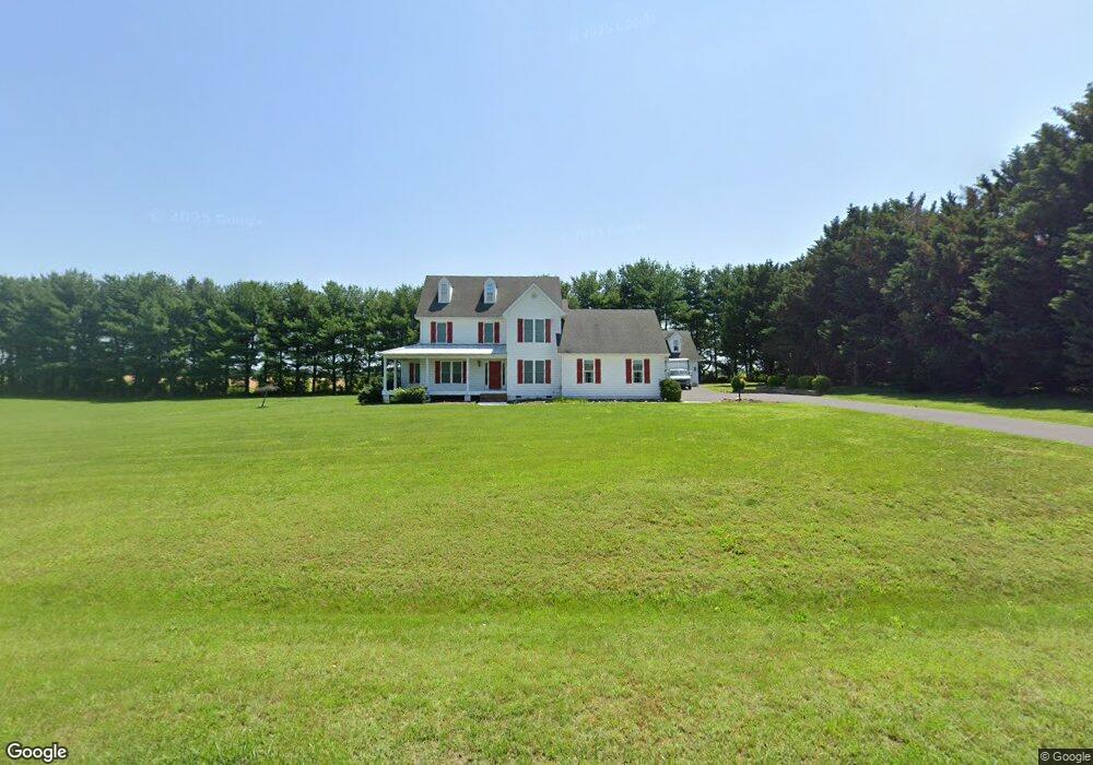
8785 Orchard Dr Chestertown, MD 21620
Estimated Value: $686,269 - $965,000
--
Bed
3
Baths
4,082
Sq Ft
$189/Sq Ft
Est. Value
About This Home
This home is located at 8785 Orchard Dr, Chestertown, MD 21620 and is currently estimated at $771,567, approximately $189 per square foot. 8785 Orchard Dr is a home located in Kent County with nearby schools including Center for Innovation, Kent County Middle School, and Kent County High School.
Ownership History
Date
Name
Owned For
Owner Type
Purchase Details
Closed on
Nov 23, 2015
Sold by
Owen Audrey M
Bought by
Owen George F and Owen Audrey M
Current Estimated Value
Purchase Details
Closed on
Jan 21, 2004
Sold by
Owen George F and Owen Audrey M
Bought by
Owen George F Sr & Audrey M Tr and U/T Owen Living Trust
Purchase Details
Closed on
Jul 11, 2003
Sold by
Yetman Alden W
Bought by
Owen George F and Owen Audrey M
Purchase Details
Closed on
Aug 29, 2002
Sold by
Chester River Group One
Bought by
Yetman Alden W
Create a Home Valuation Report for This Property
The Home Valuation Report is an in-depth analysis detailing your home's value as well as a comparison with similar homes in the area
Home Values in the Area
Average Home Value in this Area
Purchase History
| Date | Buyer | Sale Price | Title Company |
|---|---|---|---|
| Owen George F | -- | Attorney | |
| Owen Audrey M | -- | Attorney | |
| Owen George F Sr & Audrey M Tr | -- | -- | |
| Owen George F | $395,000 | -- | |
| Yetman Alden W | $59,900 | -- |
Source: Public Records
Tax History Compared to Growth
Tax History
| Year | Tax Paid | Tax Assessment Tax Assessment Total Assessment is a certain percentage of the fair market value that is determined by local assessors to be the total taxable value of land and additions on the property. | Land | Improvement |
|---|---|---|---|---|
| 2025 | $6,074 | $530,800 | $111,800 | $419,000 |
| 2024 | $5,789 | $506,567 | $0 | $0 |
| 2023 | $5,516 | $482,333 | $0 | $0 |
| 2022 | $5,209 | $458,100 | $111,800 | $346,300 |
| 2021 | $5,110 | $451,733 | $0 | $0 |
| 2020 | $5,110 | $445,367 | $0 | $0 |
| 2019 | $5,038 | $439,000 | $111,800 | $327,200 |
| 2018 | $5,038 | $439,000 | $111,800 | $327,200 |
| 2017 | $5,038 | $439,000 | $0 | $0 |
| 2016 | -- | $444,100 | $0 | $0 |
| 2015 | $5,248 | $444,100 | $0 | $0 |
| 2014 | $5,248 | $444,100 | $0 | $0 |
Source: Public Records
Map
Nearby Homes
- Lot 9 Prestwick Dr
- 318 Lincoln Dr
- 100 Adela Way
- 110 Trafford Dr
- 116 Harlan Loop
- 311 Devon Dr
- 251 Devon Dr
- 0 Cromwell Clark Rd
- 141 Prospect St
- 24543 Chestertown Rd
- 107 Malone Ave
- 611 Cannon St
- 423 Calvert St
- 109 S College Ave
- 234 N College Ave
- 2 Scheeler Rd
- 517 High St
- 222 Mount Vernon Ave
- 349 High St
- 349 & 351 High St
- 8827 Orchard Dr
- 8757 Orchard Dr
- 8800 Orchard Dr
- 8770 Orchard Dr
- 8826 Orchard Dr
- 8958 Orchard Dr
- 8962 Orchard Dr
- 8855 Orchard Dr
- 8721 Orchard Dr
- 8858 Orchard Dr
- 8954 Orchard Dr
- 8966 Orchard Dr
- 8778 Orchard Dr
- 8950 Orchard Dr
- 8970 Orchard Dr
- 8955 Orchard Dr
- 8959 Orchard Dr
- 8875 Orchard Dr
- 8685 Orchard Dr
- 8690 Orchard Dr