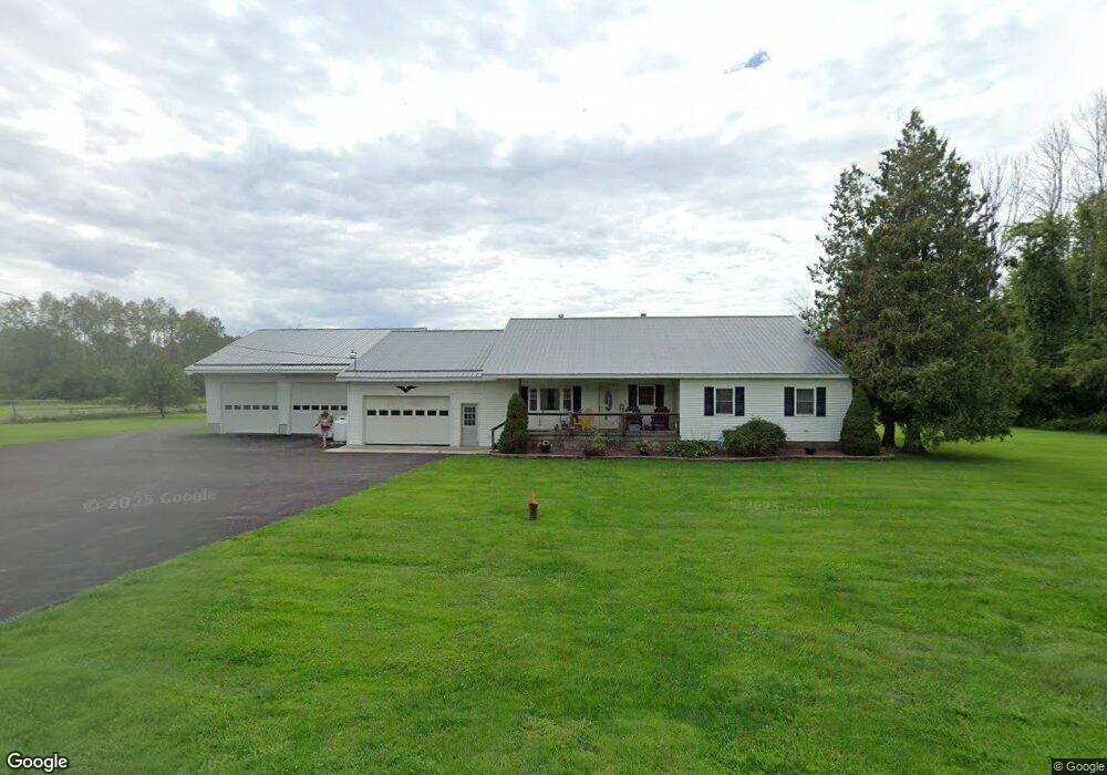
8789 Lewis Point Rd Canastota, NY 13032
Estimated Value: $158,000 - $225,000
3
Beds
3
Baths
1,404
Sq Ft
$135/Sq Ft
Est. Value
About This Home
This home is located at 8789 Lewis Point Rd, Canastota, NY 13032 and is currently estimated at $189,999, approximately $135 per square foot. 8789 Lewis Point Rd is a home located in Madison County with nearby schools including Peterboro Street Elementary School, Roberts Street Middle School, and South Side Elementary School.
Ownership History
Date
Name
Owned For
Owner Type
Purchase Details
Closed on
Dec 26, 2019
Sold by
Smith Jacob and Smith Kayla
Bought by
Koons Scott B and Koons Lori A
Current Estimated Value
Home Financials for this Owner
Home Financials are based on the most recent Mortgage that was taken out on this home.
Original Mortgage
$99,750
Outstanding Balance
$87,944
Interest Rate
3.6%
Mortgage Type
Stand Alone Refi Refinance Of Original Loan
Estimated Equity
$102,055
Purchase Details
Closed on
Jun 27, 2011
Sold by
Brown Susan
Bought by
Smith Jacob
Purchase Details
Closed on
Oct 17, 2007
Sold by
Havens Douglas A
Bought by
Brown Susan
Purchase Details
Closed on
Oct 19, 1994
Sold by
Seitz Ricky V and Seitz Karen D
Bought by
Havens Douglas A
Create a Home Valuation Report for This Property
The Home Valuation Report is an in-depth analysis detailing your home's value as well as a comparison with similar homes in the area
Home Values in the Area
Average Home Value in this Area
Purchase History
| Date | Buyer | Sale Price | Title Company |
|---|---|---|---|
| Koons Scott B | $105,000 | None Available | |
| Smith Jacob | $78,000 | George Conway | |
| Brown Susan | $42,500 | Kathleen Stevenson | |
| Havens Douglas A | $55,900 | -- |
Source: Public Records
Mortgage History
| Date | Status | Borrower | Loan Amount |
|---|---|---|---|
| Open | Koons Scott B | $99,750 |
Source: Public Records
Tax History Compared to Growth
Tax History
| Year | Tax Paid | Tax Assessment Tax Assessment Total Assessment is a certain percentage of the fair market value that is determined by local assessors to be the total taxable value of land and additions on the property. | Land | Improvement |
|---|---|---|---|---|
| 2024 | $3,887 | $82,000 | $15,600 | $66,400 |
| 2023 | $3,263 | $82,000 | $15,600 | $66,400 |
| 2022 | $3,122 | $82,000 | $15,600 | $66,400 |
| 2021 | $3,118 | $82,000 | $15,600 | $66,400 |
| 2020 | $2,980 | $82,000 | $15,600 | $66,400 |
| 2019 | -- | $74,000 | $15,600 | $58,400 |
| 2018 | $2,621 | $74,000 | $15,600 | $58,400 |
Source: Public Records
Map
Nearby Homes
- 0 Stephens Rd Unit S1580888
- 9106 Arthur Jenkins Rd
- 3064 State Route 31
- 9114 Briggs Bay Rd
- 8281 Lewis Point Rd
- 9181 Old Orchard Rd
- 9052 Edward O'Hara Ave
- 9162 Arthur Jenkins Rd
- 9175 Briggs Bay Rd
- 9663 Lewis Point Rd
- 4020 State Route 31
- 2811 White Haven Rd Unit 2
- 7988 Warners Rd
- 8362 New York 13
- 2748 Pine Ridge Rd
- 9081 Kohles Ln
- 0 Eddy Rd Unit S1633771
- 0 Route 13 Unit S1355477
- 0 Edward Ohara Ave Unit S1418656
- 0 Edward Ohara Ave Unit S1418644
- 8789 Lewis Point Rd
- 8784 Lewis Point Rd
- 8776 Lewis Point Rd
- 8796 Lewis Point Rd
- 8807 Lewis Point Rd
- 8816 Lewis Point Rd
- 8739 Lewis Point Rd
- 8599 Stephens Rd
- 8615 Stephens Rd
- 8720 Lewis Point Rd
- 8627 Stephens Rd
- 8714 Lewis Point Rd
- 8711 Lewis Point Rd
- 8868 Lewis Point Rd
- 8692 Lewis Point Rd
- 3401 Whitelaw Rd
- 3395 Whitelaw Rd
- 3423 Whitelaw Rd
- 3433 Whitelaw Rd
- 3369 Whitelaw Rd