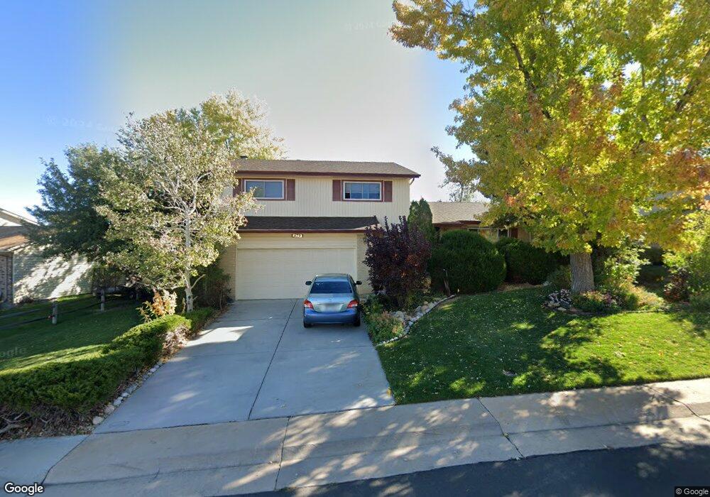
879 Mercury Cir Lone Tree, CO 80124
Estimated Value: $585,347 - $621,000
3
Beds
3
Baths
2,150
Sq Ft
$281/Sq Ft
Est. Value
About This Home
This home is located at 879 Mercury Cir, Lone Tree, CO 80124 and is currently estimated at $603,174, approximately $280 per square foot. 879 Mercury Cir is a home located in Douglas County with nearby schools including Acres Green Elementary School, Cresthill Middle School, and Highlands Ranch High School.
Ownership History
Date
Name
Owned For
Owner Type
Purchase Details
Closed on
Mar 27, 1986
Sold by
Hogg Mark E and Hogg Cathy L
Bought by
Delmendo Richard G and Delmendo Mary Ann T
Current Estimated Value
Purchase Details
Closed on
May 30, 1981
Sold by
Unavailable
Bought by
Unavailable
Create a Home Valuation Report for This Property
The Home Valuation Report is an in-depth analysis detailing your home's value as well as a comparison with similar homes in the area
Home Values in the Area
Average Home Value in this Area
Purchase History
| Date | Buyer | Sale Price | Title Company |
|---|---|---|---|
| Delmendo Richard G | $100,000 | -- | |
| Unavailable | $88,500 | -- |
Source: Public Records
Tax History Compared to Growth
Tax History
| Year | Tax Paid | Tax Assessment Tax Assessment Total Assessment is a certain percentage of the fair market value that is determined by local assessors to be the total taxable value of land and additions on the property. | Land | Improvement |
|---|---|---|---|---|
| 2024 | $2,811 | $41,020 | $8,140 | $32,880 |
| 2023 | $2,840 | $41,020 | $8,140 | $32,880 |
| 2022 | $2,009 | $29,510 | $6,910 | $22,600 |
| 2021 | $2,088 | $29,510 | $6,910 | $22,600 |
| 2020 | $1,971 | $28,950 | $6,540 | $22,410 |
| 2019 | $2,626 | $28,950 | $6,540 | $22,410 |
| 2018 | $2,119 | $25,020 | $5,690 | $19,330 |
| 2017 | $2,153 | $25,020 | $5,690 | $19,330 |
| 2016 | $1,923 | $21,880 | $4,100 | $17,780 |
| 2015 | $2,299 | $21,880 | $4,100 | $17,780 |
| 2014 | $2,075 | $18,440 | $3,980 | $14,460 |
Source: Public Records
Map
Nearby Homes
- 802 Altair Dr
- 7057 Chestnut Hill St
- 789 Hamal Dr
- 7041 Chestnut Hill Trail
- 6887 Chestnut Hill St
- 13117 Deneb Dr
- 13134 Deneb Dr
- 9275 Erminedale Dr
- 8159 Lodgepole Trail
- 6482 Silver Mesa Dr Unit B
- 6426 Nassau Ct
- 9412 La Quinta Way
- 8638 Gold Peak Dr Unit D
- 8626 Gold Peak Dr Unit B
- 8540 Gold Peak Ln Unit C
- 6266 Nassau Ct
- 8590 Gold Peak Dr Unit D
- 13483 Achilles Dr
- 13542 Achilles Dr
- 8578 Gold Peak Dr Unit G
- 875 Mercury Cir
- 885 Mercury Cir
- 889 Mercury Cir
- 13295 Peacock Dr
- 869 Mercury Cir
- 13285 Peacock Dr
- 895 Mercury Cir
- 884 Mercury Cir
- 888 Mercury Cir
- 878 Mercury Cir
- 13275 Peacock Dr
- 13256 Canopus Dr
- 868 Mercury Cir
- 899 Mercury Cir
- 866 Mercury Cir
- 13286 Peacock Dr
- 13246 Canopus Dr
- 13265 Peacock Dr
- 905 Mercury Cir
- 13358 Peacock Dr