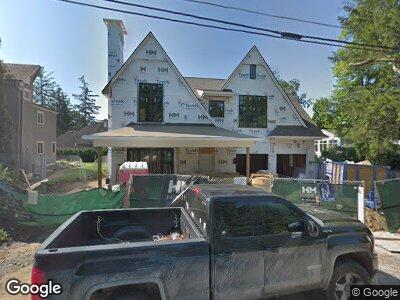
879 Randall Ct Unit Bldg-Unit Birmingham, MI 48009
Estimated Value: $3,064,000 - $3,773,000
4
Beds
8
Baths
5,105
Sq Ft
$673/Sq Ft
Est. Value
About This Home
This home is located at 879 Randall Ct Unit Bldg-Unit, Birmingham, MI 48009 and is currently estimated at $3,437,460, approximately $673 per square foot. 879 Randall Ct Unit Bldg-Unit is a home located in Oakland County with nearby schools including Pierce Elementary School, Derby Middle School, and Ernest W. Seaholm High School.
Ownership History
Date
Name
Owned For
Owner Type
Purchase Details
Closed on
Jul 10, 2019
Sold by
Hm Homes Llc
Bought by
Jahnke Keith and Jahnke Wendy
Current Estimated Value
Home Financials for this Owner
Home Financials are based on the most recent Mortgage that was taken out on this home.
Original Mortgage
$1,826,250
Interest Rate
3.82%
Mortgage Type
New Conventional
Purchase Details
Closed on
Jul 17, 2017
Sold by
Blodgett David W and Blodgett Tina
Bought by
Hm Homes Llc
Purchase Details
Closed on
Mar 9, 2012
Sold by
Newnan Henry L
Bought by
Blodgett David W and Blodgett Tina
Purchase Details
Closed on
Oct 23, 1997
Sold by
Newnan Edna S
Bought by
Edna S Newnan Tr
Create a Home Valuation Report for This Property
The Home Valuation Report is an in-depth analysis detailing your home's value as well as a comparison with similar homes in the area
Home Values in the Area
Average Home Value in this Area
Purchase History
| Date | Buyer | Sale Price | Title Company |
|---|---|---|---|
| Jahnke Keith | $2,435,000 | First American Title | |
| Hm Homes Llc | $600,000 | None Available | |
| Blodgett David W | $200,000 | First American Title Ins Co | |
| Edna S Newnan Tr | -- | -- |
Source: Public Records
Mortgage History
| Date | Status | Borrower | Loan Amount |
|---|---|---|---|
| Open | Jahnke Keith | $1,780,000 | |
| Closed | Jahnke Keith | $1,780,000 | |
| Closed | Jaenke Keith | $1,820,000 | |
| Closed | Jahnke Keith | $1,826,250 |
Source: Public Records
Tax History Compared to Growth
Tax History
| Year | Tax Paid | Tax Assessment Tax Assessment Total Assessment is a certain percentage of the fair market value that is determined by local assessors to be the total taxable value of land and additions on the property. | Land | Improvement |
|---|---|---|---|---|
| 2024 | $46,149 | $1,393,800 | $0 | $0 |
| 2023 | $44,222 | $1,305,890 | $0 | $0 |
| 2022 | $47,414 | $1,228,940 | $0 | $0 |
| 2021 | $47,976 | $1,193,320 | $0 | $0 |
| 2020 | $42,745 | $1,176,780 | $0 | $0 |
| 2019 | $42,304 | $802,580 | $0 | $0 |
Source: Public Records
Map
Nearby Homes
- 895 Harmon St
- 362 Southfield Rd
- 480 Southfield Rd
- 470 Southfield Rd Unit 7
- 570 Townsend St Unit 2
- 620 Lakeside Dr
- 329 Linden Rd
- 300 Warren Ct
- 578 Woodland St
- 252 Linden Rd
- 472 Bonnie Brier St
- 583 Southfield Rd
- 404 Linden Rd
- 628 Watkins St
- 611 Watkins St
- 631 Watkins St
- 350 Shirley Rd
- 369 N Old Woodward Ave Unit 307
- 369 N Old Woodward Ave Unit 206
- 369 N Old Woodward Ave Unit 301
- 879 Randall Ct Unit Bldg-Unit
- 879 Randall Ct
- 839 Randall Ct Unit Bldg-Unit
- 839 Randall Ct
- 251 Baldwin Rd
- 221 Baldwin Rd
- 221 Baldwin Rd
- 280 Millrace Rd Unit Bldg-Unit
- 280 Millrace Rd
- 260 Millrace Rd
- 323 Baldwin Rd
- 250 Millrace Rd
- 201 Baldwin Rd
- 240 Millrace Rd
- 325 Baldwin Rd
- 270 Baldwin Rd
- 232 Baldwin Rd Unit Bldg-Unit
- 232 Baldwin Rd
- 190 Millrace Rd Unit Bldg-Unit
- 190 Millrace Rd