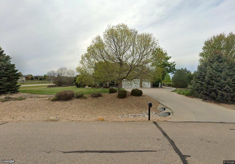
8798 Longs Peak Cir Windsor, CO 80550
Estimated Value: $1,197,964 - $1,401,000
4
Beds
4
Baths
3,630
Sq Ft
$355/Sq Ft
Est. Value
About This Home
This home is located at 8798 Longs Peak Cir, Windsor, CO 80550 and is currently estimated at $1,289,991, approximately $355 per square foot. 8798 Longs Peak Cir is a home located in Larimer County with nearby schools including High Plains School, Mountain View High School, and Colorado Early Colleges Windsor.
Ownership History
Date
Name
Owned For
Owner Type
Purchase Details
Closed on
Nov 15, 2006
Sold by
Lennar Colorado Llc
Bought by
Welton Brandon Arthur and Welton Tracy
Current Estimated Value
Home Financials for this Owner
Home Financials are based on the most recent Mortgage that was taken out on this home.
Original Mortgage
$356,000
Outstanding Balance
$208,077
Interest Rate
6%
Mortgage Type
New Conventional
Estimated Equity
$1,081,914
Create a Home Valuation Report for This Property
The Home Valuation Report is an in-depth analysis detailing your home's value as well as a comparison with similar homes in the area
Home Values in the Area
Average Home Value in this Area
Purchase History
| Date | Buyer | Sale Price | Title Company |
|---|---|---|---|
| Welton Brandon Arthur | $445,000 | North American Title |
Source: Public Records
Mortgage History
| Date | Status | Borrower | Loan Amount |
|---|---|---|---|
| Open | Welton Brandon Arthur | $356,000 |
Source: Public Records
Tax History Compared to Growth
Tax History
| Year | Tax Paid | Tax Assessment Tax Assessment Total Assessment is a certain percentage of the fair market value that is determined by local assessors to be the total taxable value of land and additions on the property. | Land | Improvement |
|---|---|---|---|---|
| 2025 | $6,698 | $76,588 | $27,470 | $49,118 |
| 2024 | $6,488 | $76,588 | $27,470 | $49,118 |
| 2022 | $4,928 | $53,689 | $17,723 | $35,966 |
| 2021 | $5,050 | $55,234 | $18,233 | $37,001 |
| 2020 | $4,408 | $48,155 | $15,158 | $32,997 |
| 2019 | $4,343 | $48,155 | $15,158 | $32,997 |
| 2018 | $4,159 | $44,330 | $11,232 | $33,098 |
| 2017 | $3,659 | $44,330 | $11,232 | $33,098 |
| 2016 | $3,228 | $37,970 | $10,030 | $27,940 |
| 2015 | $3,188 | $44,240 | $10,030 | $34,210 |
| 2014 | $3,138 | $36,060 | $7,120 | $28,940 |
Source: Public Records
Map
Nearby Homes
- 4609 Freehold Dr
- 4605 Freehold Dr
- 7407 Pimlico Dr
- 7401 Pimlico Dr
- 7401 Turnbull Ct
- 4511 Haystack Dr
- 5504 Fairmount Dr
- 5830 Last Pointe Dr
- 7845 Blackwood Dr
- 8881 Longs Peak Cir
- 8181 Wynstone Dr
- 5849 Crooked Stick Dr
- 5954 Black Lion Ct
- 8736 Blackwood Dr
- Plan C417 - 60 at Sugar Hills at RainDance - RainDance 60'
- Plan C505 - 60 at Festival at RainDance - RainDance 60'
- Plan C502 - 60 at Festival at RainDance - RainDance 60'
- Plan C502 - 60 at RainDance - 60'
- Plan C417 - 60 at Festival at RainDance - RainDance 60'
- Plan C555 - National 60s/70s at Sugar Hills at RainDance - RainDance National 60s/70s
- 8796 Longs Peak Cir
- 8799 Longs Peak Cir
- 8800 Longs Peak Cir
- 8805 Longs Peak Cir
- 8795 Longs Peak Cir
- 8809 Longs Peak Cir
- 8814 Longs Peak Cir
- 5202 Horizon Ridge Dr
- 5204 Horizon Ridge Dr
- 7769 Big Sky Ct
- 7787 Big Sky Ct
- 8813 Longs Peak Cir
- 5206 Horizon Ridge Dr
- 5208 Horizon Ridge Dr
- 4614 Horizon Ridge Dr
- 4804 Horizon Ridge Dr
- 4722 Horizon Ridge Dr
- 4690 Horizon Ridge Dr
- 4778 Horizon Ridge Dr
- 4746 Horizon Ridge Dr