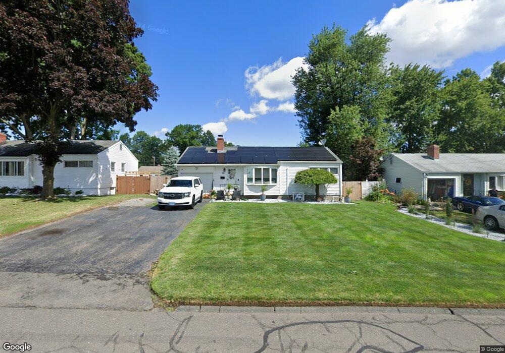
88 Harding St Wethersfield, CT 06109
Estimated Value: $334,000 - $354,000
3
Beds
2
Baths
1,024
Sq Ft
$336/Sq Ft
Est. Value
About This Home
This home is located at 88 Harding St, Wethersfield, CT 06109 and is currently estimated at $344,457, approximately $336 per square foot. 88 Harding St is a home located in Hartford County with nearby schools including Emerson-Williams School, Silas Deane Middle School, and Wethersfield High School.
Ownership History
Date
Name
Owned For
Owner Type
Purchase Details
Closed on
May 20, 2024
Sold by
Portonova Francis
Bought by
Portonova Francis J
Current Estimated Value
Home Financials for this Owner
Home Financials are based on the most recent Mortgage that was taken out on this home.
Original Mortgage
$240,000
Outstanding Balance
$236,635
Interest Rate
6.88%
Mortgage Type
Purchase Money Mortgage
Estimated Equity
$107,822
Purchase Details
Closed on
May 29, 2002
Sold by
Gormano Marilyn
Bought by
Portonova Lori A and Portonova Francis J
Purchase Details
Closed on
Sep 29, 1998
Sold by
Martin Janet C
Bought by
Germano Marilyn T
Create a Home Valuation Report for This Property
The Home Valuation Report is an in-depth analysis detailing your home's value as well as a comparison with similar homes in the area
Home Values in the Area
Average Home Value in this Area
Purchase History
| Date | Buyer | Sale Price | Title Company |
|---|---|---|---|
| Portonova Francis J | $322,000 | None Available | |
| Portonova Francis J | $322,000 | None Available | |
| Portonova Lori A | $155,000 | -- | |
| Germano Marilyn T | $115,000 | -- | |
| Portonova Lori A | $155,000 | -- | |
| Germano Marilyn T | $115,000 | -- |
Source: Public Records
Mortgage History
| Date | Status | Borrower | Loan Amount |
|---|---|---|---|
| Open | Portonova Francis J | $240,000 | |
| Closed | Portonova Francis J | $240,000 | |
| Previous Owner | Germano Marilyn T | $55,000 | |
| Previous Owner | Germano Marilyn T | $40,000 |
Source: Public Records
Tax History
| Year | Tax Paid | Tax Assessment Tax Assessment Total Assessment is a certain percentage of the fair market value that is determined by local assessors to be the total taxable value of land and additions on the property. | Land | Improvement |
|---|---|---|---|---|
| 2025 | $7,950 | $192,860 | $69,260 | $123,600 |
| 2024 | $6,086 | $140,810 | $72,100 | $68,710 |
| 2023 | $5,883 | $140,810 | $72,100 | $68,710 |
| 2022 | $5,784 | $140,810 | $72,100 | $68,710 |
| 2021 | $5,727 | $140,810 | $72,100 | $68,710 |
| 2020 | $5,730 | $140,810 | $72,100 | $68,710 |
| 2019 | $5,737 | $140,810 | $72,100 | $68,710 |
| 2018 | $5,668 | $139,000 | $69,000 | $70,000 |
| 2017 | $5,528 | $139,000 | $69,000 | $70,000 |
| 2016 | $5,357 | $139,000 | $69,000 | $70,000 |
| 2015 | $5,308 | $139,000 | $69,000 | $70,000 |
| 2014 | $5,107 | $139,000 | $69,000 | $70,000 |
Source: Public Records
Map
Nearby Homes
- 295 Ridge Rd Unit 8
- 55 Rutledge Rd
- 144 Brown St
- 1 Bristol St
- 19 Albert Ave
- 1 Brussels Ave
- 173 Timber Trail
- 20 Forest Dr
- 63 Wells Farm Dr
- 129 Goff Rd
- 192 Wolcott Hill Rd
- 219-221 Jordan Ln
- 764 Ridge Rd
- 62 Schoolhouse Crossing
- 15 Potter Crossing
- 43 Edward St
- 25 Tinsmith Crossing
- 23 Hillcrest Ave
- 17 Salem St
- 158 Dix Rd
Your Personal Tour Guide
Ask me questions while you tour the home.