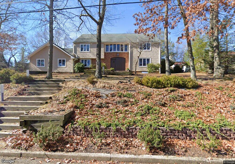
880 Breezy Oaks Dr Toms River, NJ 08753
Estimated Value: $910,872 - $967,000
4
Beds
3
Baths
4,857
Sq Ft
$193/Sq Ft
Est. Value
About This Home
This home is located at 880 Breezy Oaks Dr, Toms River, NJ 08753 and is currently estimated at $935,218, approximately $192 per square foot. 880 Breezy Oaks Dr is a home located in Ocean County with nearby schools including St Joseph Grade School and Donovan Catholic High School.
Ownership History
Date
Name
Owned For
Owner Type
Purchase Details
Closed on
Aug 17, 2001
Current Estimated Value
Home Financials for this Owner
Home Financials are based on the most recent Mortgage that was taken out on this home.
Original Mortgage
$100,000
Interest Rate
6.98%
Purchase Details
Closed on
Jul 30, 2001
Sold by
Abramson Linda
Bought by
Lee Kyung and Lee Grace
Home Financials for this Owner
Home Financials are based on the most recent Mortgage that was taken out on this home.
Original Mortgage
$100,000
Interest Rate
6.98%
Create a Home Valuation Report for This Property
The Home Valuation Report is an in-depth analysis detailing your home's value as well as a comparison with similar homes in the area
Home Values in the Area
Average Home Value in this Area
Purchase History
| Date | Buyer | Sale Price | Title Company |
|---|---|---|---|
| -- | -- | -- | |
| Lee Kyung | $335,100 | -- |
Source: Public Records
Mortgage History
| Date | Status | Borrower | Loan Amount |
|---|---|---|---|
| Previous Owner | Lee Kyung | $100,000 |
Source: Public Records
Tax History Compared to Growth
Tax History
| Year | Tax Paid | Tax Assessment Tax Assessment Total Assessment is a certain percentage of the fair market value that is determined by local assessors to be the total taxable value of land and additions on the property. | Land | Improvement |
|---|---|---|---|---|
| 2025 | $11,806 | $648,300 | $317,200 | $331,100 |
| 2024 | $11,222 | $648,300 | $317,200 | $331,100 |
| 2023 | $10,820 | $648,300 | $317,200 | $331,100 |
| 2022 | $10,820 | $648,300 | $317,200 | $331,100 |
| 2021 | $10,908 | $465,200 | $129,300 | $335,900 |
| 2020 | $11,602 | $465,200 | $129,300 | $335,900 |
| 2019 | $11,100 | $465,200 | $129,300 | $335,900 |
| 2018 | $10,951 | $465,200 | $129,300 | $335,900 |
| 2017 | $10,858 | $465,200 | $129,300 | $335,900 |
| 2016 | $10,574 | $465,200 | $129,300 | $335,900 |
| 2015 | $10,174 | $465,200 | $129,300 | $335,900 |
| 2014 | $9,685 | $465,200 | $129,300 | $335,900 |
Source: Public Records
Map
Nearby Homes
- 741 Spruce Hill Dr
- 830 Brookside Dr
- 711 Bay Ave
- 241 Lester Rd
- 718 Arrow Dr
- 707 Cedar Point Ct
- 939 Alden Dr
- 679 Clifton Ave
- 73 Cedar Grove Rd
- 507 Sloop Ct
- 308 Cedar Grove Rd
- 308 Tradewinds Ave
- 14 Turnberry Cir Unit 117
- 751 High Meadow Dr
- 22 Turnberry Cir Unit 121
- 1037 Savannah St
- 523 Pheasant Ln
- 1112 Formicola St
- 696 Schoolhouse Ln
- 138 Walnut St
- 872 Breezy Oaks Dr
- 144 Lester Rd
- 884 Breezy Oaks Dr
- 143 Lester Rd
- 148 Lester Rd
- 864 Breezy Oaks Dr
- 152 Lester Rd
- 147 Lester Rd
- 876 Brookside Dr
- 872 Brookside Dr
- 880 Brookside Dr
- 156 Lester Rd
- 868 Brookside Dr
- 151 Lester Rd
- 884 Brookside Dr
- 848 Breezy Oaks Dr
- 148 Lakeview Ct
- 864 Brookside Dr
- 160 Lester Rd
- 888 Brookside Dr