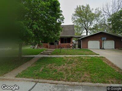
880 Locust St Syracuse, NE 68446
Estimated Value: $242,000 - $344,000
3
Beds
3
Baths
1,932
Sq Ft
$154/Sq Ft
Est. Value
About This Home
This home is located at 880 Locust St, Syracuse, NE 68446 and is currently estimated at $297,191, approximately $153 per square foot. 880 Locust St is a home located in Otoe County with nearby schools including Elementary School at Syracuse and High School at Syracuse.
Ownership History
Date
Name
Owned For
Owner Type
Purchase Details
Closed on
Oct 7, 2021
Sold by
Dey Daren L
Bought by
Dey Caren A
Current Estimated Value
Purchase Details
Closed on
Jun 1, 2006
Sold by
Apel Ronald R and Apel Patricia M
Bought by
Dey Caren A and Dey Daren L
Home Financials for this Owner
Home Financials are based on the most recent Mortgage that was taken out on this home.
Original Mortgage
$88,000
Interest Rate
6.5%
Mortgage Type
New Conventional
Purchase Details
Closed on
Jan 27, 2005
Sold by
Apel Ronald R and Apel Patricia M
Bought by
Apel Ronald R and Apel Patricia M
Create a Home Valuation Report for This Property
The Home Valuation Report is an in-depth analysis detailing your home's value as well as a comparison with similar homes in the area
Home Values in the Area
Average Home Value in this Area
Purchase History
| Date | Buyer | Sale Price | Title Company |
|---|---|---|---|
| Dey Caren A | -- | None Available | |
| Dey Caren A | $120,000 | None Available | |
| Apel Ronald R | -- | None Available |
Source: Public Records
Mortgage History
| Date | Status | Borrower | Loan Amount |
|---|---|---|---|
| Open | Dey Daren L | $12,000 | |
| Open | Dey Daren L | $94,400 | |
| Closed | Dey Caren A | $47,000 | |
| Closed | Dey Daren L | $68,000 | |
| Closed | Dey Caren A | $88,000 |
Source: Public Records
Tax History Compared to Growth
Tax History
| Year | Tax Paid | Tax Assessment Tax Assessment Total Assessment is a certain percentage of the fair market value that is determined by local assessors to be the total taxable value of land and additions on the property. | Land | Improvement |
|---|---|---|---|---|
| 2024 | $3,498 | $205,081 | $7,640 | $197,441 |
| 2023 | $3,960 | $205,081 | $7,640 | $197,441 |
| 2022 | $3,179 | $165,593 | $7,640 | $157,953 |
| 2021 | $2,722 | $144,990 | $7,640 | $137,350 |
| 2020 | $2,762 | $144,990 | $7,640 | $137,350 |
| 2019 | $2,792 | $144,990 | $7,640 | $137,350 |
| 2018 | $2,669 | $144,990 | $7,640 | $137,350 |
| 2017 | $2,440 | $136,060 | $6,340 | $129,720 |
| 2016 | $2,438 | $136,060 | $6,340 | $129,720 |
| 2015 | $2,456 | $136,060 | $6,340 | $129,720 |
| 2014 | $1,486 | $77,530 | $6,340 | $71,190 |
| 2012 | $1,507 | $77,530 | $6,340 | $71,190 |
Source: Public Records
Map
Nearby Homes