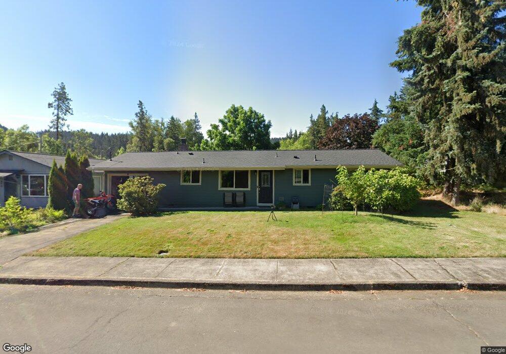
880 Sprague St Eugene, OR 97405
Southeast Eugene NeighborhoodEstimated Value: $406,000 - $433,000
3
Beds
1
Bath
1,012
Sq Ft
$412/Sq Ft
Est. Value
About This Home
This home is located at 880 Sprague St, Eugene, OR 97405 and is currently estimated at $417,392, approximately $412 per square foot. 880 Sprague St is a home located in Lane County with nearby schools including Edgewood Community Elementary School, Spencer Butte Middle School, and South Eugene High School.
Ownership History
Date
Name
Owned For
Owner Type
Purchase Details
Closed on
Aug 8, 2012
Sold by
Guthrie Pattie
Bought by
Swartz Adrian and Swartz Nazia
Current Estimated Value
Home Financials for this Owner
Home Financials are based on the most recent Mortgage that was taken out on this home.
Original Mortgage
$124,800
Interest Rate
3.52%
Mortgage Type
New Conventional
Purchase Details
Closed on
Oct 29, 2008
Sold by
Wesley Gladys Kay
Bought by
Guthrie Wade and Guthrie Patti
Home Financials for this Owner
Home Financials are based on the most recent Mortgage that was taken out on this home.
Original Mortgage
$202,023
Interest Rate
5.77%
Mortgage Type
FHA
Create a Home Valuation Report for This Property
The Home Valuation Report is an in-depth analysis detailing your home's value as well as a comparison with similar homes in the area
Home Values in the Area
Average Home Value in this Area
Purchase History
| Date | Buyer | Sale Price | Title Company |
|---|---|---|---|
| Swartz Adrian | $156,000 | Cascade Title Company | |
| Guthrie Wade | $205,700 | Fidelity National Title Insu |
Source: Public Records
Mortgage History
| Date | Status | Borrower | Loan Amount |
|---|---|---|---|
| Previous Owner | Swartz Adrian | $124,800 | |
| Previous Owner | Guthrie Wade | $202,023 |
Source: Public Records
Tax History
| Year | Tax Paid | Tax Assessment Tax Assessment Total Assessment is a certain percentage of the fair market value that is determined by local assessors to be the total taxable value of land and additions on the property. | Land | Improvement |
|---|---|---|---|---|
| 2025 | $3,578 | $183,647 | -- | -- |
| 2024 | $3,534 | $178,299 | -- | -- |
| 2023 | $3,534 | $173,106 | $0 | $0 |
| 2022 | $3,310 | $168,065 | $0 | $0 |
| 2021 | $3,109 | $163,170 | $0 | $0 |
| 2020 | $3,120 | $158,418 | $0 | $0 |
| 2019 | $3,014 | $153,804 | $0 | $0 |
| 2018 | $2,837 | $144,976 | $0 | $0 |
| 2017 | $2,710 | $144,976 | $0 | $0 |
| 2016 | $2,642 | $140,753 | $0 | $0 |
| 2015 | $2,567 | $136,653 | $0 | $0 |
Source: Public Records
Map
Nearby Homes
- 892 Sprague St
- 4733 E Amazon Dr
- 4680 W Hillside Dr
- 4429 Fox Hollow Rd Unit 3
- 4425 Hilyard St
- 4845 Brookwood St
- 4364 Fox Hollow Rd
- 910 E 43rd Ave
- 4320 Fox Hollow Rd
- 4835 Elva Ln
- 1755 E 43rd Ave
- 4734 Brookwood St
- 4295 Ferry St
- 0 Wendell Ln Unit 200453475
- 0 Wendell Ln Unit 279865930
- 0 Wendell Ln Unit 1
- 1862 E 43rd Ave
- 395 E 46th Ave
- 1865 E 43rd Ave
- 0 Why Worry Ln
- 860 Sprague St
- 4854 W Amazon Dr
- 890 Sprague St Unit 1
- 4850 W Amazon Dr
- 4858 W Amazon Dr
- 855 Sprague St
- 830 Sprague St
- 840 Sprague St
- 893 Sprague St
- 4884 W Amazon Dr
- 4866 W Amazon Dr
- 843 Sprague St
- 4790 W Amazon Dr
- 810 Sprague St
- 865 Sprague St
- 4835 W Hillside Dr
- 825 Sprague St
- 4855 W Hillside Dr
- 4875 W Hillside Dr
- 4896 W Amazon Dr
Your Personal Tour Guide
Ask me questions while you tour the home.