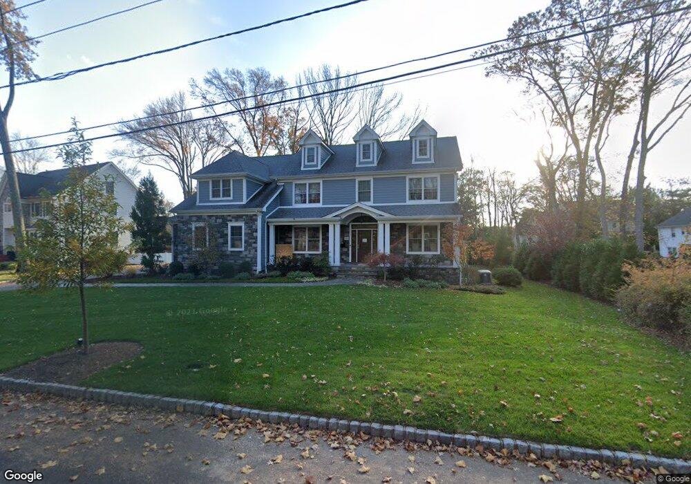
880 Talcott Rd Westfield, NJ 07090
Estimated Value: $2,146,000 - $2,616,000
--
Bed
--
Bath
4,736
Sq Ft
$501/Sq Ft
Est. Value
About This Home
This home is located at 880 Talcott Rd, Westfield, NJ 07090 and is currently estimated at $2,374,532, approximately $501 per square foot. 880 Talcott Rd is a home located in Union County with nearby schools including Tamaques Elementary School, Edison Intermediate School, and Westfield Senior High School.
Ownership History
Date
Name
Owned For
Owner Type
Purchase Details
Closed on
Jan 11, 2016
Sold by
Michael Mahoney Llc
Bought by
Goodman Jonathan and Goodman Samantha
Current Estimated Value
Home Financials for this Owner
Home Financials are based on the most recent Mortgage that was taken out on this home.
Original Mortgage
$995,000
Outstanding Balance
$772,448
Interest Rate
3.25%
Mortgage Type
Adjustable Rate Mortgage/ARM
Estimated Equity
$1,602,084
Purchase Details
Closed on
Apr 4, 2015
Sold by
London Laura L Exx
Bought by
Michael Mahoney Llc
Purchase Details
Closed on
Oct 14, 1999
Sold by
Liebesman William P
Bought by
Liebesman Stella F
Purchase Details
Closed on
May 7, 1999
Sold by
Liebesman William P
Bought by
Liebsman Stella
Create a Home Valuation Report for This Property
The Home Valuation Report is an in-depth analysis detailing your home's value as well as a comparison with similar homes in the area
Home Values in the Area
Average Home Value in this Area
Purchase History
| Date | Buyer | Sale Price | Title Company |
|---|---|---|---|
| Goodman Jonathan | $1,699,900 | -- | |
| Michael Mahoney Llc | $675,000 | -- | |
| Liebesman Stella F | -- | -- | |
| Liebsman Stella | -- | -- |
Source: Public Records
Mortgage History
| Date | Status | Borrower | Loan Amount |
|---|---|---|---|
| Open | Goodman Jonathan | $995,000 |
Source: Public Records
Tax History Compared to Growth
Tax History
| Year | Tax Paid | Tax Assessment Tax Assessment Total Assessment is a certain percentage of the fair market value that is determined by local assessors to be the total taxable value of land and additions on the property. | Land | Improvement |
|---|---|---|---|---|
| 2025 | $37,491 | $1,664,800 | $530,100 | $1,134,700 |
| 2024 | $36,725 | $1,664,800 | $530,100 | $1,134,700 |
| 2023 | $36,725 | $1,664,800 | $530,100 | $1,134,700 |
| 2022 | $35,960 | $1,664,800 | $530,100 | $1,134,700 |
| 2021 | $36,010 | $1,664,800 | $530,100 | $1,134,700 |
| 2020 | $35,926 | $1,664,800 | $530,100 | $1,134,700 |
| 2019 | $35,793 | $1,664,800 | $530,100 | $1,134,700 |
| 2018 | $35,105 | $377,600 | $88,700 | $288,900 |
| 2017 | $34,913 | $377,600 | $88,700 | $288,900 |
| 2016 | $8,009 | $88,700 | $88,700 | $0 |
| 2015 | $15,079 | $170,400 | $88,700 | $81,700 |
| 2014 | $14,581 | $170,400 | $88,700 | $81,700 |
Source: Public Records
Map
Nearby Homes
- 917 Pennsylvania Ave
- 1466 Lamberts Mill Rd
- 840 Dorian Rd
- 834 Tice Place
- 11 Mohawk Trail
- 2 Dutch Ln
- 1545 Martine Ave
- 30 Stoneleigh Park
- 1840 Raritan Rd
- 631 Kensington Dr
- 1283 Rahway Ave
- 614 Dorian Rd
- 817 Summit Ave
- 119 Lamberts Mill Rd
- 2154 W Broad St
- 524 Edgar Rd
- 2 Unami Ln
- 119 N Scotch Plains Ave
- 410 Edgar Rd
- 8 Maddaket
- 890 Talcott Rd
- 859 Nancy Way
- 881 Lamberts Mill Rd
- 863 Nancy Way
- 4 Bates Way
- 900 Talcott Rd
- 899 Lamberts Mill Rd
- 867 Nancy Way
- 855 Nancy Way
- 8 Bates Way
- 851 Nancy Way
- 917 Lamberts Mill Rd
- 920 Talcott Rd
- 5 Bates Way
- 858 Nancy Way
- 12 Bates Way
- 862 Nancy Way
- 856 Nancy Way
- 847 Nancy Way
- 935 Lamberts Mill Rd