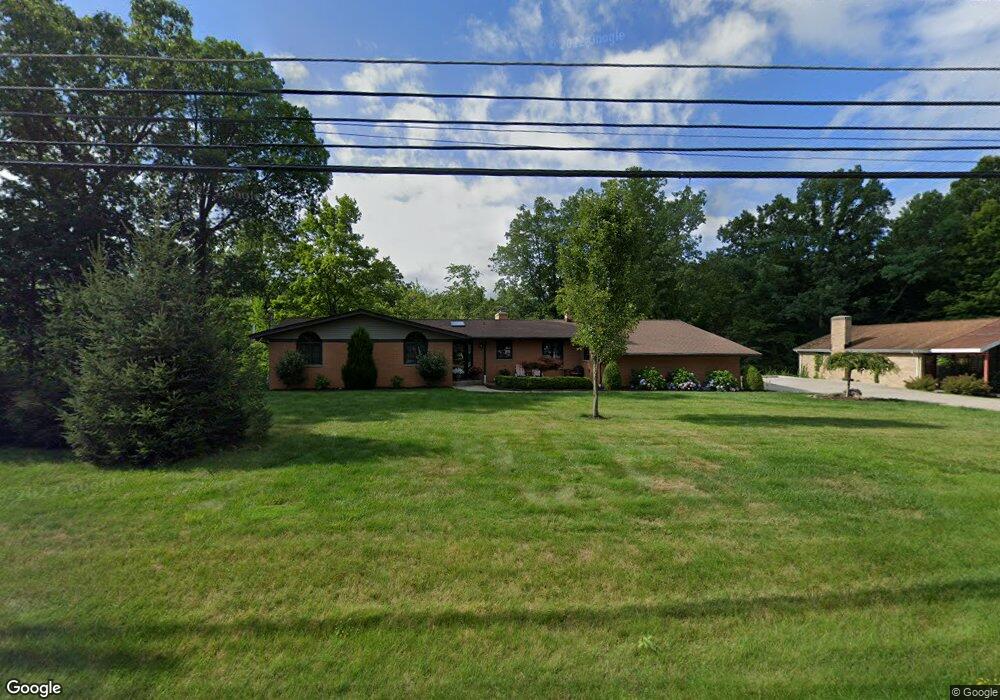
8800 Brookside Rd Independence, OH 44131
Estimated Value: $331,083 - $381,000
3
Beds
3
Baths
1,999
Sq Ft
$180/Sq Ft
Est. Value
About This Home
This home is located at 8800 Brookside Rd, Independence, OH 44131 and is currently estimated at $360,771, approximately $180 per square foot. 8800 Brookside Rd is a home located in Cuyahoga County with nearby schools including Independence Primary School, Independence Middle School, and Independence High School.
Ownership History
Date
Name
Owned For
Owner Type
Purchase Details
Closed on
Nov 25, 2024
Sold by
Franko William W and Franko Susie
Bought by
Tabbaa Tara and Tabbaa Dana
Current Estimated Value
Purchase Details
Closed on
Nov 13, 2013
Sold by
Miller Mark C
Bought by
Franko William W and Franko Susie
Purchase Details
Closed on
Jan 19, 2001
Sold by
Miller Julie A
Bought by
Miller Mark C
Purchase Details
Closed on
Jun 25, 1984
Sold by
Boettner Wilfred H and Boettner Mary E
Bought by
Miller Mark C
Purchase Details
Closed on
Jan 1, 1975
Bought by
Boettner Wilfred H and Boettner Mary E
Create a Home Valuation Report for This Property
The Home Valuation Report is an in-depth analysis detailing your home's value as well as a comparison with similar homes in the area
Home Values in the Area
Average Home Value in this Area
Purchase History
| Date | Buyer | Sale Price | Title Company |
|---|---|---|---|
| Tabbaa Tara | $200,000 | Fidelity National Title | |
| Tabbaa Tara | $200,000 | Fidelity National Title | |
| Franko William W | $155,000 | Suntrust Title Agency | |
| Miller Mark C | -- | -- | |
| Miller Mark C | $110,000 | -- | |
| Boettner Wilfred H | -- | -- |
Source: Public Records
Tax History
| Year | Tax Paid | Tax Assessment Tax Assessment Total Assessment is a certain percentage of the fair market value that is determined by local assessors to be the total taxable value of land and additions on the property. | Land | Improvement |
|---|---|---|---|---|
| 2024 | $5,113 | $106,470 | $35,105 | $71,365 |
| 2023 | $4,654 | $87,920 | $35,700 | $52,220 |
| 2022 | $4,628 | $87,920 | $35,700 | $52,220 |
| 2021 | $4,562 | $87,920 | $35,700 | $52,220 |
| 2020 | $4,462 | $80,680 | $32,760 | $47,920 |
| 2019 | $4,308 | $230,500 | $93,600 | $136,900 |
| 2018 | $4,678 | $80,680 | $32,760 | $47,920 |
| 2017 | $5,161 | $92,370 | $34,480 | $57,890 |
| 2016 | $5,109 | $91,500 | $34,480 | $57,020 |
| 2015 | $4,681 | $91,500 | $34,480 | $57,020 |
| 2014 | $4,681 | $84,700 | $31,920 | $52,780 |
Source: Public Records
Map
Nearby Homes
- 7311 Brecksville Rd
- 7003 Brecksville Rd
- 6752 Rivercrest Dr
- SL 23 Kingscote Park
- 8001 Robin Ln
- 10635 Tanager Trail
- 6626 Hawthorne Dr
- 6312 E Pleasant Valley Rd
- 6119 E Sprague Rd
- 6895 Carriage Hill Dr Unit E77
- 7030 Carriage Hill Dr Unit 202
- 11004 Greenhaven Pkwy
- 6930 Carriage Hill Dr Unit 101
- 6910 Carriage Hill Dr Unit 104
- 9800 Gleeson Dr
- 8420 Stone Rd
- 6990 S Great Oaks Pkwy
- 8556 Brecksville Rd
- 0 Brecksville Rd
- 8630 Hollis Ln
- 8709 Brookside Rd
- 8417 Brookside Rd
- 8414 Brookside Rd
- 8800 Bramley Dr
- 8403 Brookside Rd
- 8410 Brookside Rd
- 8703 Brookside Rd
- 8715 Bramley Dr
- 8818 Bramley Dr
- 8321 Brookside Rd
- 8408 Brookside Rd
- 8801 Bramley Dr
- 8324 Brookside Rd
- 8311 Brookside Rd
- 8815 Bramley Dr
- 8926 Brookside Rd
- 8315 Montello Rd
- 8304 Brookside Rd
- 8316 Montello Rd
Your Personal Tour Guide
Ask me questions while you tour the home.