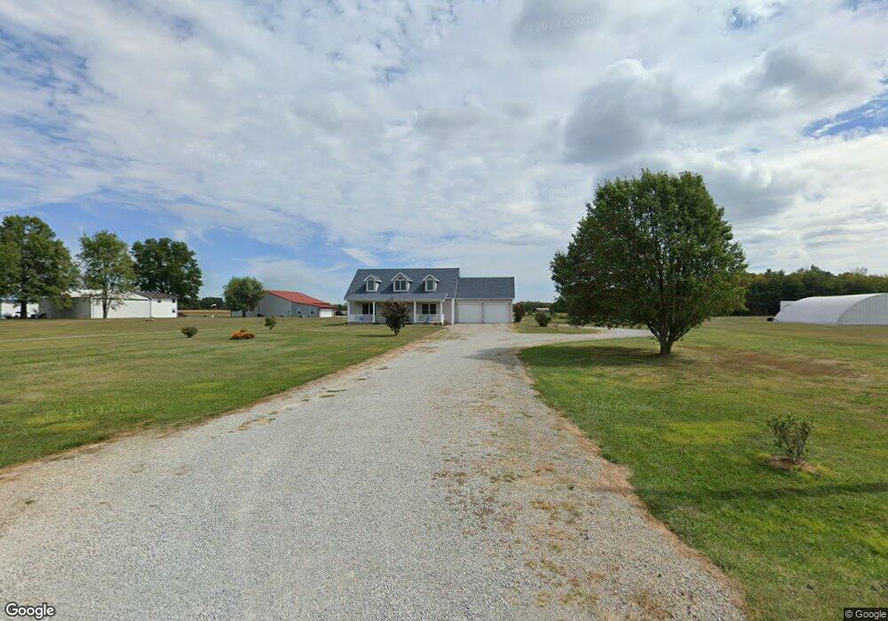
8804 Airport Rd Georgetown, OH 45121
Estimated Value: $157,000 - $198,000
3
Beds
2
Baths
1,232
Sq Ft
$143/Sq Ft
Est. Value
About This Home
This home is located at 8804 Airport Rd, Georgetown, OH 45121 and is currently estimated at $176,339, approximately $143 per square foot. 8804 Airport Rd is a home located in Brown County with nearby schools including Georgetown Elementary School and Georgetown Jr/Sr High School.
Ownership History
Date
Name
Owned For
Owner Type
Purchase Details
Closed on
Jul 21, 2017
Sold by
Latham Randall W and Latham Donna M
Bought by
Click Michael A and Click Suzanne M
Current Estimated Value
Home Financials for this Owner
Home Financials are based on the most recent Mortgage that was taken out on this home.
Original Mortgage
$85,000
Interest Rate
3.91%
Mortgage Type
New Conventional
Create a Home Valuation Report for This Property
The Home Valuation Report is an in-depth analysis detailing your home's value as well as a comparison with similar homes in the area
Home Values in the Area
Average Home Value in this Area
Purchase History
| Date | Buyer | Sale Price | Title Company |
|---|---|---|---|
| Click Michael A | $110,000 | Technetitle Agency Inc |
Source: Public Records
Mortgage History
| Date | Status | Borrower | Loan Amount |
|---|---|---|---|
| Closed | Click Michael A | $85,000 |
Source: Public Records
Tax History Compared to Growth
Tax History
| Year | Tax Paid | Tax Assessment Tax Assessment Total Assessment is a certain percentage of the fair market value that is determined by local assessors to be the total taxable value of land and additions on the property. | Land | Improvement |
|---|---|---|---|---|
| 2024 | $1,649 | $45,470 | $2,710 | $42,760 |
| 2023 | $1,649 | $34,210 | $2,320 | $31,890 |
| 2022 | $1,349 | $34,210 | $2,320 | $31,890 |
| 2021 | $1,337 | $34,210 | $2,320 | $31,890 |
| 2020 | $1,182 | $28,510 | $1,930 | $26,580 |
| 2019 | $1,174 | $28,510 | $1,930 | $26,580 |
| 2018 | $1,166 | $28,510 | $1,930 | $26,580 |
| 2017 | $874 | $25,220 | $2,120 | $23,100 |
| 2016 | $874 | $25,220 | $2,120 | $23,100 |
| 2015 | $916 | $25,220 | $2,120 | $23,100 |
| 2014 | $916 | $25,030 | $1,930 | $23,100 |
| 2013 | $913 | $25,030 | $1,930 | $23,100 |
Source: Public Records
Map
Nearby Homes
- 143 Hamer Rd
- 30 Straight Dr
- 83 Hamer Rd
- 427 Kenwood Ave
- 874 Mount Orab Pike
- 331 Spring Grove Dr
- 60 New St
- 403 Elmwood Ct
- 401 Elmwood Ct
- 508 Mount Orab Pike
- 406 E North St
- 414 N Water St
- 102 N Elm St
- 107 N Elm St
- 708 E State St
- 666 E State St
- 409 N Main St
- 405 N Main St
- 120 N Apple St
- 5781 Camp Run Rd
- 8804 Airport Rd
- 8816 Airport Rd
- 8846 Airport Rd
- 8846 Airport Rd
- 8774 Airport Rd
- 8710 Airport Rd
- 106 Airport Ln
- 8914 Airport Rd
- 4971 Camp Run Rd
- 8940 Airport Rd
- 5081 Camp Run Rd
- 5117 Camp Run Rd
- 5102 Camp Run Rd
- 9001 Airport Rd
- 8759 McGohan Rd
- 5134 Camp Run Rd
- 8809 McGohan Rd
- 4962 Camp Run Rd
- 8737 McGohan Rd
- 8861 McGohan Rd