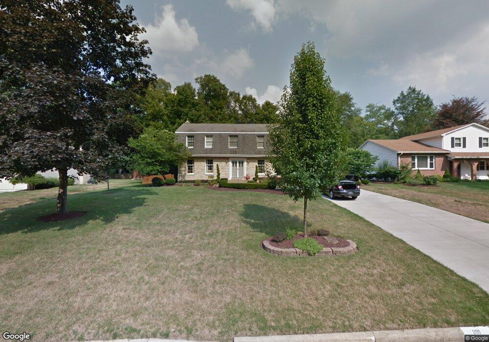
881 Squirrel Hill Dr Youngstown, OH 44512
Estimated Value: $321,742 - $335,000
3
Beds
2
Baths
2,352
Sq Ft
$140/Sq Ft
Est. Value
About This Home
This home is located at 881 Squirrel Hill Dr, Youngstown, OH 44512 and is currently estimated at $328,936, approximately $139 per square foot. 881 Squirrel Hill Dr is a home located in Mahoning County with nearby schools including Stadium Drive Elementary School, Boardman Center Middle School, and Boardman High School.
Ownership History
Date
Name
Owned For
Owner Type
Purchase Details
Closed on
Dec 14, 1995
Sold by
Pennsy Dev Co
Bought by
Santiago Ramon J and Santiago Michelle G
Current Estimated Value
Home Financials for this Owner
Home Financials are based on the most recent Mortgage that was taken out on this home.
Original Mortgage
$70,000
Interest Rate
5.29%
Mortgage Type
New Conventional
Purchase Details
Closed on
Jun 29, 1987
Bought by
Chmielewski Steve
Create a Home Valuation Report for This Property
The Home Valuation Report is an in-depth analysis detailing your home's value as well as a comparison with similar homes in the area
Home Values in the Area
Average Home Value in this Area
Purchase History
| Date | Buyer | Sale Price | Title Company |
|---|---|---|---|
| Santiago Ramon J | $162,500 | -- | |
| Chmielewski Steve | -- | -- |
Source: Public Records
Mortgage History
| Date | Status | Borrower | Loan Amount |
|---|---|---|---|
| Closed | Santiago Ramon J | $70,000 |
Source: Public Records
Tax History Compared to Growth
Tax History
| Year | Tax Paid | Tax Assessment Tax Assessment Total Assessment is a certain percentage of the fair market value that is determined by local assessors to be the total taxable value of land and additions on the property. | Land | Improvement |
|---|---|---|---|---|
| 2024 | $4,664 | $92,520 | $12,880 | $79,640 |
| 2023 | $4,601 | $92,520 | $12,880 | $79,640 |
| 2022 | $4,252 | $65,390 | $13,040 | $52,350 |
| 2021 | $4,254 | $65,390 | $13,040 | $52,350 |
| 2020 | $4,277 | $65,390 | $13,040 | $52,350 |
| 2019 | $4,406 | $60,550 | $12,080 | $48,470 |
| 2018 | $3,834 | $60,550 | $12,080 | $48,470 |
| 2017 | $3,831 | $60,550 | $12,080 | $48,470 |
| 2016 | $3,830 | $59,940 | $11,070 | $48,870 |
| 2015 | $3,753 | $59,940 | $11,070 | $48,870 |
| 2014 | $3,764 | $59,940 | $11,070 | $48,870 |
| 2013 | $3,716 | $59,940 | $11,070 | $48,870 |
Source: Public Records
Map
Nearby Homes
- 7716 Silver Fox Dr
- 7692 W Parkside Dr
- 7511 E Parkside Dr
- 7784 Hitchcock Rd
- 7603 Red Fox Dr
- 7556 Jaguar Dr
- 7544 Jaguar Dr
- 179 Southwoods Ave
- 7553 Glenwood Ave
- 8121 Hitchcock Rd Unit 10
- 2319 Hunters Ridge
- 7851 Huntington Cir
- 7387 Oregon Trail
- 7367 Oregon Trail
- 0 Pinewood Dr Unit 5140025
- 1193 Red Tail Hawk Ct Unit 1
- 466 Green Garden Dr
- 134 Mayflower Dr
- 6938 Ron Park Place
- 1133 Red Tail Hawk Ct Unit 6
- 887 Squirrel Hill Dr
- 873 Squirrel Hill Dr
- 7754 Silver Fox Dr
- 7760 Silver Fox Dr
- 893 Squirrel Hill Dr
- 7752 Silver Fox Dr
- 867 Squirrel Hill Dr
- 880 Squirrel Hill Dr
- 7764 Silver Fox Dr
- 7748 Silver Fox Dr
- 892 Squirrel Hill Dr
- 859 Squirrel Hill Dr
- 889 Squirrel Hill Dr
- 899 Squirrel Hill Dr
- 866 Squirrel Hill Dr
- 7744 Silver Fox Dr
- 7768 Silver Fox Dr
- 898 Squirrel Hill Dr
- 7757 Silver Fox Dr
- 7753 Silver Fox Dr