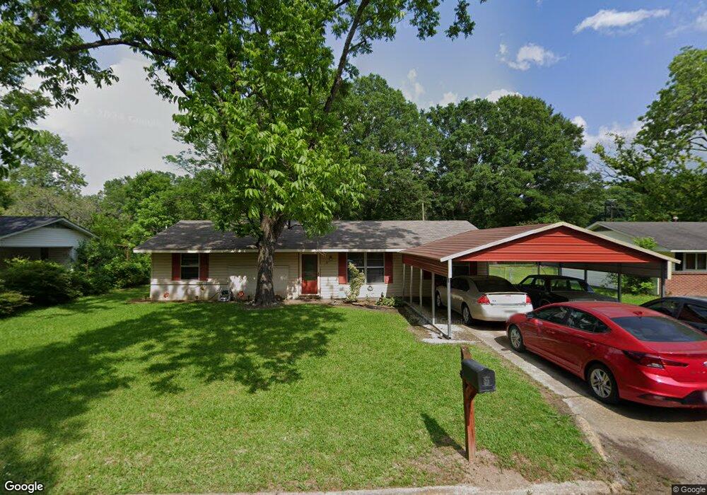
882 Locust Dr West Point, MS 39773
Estimated Value: $116,000 - $141,000
3
Beds
--
Bath
1,211
Sq Ft
$105/Sq Ft
Est. Value
About This Home
This home is located at 882 Locust Dr, West Point, MS 39773 and is currently estimated at $127,616, approximately $105 per square foot. 882 Locust Dr is a home located in Clay County with nearby schools including East Side Elementary School, West Clay Elementary School, and Church Hill Elementary School.
Ownership History
Date
Name
Owned For
Owner Type
Purchase Details
Closed on
Aug 10, 2012
Sold by
Federal National Mortgage Association
Bought by
Jones Shirley F
Current Estimated Value
Purchase Details
Closed on
Jun 29, 2006
Sold by
Young Kavan L and Young Tonya H
Bought by
Hollis Rex Allen
Create a Home Valuation Report for This Property
The Home Valuation Report is an in-depth analysis detailing your home's value as well as a comparison with similar homes in the area
Purchase History
| Date | Buyer | Sale Price | Title Company |
|---|---|---|---|
| Jones Shirley F | -- | -- | |
| Hollis Rex Allen | -- | -- |
Source: Public Records
Tax History
| Year | Tax Paid | Tax Assessment Tax Assessment Total Assessment is a certain percentage of the fair market value that is determined by local assessors to be the total taxable value of land and additions on the property. | Land | Improvement |
|---|---|---|---|---|
| 2025 | -- | $5,957 | $1,140 | $4,817 |
| 2024 | -- | $5,957 | $1,140 | $4,817 |
| 2023 | $185 | $5,957 | $1,140 | $4,817 |
| 2022 | $0 | $5,957 | $1,140 | $4,817 |
| 2021 | $0 | $5,957 | $1,140 | $4,817 |
| 2020 | $185 | $5,957 | $1,140 | $4,817 |
| 2019 | $185 | $5,913 | $1,140 | $4,773 |
| 2018 | $175 | $5,913 | $1,140 | $4,773 |
| 2017 | $173 | $5,913 | $1,140 | $4,773 |
| 2016 | $170 | $5,913 | $1,140 | $4,773 |
| 2015 | $167 | $5,534 | $1,140 | $4,394 |
| 2014 | $152 | $5,534 | $1,140 | $4,394 |
| 2013 | $152 | $5,534 | $1,140 | $4,394 |
Source: Public Records
Map
Nearby Homes
- 218 Lewellen St
- 7642 Highway 45 Alternate N
- 0 Kennedy Dr
- 0 Us Hwy 45a Unit 4033641
- 0 Us Hwy 45a Unit 22-3720
- 237 Guyton Cir
- 49 Barksdale Dr
- 123 Cottrell St
- 530 E Morrow St
- 13 Cul de Sac St
- 399 Lone Oak Dr
- 0 Mississippi 50
- 761 E Morrow St
- 0 Us-45 Alt N Lot 14
- 26788 E Main St
- 26852 E Main St
- 27045 E Main St
- 26596 E Main St
- 184 Tournament St
- 228 S Division St
- 866 Locust Dr
- 47 Locust Dr
- 874 Locust Dr
- 15 Locust Dr
- 1449 N Division St
- 875 Locust Dr
- 883 Locust Dr
- 1439 N Division St
- 889 N Division St
- 891 Locust Dr
- 1425 N Division St
- 881 N Division St
- 113 Cherry Ln
- 867 Locust Dr
- 2772 Cherry Rd
- 109 Cherry Ln
- 105 Cherry Ln
- 861 N Division St
- 100 Cherry Ln
- 305 Cherry Ln
Your Personal Tour Guide
Ask me questions while you tour the home.