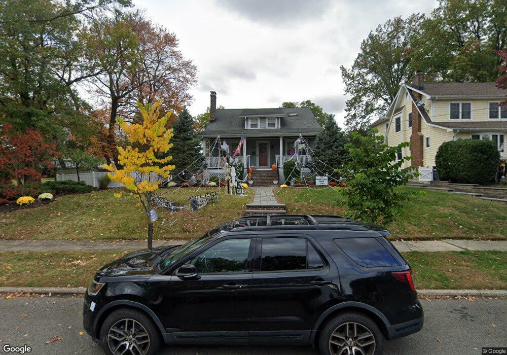
884 Dorian Rd Westfield, NJ 07090
Estimated Value: $1,109,000 - $1,214,919
--
Bed
--
Bath
2,078
Sq Ft
$550/Sq Ft
Est. Value
About This Home
This home is located at 884 Dorian Rd, Westfield, NJ 07090 and is currently estimated at $1,142,480, approximately $549 per square foot. 884 Dorian Rd is a home located in Union County with nearby schools including McKinley Elementary School, Westfield Senior High School, and Holy Trinity School.
Ownership History
Date
Name
Owned For
Owner Type
Purchase Details
Closed on
Oct 31, 2017
Sold by
Fitzpatrick James C and Fitzpatrick Tracey M
Bought by
Sarvey Peter E and Sarvey Amy C
Current Estimated Value
Home Financials for this Owner
Home Financials are based on the most recent Mortgage that was taken out on this home.
Original Mortgage
$461,400
Outstanding Balance
$386,631
Interest Rate
3.85%
Mortgage Type
New Conventional
Estimated Equity
$755,849
Purchase Details
Closed on
Jul 14, 2009
Sold by
Whitlock Dinah Laurie
Bought by
Fitzpatrick James C and Fitzpatrick Tracey M
Home Financials for this Owner
Home Financials are based on the most recent Mortgage that was taken out on this home.
Original Mortgage
$360,000
Interest Rate
5.58%
Mortgage Type
Purchase Money Mortgage
Create a Home Valuation Report for This Property
The Home Valuation Report is an in-depth analysis detailing your home's value as well as a comparison with similar homes in the area
Home Values in the Area
Average Home Value in this Area
Purchase History
| Date | Buyer | Sale Price | Title Company |
|---|---|---|---|
| Sarvey Peter E | $769,000 | None Available | |
| Fitzpatrick James C | $450,000 | Multiple |
Source: Public Records
Mortgage History
| Date | Status | Borrower | Loan Amount |
|---|---|---|---|
| Open | Sarvey Peter E | $461,400 | |
| Previous Owner | Fitzpatrick James C | $360,000 |
Source: Public Records
Tax History Compared to Growth
Tax History
| Year | Tax Paid | Tax Assessment Tax Assessment Total Assessment is a certain percentage of the fair market value that is determined by local assessors to be the total taxable value of land and additions on the property. | Land | Improvement |
|---|---|---|---|---|
| 2025 | $17,444 | $774,600 | $527,100 | $247,500 |
| 2024 | $17,088 | $774,600 | $527,100 | $247,500 |
| 2023 | $17,088 | $774,600 | $527,100 | $247,500 |
| 2022 | $16,731 | $774,600 | $527,100 | $247,500 |
| 2021 | $16,755 | $774,600 | $527,100 | $247,500 |
| 2020 | $16,716 | $774,600 | $527,100 | $247,500 |
| 2019 | $16,654 | $774,600 | $527,100 | $247,500 |
| 2018 | $10,543 | $113,400 | $65,100 | $48,300 |
| 2017 | $10,485 | $113,400 | $65,100 | $48,300 |
| 2016 | $10,112 | $112,000 | $65,100 | $46,900 |
| 2015 | $9,911 | $112,000 | $65,100 | $46,900 |
| 2014 | $9,584 | $112,000 | $65,100 | $46,900 |
Source: Public Records
Map
Nearby Homes
- 1466 Lamberts Mill Rd
- 314 Highgate Ave
- 119 Lamberts Mill Rd
- 2154 W Broad St
- 525 Edgar Rd
- 524 Edgar Rd
- 2 Brookside Ct
- 614 Dorian Rd
- 676 Vermont St
- 2116 Newark Ave
- 1933 W Broad St
- 2 Dutch Ln
- 724 South Ave W Unit 724A
- 538 Westfield Ave
- 1933 Mary Ellen Ln
- 522 Boulevard
- 834 Tice Place
- 350 W Dudley Ave
- 57 Rambling Dr
- 814 Summit Ave
- 321 Lamberts Mill Rd
- 874 Dorian Rd
- 1466 Lamberts Mill Rd Unit 1
- 311 Lamberts Mill Rd
- 2153 Gallagher Ave
- 310 Saint Johns Place
- 1478 Lamberts Mill Rd
- 881 Dorian Rd
- 871 Dorian Rd
- 866 Dorian Rd
- 2150 Gallagher Ave
- 869 Dorian Rd
- 1446 Lamberts Mill Rd
- 785 Warren St
- 777 Warren St
- 1484 Lamberts Mill Rd
- 771 Warren St
- 862 Dorian Rd
- 321 Saint Johns Place
- 867 Dorian Rd