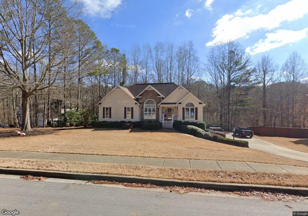
884 Whitby Dr Douglasville, GA 30134
Estimated Value: $324,000 - $394,000
4
Beds
3
Baths
1,749
Sq Ft
$199/Sq Ft
Est. Value
About This Home
This home is located at 884 Whitby Dr, Douglasville, GA 30134 and is currently estimated at $347,619, approximately $198 per square foot. 884 Whitby Dr is a home located in Paulding County with nearby schools including Connie Dugan Elementary School, Irma C. Austin Middle School, and South Paulding High School.
Ownership History
Date
Name
Owned For
Owner Type
Purchase Details
Closed on
Oct 26, 2000
Sold by
Ronnir Cochran Properties
Bought by
Burdett Roy O and Burdett Linda D
Current Estimated Value
Purchase Details
Closed on
Jul 17, 2000
Sold by
Earl Cohran Homes Inc
Bought by
Cohran Ronnie
Home Financials for this Owner
Home Financials are based on the most recent Mortgage that was taken out on this home.
Original Mortgage
$136,000
Interest Rate
8.23%
Mortgage Type
New Conventional
Create a Home Valuation Report for This Property
The Home Valuation Report is an in-depth analysis detailing your home's value as well as a comparison with similar homes in the area
Home Values in the Area
Average Home Value in this Area
Purchase History
| Date | Buyer | Sale Price | Title Company |
|---|---|---|---|
| Burdett Roy O | $146,900 | -- | |
| Ronnie Cochran Properties | -- | -- | |
| Cohran Ronnie | $29,000 | -- |
Source: Public Records
Mortgage History
| Date | Status | Borrower | Loan Amount |
|---|---|---|---|
| Previous Owner | Cohran Ronnie | $136,000 |
Source: Public Records
Tax History Compared to Growth
Tax History
| Year | Tax Paid | Tax Assessment Tax Assessment Total Assessment is a certain percentage of the fair market value that is determined by local assessors to be the total taxable value of land and additions on the property. | Land | Improvement |
|---|---|---|---|---|
| 2024 | $3,388 | $139,440 | $12,000 | $127,440 |
| 2023 | $3,350 | $131,040 | $12,000 | $119,040 |
| 2022 | $2,799 | $109,240 | $12,000 | $97,240 |
| 2021 | $2,755 | $96,680 | $12,000 | $84,680 |
| 2020 | $2,411 | $83,040 | $12,000 | $71,040 |
| 2019 | $2,260 | $76,880 | $12,000 | $64,880 |
| 2016 | $1,934 | $65,840 | $12,000 | $53,840 |
| 2015 | $1,822 | $61,040 | $12,000 | $49,040 |
| 2014 | $1,533 | $50,440 | $12,000 | $38,440 |
| 2013 | -- | $43,720 | $12,000 | $31,720 |
Source: Public Records
Map
Nearby Homes
- 860 Whitby Dr
- 910 Whitby Dr
- 865 Whitby Dr
- 915 Whitby Dr
- 920 Whitby Dr
- 923 Whitby Dr
- 980 Tynsdale Dr
- 843 Whitby Dr
- 977 Tynsdale Dr
- 810 Whitby Dr
- 948 Tynsdale Dr
- 961 Tynsdale Dr
- 825 Whitby Dr
- 788 Whitby Dr
- 914 Tynsdale Dr
- 807 Whitby Dr
- 124 Warrenton Dr
- 148 Warrenton Dr
- 949 Tynsdale Dr
- 104 Warrenton Dr