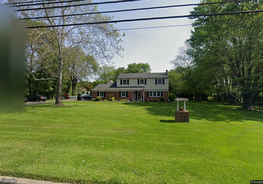
885 Pulinski Rd Warminster, PA 18974
Estimated Value: $582,000 - $684,000
4
Beds
3
Baths
2,222
Sq Ft
$284/Sq Ft
Est. Value
About This Home
This home is located at 885 Pulinski Rd, Warminster, PA 18974 and is currently estimated at $630,669, approximately $283 per square foot. 885 Pulinski Rd is a home located in Bucks County with nearby schools including Maureen M. Welch Elementary School, Richboro Middle School, and Council Rock High School - South.
Ownership History
Date
Name
Owned For
Owner Type
Purchase Details
Closed on
Mar 29, 1996
Sold by
Frusco Christopher J and Frusco Anna Marie
Bought by
Palumbo David R and Palumbo Christine
Current Estimated Value
Home Financials for this Owner
Home Financials are based on the most recent Mortgage that was taken out on this home.
Original Mortgage
$146,000
Outstanding Balance
$6,865
Interest Rate
7.34%
Estimated Equity
$623,804
Purchase Details
Closed on
Sep 15, 1993
Bought by
Frusco Christopher J and Anna Marie
Create a Home Valuation Report for This Property
The Home Valuation Report is an in-depth analysis detailing your home's value as well as a comparison with similar homes in the area
Home Values in the Area
Average Home Value in this Area
Purchase History
| Date | Buyer | Sale Price | Title Company |
|---|---|---|---|
| Palumbo David R | $183,000 | -- | |
| Frusco Christopher J | $193,000 | -- |
Source: Public Records
Mortgage History
| Date | Status | Borrower | Loan Amount |
|---|---|---|---|
| Open | Palumbo David R | $146,000 |
Source: Public Records
Tax History Compared to Growth
Tax History
| Year | Tax Paid | Tax Assessment Tax Assessment Total Assessment is a certain percentage of the fair market value that is determined by local assessors to be the total taxable value of land and additions on the property. | Land | Improvement |
|---|---|---|---|---|
| 2025 | $6,934 | $36,000 | $9,760 | $26,240 |
| 2024 | $6,934 | $36,000 | $9,760 | $26,240 |
| 2023 | $6,535 | $36,000 | $9,760 | $26,240 |
| 2022 | $6,475 | $36,000 | $9,760 | $26,240 |
| 2021 | $6,270 | $36,000 | $9,760 | $26,240 |
| 2020 | $6,129 | $36,000 | $9,760 | $26,240 |
| 2019 | $5,867 | $36,000 | $9,760 | $26,240 |
| 2018 | $5,763 | $36,000 | $9,760 | $26,240 |
| 2017 | $5,540 | $36,000 | $9,760 | $26,240 |
| 2016 | $5,540 | $36,000 | $9,760 | $26,240 |
| 2015 | -- | $36,000 | $9,760 | $26,240 |
| 2014 | -- | $36,000 | $9,760 | $26,240 |
Source: Public Records
Map
Nearby Homes
- 223 Cecelia Acres Dr
- 18 Lacey Ln
- 8 Lacey Ln
- 11 Spring Mill Dr
- 9 Spring Mill Dr
- 10 Spring Mill Dr
- The Addis Plan at The Reserve at Spring Mill
- The Beckett Plan at The Reserve at Spring Mill
- 59 Parry Way
- 55 Parry Way
- 3 Shady Pines Dr
- 56 Parry Way
- 23 Oxford Dr
- 290 Hatboro Rd
- 146 Grandview Dr
- 636 Almshouse Rd
- 105 Edwards Dr
- 1000 Old Jacksonville Rd
- 112 Edwards Dr
- 6 Breckenridge Dr
- Lot 1 Pulinski Rd
- 895 Pulinski Rd
- 90 Wheatsheaf Rd
- 851 Pulinski Rd
- 70 Wheatsheaf Rd
- 110 Wheatsheaf Rd
- 8 Golfview Dr
- 905 Pulinski Rd
- 841 Pulinski Rd
- 50 Wheatsheaf Rd
- 85 Wheatsheaf Rd
- 130 Grasshopper Dr
- 120 Grasshopper Dr
- 840 Pulinski Rd
- 890 Pulinski Rd
- 63 Wheatsheaf Rd
- 16 Golfview Dr
- 10 Wheatsheaf Rd
- 30 Wheatsheaf Rd
- 815 Pulinski Rd