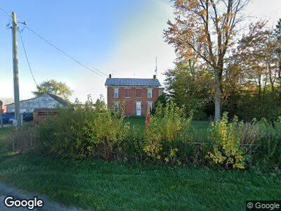
8855 State Route 705 Yorkshire, OH 45388
Estimated Value: $242,967 - $422,000
4
Beds
2
Baths
2,592
Sq Ft
$121/Sq Ft
Est. Value
About This Home
This home is located at 8855 State Route 705, Yorkshire, OH 45388 and is currently estimated at $314,742, approximately $121 per square foot. 8855 State Route 705 is a home located in Darke County with nearby schools including Marion Local Elementary School and Marion Local High School.
Ownership History
Date
Name
Owned For
Owner Type
Purchase Details
Closed on
May 19, 2009
Sold by
Rutschilling Amy Marie
Bought by
Rutschilling Larry William
Current Estimated Value
Home Financials for this Owner
Home Financials are based on the most recent Mortgage that was taken out on this home.
Original Mortgage
$55,000
Interest Rate
4.9%
Mortgage Type
New Conventional
Purchase Details
Closed on
Sep 1, 1988
Bought by
Rutschilling Larry William
Purchase Details
Closed on
Aug 1, 1988
Bought by
Rutschilling Larry William
Create a Home Valuation Report for This Property
The Home Valuation Report is an in-depth analysis detailing your home's value as well as a comparison with similar homes in the area
Home Values in the Area
Average Home Value in this Area
Purchase History
| Date | Buyer | Sale Price | Title Company |
|---|---|---|---|
| Rutschilling Larry William | -- | Attorney | |
| Rutschilling Larry William | $52,100 | -- | |
| Rutschilling Larry William | $102,900 | -- |
Source: Public Records
Mortgage History
| Date | Status | Borrower | Loan Amount |
|---|---|---|---|
| Open | Rutschilling Larry William | $62,000 | |
| Closed | Rutschilling Larry William | $55,000 |
Source: Public Records
Tax History Compared to Growth
Tax History
| Year | Tax Paid | Tax Assessment Tax Assessment Total Assessment is a certain percentage of the fair market value that is determined by local assessors to be the total taxable value of land and additions on the property. | Land | Improvement |
|---|---|---|---|---|
| 2024 | $2,163 | $59,430 | $11,610 | $47,820 |
| 2023 | $2,164 | $59,430 | $11,610 | $47,820 |
| 2022 | $1,821 | $48,760 | $10,010 | $38,750 |
| 2021 | $1,854 | $48,760 | $10,010 | $38,750 |
| 2020 | $1,859 | $48,760 | $10,010 | $38,750 |
| 2019 | $1,632 | $42,010 | $9,720 | $32,290 |
| 2018 | $1,701 | $42,010 | $9,720 | $32,290 |
| 2017 | $1,308 | $42,010 | $9,720 | $32,290 |
| 2016 | $1,289 | $32,430 | $8,970 | $23,460 |
| 2015 | $1,289 | $32,430 | $8,970 | $23,460 |
| 2014 | $1,291 | $32,430 | $8,970 | $23,460 |
| 2013 | $1,438 | $32,150 | $8,690 | $23,460 |
Source: Public Records
Map
Nearby Homes
- 8855 State Route 705
- 8845 Ohio 705
- 8687 State Route 705
- 14444 Reed Rd
- 8528 State Route 705
- 8733 N Star Fort Loramie Rd
- 230 Church St
- 177 Church St
- 178 Church St
- 147 Church St
- 14391 Coble Rd
- 156 E Main St
- 14407 Coble Rd
- 168 Church St
- 137 Church St
- 14071 Coble Rd
- 146 W Main St
- 127 Church St
- 137 E Main St
- 14502 Coble Rd