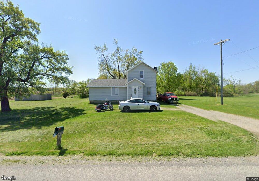
8864 Packard Rd Morenci, MI 49256
Estimated Value: $104,000 - $216,000
3
Beds
1
Bath
1,602
Sq Ft
$98/Sq Ft
Est. Value
About This Home
This home is located at 8864 Packard Rd, Morenci, MI 49256 and is currently estimated at $157,034, approximately $98 per square foot. 8864 Packard Rd is a home located in Lenawee County with nearby schools including Ruth McGregor Elementary School and Sand Creek High School.
Ownership History
Date
Name
Owned For
Owner Type
Purchase Details
Closed on
Jul 10, 2020
Sold by
Clore Victor R
Bought by
Clore Victor R
Current Estimated Value
Purchase Details
Closed on
Jul 23, 2014
Sold by
Fannie Mae
Bought by
Clore Victor R
Purchase Details
Closed on
Jan 31, 2014
Sold by
Doldsmith Dale and Goldsmith Dale R
Bought by
Fannie Mae and Federal National Mortgage Association
Purchase Details
Closed on
Oct 28, 2013
Sold by
First Federal Bank Of Midwest
Bought by
Fannie Mae and Federal National Mortgage Association
Purchase Details
Closed on
Dec 15, 2007
Sold by
Goldsmith Louann and Goldsmith Dale
Bought by
Goldsmith Dale
Purchase Details
Closed on
Mar 17, 1992
Bought by
Fannie Mae
Create a Home Valuation Report for This Property
The Home Valuation Report is an in-depth analysis detailing your home's value as well as a comparison with similar homes in the area
Purchase History
| Date | Buyer | Sale Price | Title Company |
|---|---|---|---|
| Clore Victor R | -- | None Available | |
| Clore Victor R | $37,000 | Midstate Title | |
| Fannie Mae | $4,000 | None Available | |
| Fannie Mae | -- | None Available | |
| Goldsmith Dale | -- | None Available | |
| Fannie Mae | -- | -- |
Source: Public Records
Tax History
| Year | Tax Paid | Tax Assessment Tax Assessment Total Assessment is a certain percentage of the fair market value that is determined by local assessors to be the total taxable value of land and additions on the property. | Land | Improvement |
|---|---|---|---|---|
| 2025 | $1,323 | $61,600 | $0 | $0 |
| 2024 | $6 | $61,500 | $0 | $0 |
| 2023 | $1,209 | $57,600 | $0 | $0 |
| 2022 | $1,170 | $50,900 | $0 | $0 |
| 2021 | $1,170 | $43,600 | $0 | $0 |
| 2020 | $961 | $40,400 | $0 | $0 |
| 2019 | $109,614 | $34,200 | $0 | $0 |
| 2018 | $1,641 | $34,196 | $0 | $0 |
| 2017 | $1,603 | $33,107 | $0 | $0 |
| 2016 | $1,840 | $38,902 | $0 | $0 |
| 2014 | -- | $36,519 | $0 | $0 |
Source: Public Records
Map
Nearby Homes
- 9088 Elliott Hwy
- 8058 Packard Rd
- V L 80a W Weston Rd
- V L 35a W Weston Rd
- 4084 Seneca St
- 0 W Weston Rd
- 10454 M 156
- 4308 W Mulberry Rd
- 6000 Tomer Rd
- 6993 Morey Hwy
- 4511 Furman Hwy
- Lot 10 Whitehouse Ct
- Lot 9 Silver Creek Dr
- 00 Coomer St Unit 9728 Coomer St
- Lot 8 Whitehouse Ct
- 945 N Summit St
- 507 Page St
- 328 E Main St
- 124 W Walnut Rd
- 504 North St
- 8864 Packard Rd Unit PACKARD
- 7058 Packard Rd
- 7024 Packard Rd
- 8807 Tuttle Hwy
- 7218 Packard Rd
- 6603 Packard Rd
- 6308 Packard Rd
- 6532 Packard Rd
- 9326 Clement Hwy
- 9524 Clement Hwy
- 7605 Packard Rd
- 6792 W Horton Rd
- 7000 Wiley Rd
- 6568 Brower Rd
- 7768 Wiley Rd
- 7714 Packard Rd
- 7780 Wiley Rd
- 8155 Tuttle Hwy
- 6161 Packard Rd Unit BLK
- 6158 Packard Rd
Your Personal Tour Guide
Ask me questions while you tour the home.