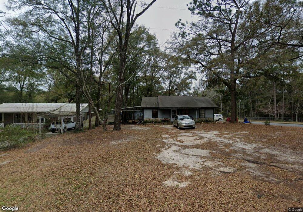
887 Dixie St Crestview, FL 32536
Estimated Value: $158,852 - $325,000
3
Beds
1
Bath
1,186
Sq Ft
$179/Sq Ft
Est. Value
About This Home
This home is located at 887 Dixie St, Crestview, FL 32536 and is currently estimated at $211,713, approximately $178 per square foot. 887 Dixie St is a home located in Okaloosa County with nearby schools including Northwood Elementary School, Davidson Middle School, and Crestview High School.
Ownership History
Date
Name
Owned For
Owner Type
Purchase Details
Closed on
Jan 31, 2018
Sold by
Smith Lance Henry
Bought by
Smith Loretta Gail
Current Estimated Value
Purchase Details
Closed on
Jan 15, 2018
Sold by
Smith Lance Henry
Bought by
Smith Loretta Gail
Purchase Details
Closed on
Jul 13, 2010
Sold by
Deese Harold L
Bought by
Smith Lance H and Smith Loretta G
Home Financials for this Owner
Home Financials are based on the most recent Mortgage that was taken out on this home.
Original Mortgage
$42,400
Interest Rate
4.73%
Mortgage Type
New Conventional
Create a Home Valuation Report for This Property
The Home Valuation Report is an in-depth analysis detailing your home's value as well as a comparison with similar homes in the area
Home Values in the Area
Average Home Value in this Area
Purchase History
| Date | Buyer | Sale Price | Title Company |
|---|---|---|---|
| Smith Loretta Gail | $100 | None Listed On Document | |
| Smith Loretta Gail | -- | Attorney | |
| Smith Lance H | $53,000 | The Main Street Land Title C |
Source: Public Records
Mortgage History
| Date | Status | Borrower | Loan Amount |
|---|---|---|---|
| Previous Owner | Smith Lance H | $42,400 |
Source: Public Records
Tax History
| Year | Tax Paid | Tax Assessment Tax Assessment Total Assessment is a certain percentage of the fair market value that is determined by local assessors to be the total taxable value of land and additions on the property. | Land | Improvement |
|---|---|---|---|---|
| 2025 | $1,929 | $121,514 | $25,835 | $95,679 |
| 2024 | $1,823 | $116,274 | $23,486 | $92,788 |
| 2023 | $1,823 | $124,415 | $21,949 | $102,466 |
| 2022 | $1,690 | $116,730 | $20,513 | $96,217 |
| 2021 | $1,477 | $88,199 | $19,525 | $68,674 |
| 2020 | $1,372 | $81,631 | $19,142 | $62,489 |
| 2019 | $1,258 | $73,949 | $19,142 | $54,807 |
| 2018 | $1,208 | $70,344 | $0 | $0 |
| 2017 | $1,156 | $66,406 | $0 | $0 |
| 2016 | $1,138 | $65,720 | $0 | $0 |
| 2015 | $1,100 | $62,154 | $0 | $0 |
| 2014 | $1,025 | $61,153 | $0 | $0 |
Source: Public Records
Map
Nearby Homes
- 885 Dixie St
- 721 Mclaughlin Ave
- 602 Mc Laughlin St
- 602 Mclaughlin Ave
- 725 Mclaughlin Ave
- 902 Dixie St
- 1.56 Acres Mc Laughlin St
- 961 Dixie St
- 960 Dixie St
- 600 Mclaughlin Ave
- 875 Georgia St
- 798 Dixie St
- 901 Georgia St
- 1002 Anderson St
- 908 Anderson St
- 740 Dixie St
- 797 Georgia St
- 997 Georgia St
- 708 Dixie St
- 898 Georgia St
Your Personal Tour Guide
Ask me questions while you tour the home.