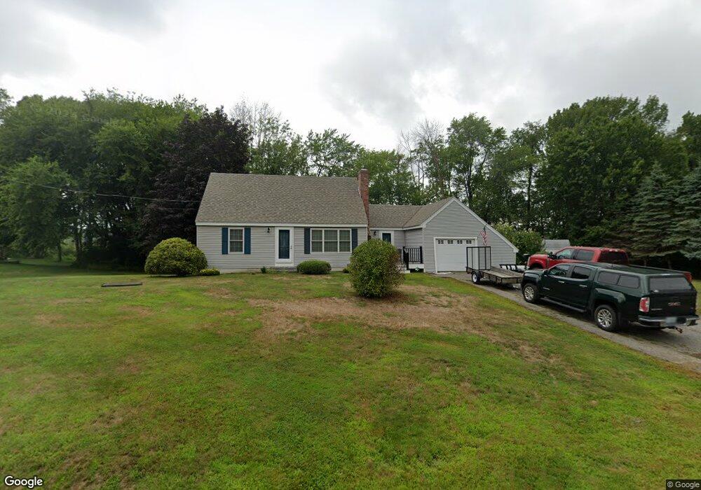
888 Banfield Rd Portsmouth, NH 03801
Estimated Value: $653,000 - $694,000
3
Beds
2
Baths
1,284
Sq Ft
$520/Sq Ft
Est. Value
About This Home
This home is located at 888 Banfield Rd, Portsmouth, NH 03801 and is currently estimated at $668,081, approximately $520 per square foot. 888 Banfield Rd is a home located in Rockingham County with nearby schools including Mary C. Dondero Elementary School, Portsmouth Middle School, and Portsmouth High School.
Ownership History
Date
Name
Owned For
Owner Type
Purchase Details
Closed on
Oct 31, 2023
Sold by
Combs Charles D and Combs Joyce E
Bought by
Combs Ft and Combs
Current Estimated Value
Purchase Details
Closed on
Aug 31, 1989
Bought by
Combs Charles D and Combs Joyce E
Create a Home Valuation Report for This Property
The Home Valuation Report is an in-depth analysis detailing your home's value as well as a comparison with similar homes in the area
Home Values in the Area
Average Home Value in this Area
Purchase History
| Date | Buyer | Sale Price | Title Company |
|---|---|---|---|
| Combs Ft | -- | None Available | |
| Combs Charles D | -- | -- |
Source: Public Records
Mortgage History
| Date | Status | Borrower | Loan Amount |
|---|---|---|---|
| Previous Owner | Combs Charles D | $75,000 |
Source: Public Records
Tax History Compared to Growth
Tax History
| Year | Tax Paid | Tax Assessment Tax Assessment Total Assessment is a certain percentage of the fair market value that is determined by local assessors to be the total taxable value of land and additions on the property. | Land | Improvement |
|---|---|---|---|---|
| 2024 | $6,099 | $545,500 | $249,500 | $296,000 |
| 2023 | $6,049 | $375,000 | $175,200 | $199,800 |
| 2022 | $5,700 | $375,000 | $175,200 | $199,800 |
| 2021 | $5,636 | $375,000 | $175,200 | $199,800 |
| 2020 | $5,513 | $375,000 | $175,200 | $199,800 |
| 2019 | $5,549 | $373,400 | $175,200 | $198,200 |
| 2018 | $5,138 | $324,400 | $150,900 | $173,500 |
| 2017 | $4,731 | $307,600 | $134,100 | $173,500 |
| 2016 | $4,488 | $263,400 | $122,300 | $141,100 |
| 2015 | $4,422 | $263,400 | $122,300 | $141,100 |
| 2014 | $4,512 | $249,300 | $118,100 | $131,200 |
| 2013 | $4,465 | $249,300 | $118,100 | $131,200 |
| 2012 | $4,375 | $249,300 | $118,100 | $131,200 |
Source: Public Records
Map
Nearby Homes
- 540 Ocean Rd
- 380 Ocean Rd Unit 9
- 445 Ocean Rd Unit 4
- 26 Mariette Dr
- 163 Ocean Rd
- 80 Constitution Ave Unit 225
- 80 Constitution Ave Unit 231
- 80 Constitution Ave Unit 321
- 80 Constitution Ave Unit 411
- 80 Constitution Ave Unit 429
- 80 Constitution Ave Unit 222
- Moffat Plan at Sage Portsmouth
- 80 Constitution Ave Unit 211
- Wadsworth Plan at Sage Portsmouth
- Franklin Plan at Sage Portsmouth
- 80 Constitution Ave Unit 328
- 80 Constitution Ave Unit 306
- 80 Constitution Ave Unit 323
- Langdon Plan at Sage Portsmouth
- 80 Constitution Ave Unit 325
- 886 Banfield Rd
- 890 Banfield Rd
- 901 Banfield Rd
- 892 Banfield Rd
- 300 Heritage Ave
- 875 Banfield Rd
- 975 Banfield Rd
- 1011 Banfield Rd
- 969 Banfield Rd
- 280 Heritage Ave
- 280 Heritage Ave
- 280 Heritage Ave Unit B
- 280 Heritage Ave Unit A
- 280 Heritage Ave Unit G
- 280 Heritage Ave Unit H
- 280 Heritage Ave Unit E
- 1047 Banfield Rd
- 850 Banfield Rd
- 820 Banfield Rd
- 124 Heritage Ave Unit 12