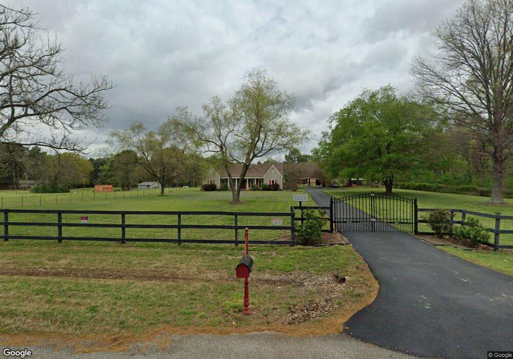
8884 Cedar Crest Ln Olive Branch, MS 38654
Estimated Value: $368,000 - $464,000
4
Beds
3
Baths
2,700
Sq Ft
$146/Sq Ft
Est. Value
About This Home
This home is located at 8884 Cedar Crest Ln, Olive Branch, MS 38654 and is currently estimated at $394,493, approximately $146 per square foot. 8884 Cedar Crest Ln is a home located in DeSoto County with nearby schools including Olive Branch Elementary School, Chickasaw Elementary School, and Olive Branch Middle School.
Ownership History
Date
Name
Owned For
Owner Type
Purchase Details
Closed on
Jun 29, 2010
Sold by
Acers Angelee
Bought by
Stabenow Jennifer M and Stabenow Timothy H
Current Estimated Value
Home Financials for this Owner
Home Financials are based on the most recent Mortgage that was taken out on this home.
Original Mortgage
$240,052
Outstanding Balance
$159,916
Interest Rate
4.77%
Mortgage Type
VA
Estimated Equity
$234,577
Create a Home Valuation Report for This Property
The Home Valuation Report is an in-depth analysis detailing your home's value as well as a comparison with similar homes in the area
Home Values in the Area
Average Home Value in this Area
Purchase History
| Date | Buyer | Sale Price | Title Company |
|---|---|---|---|
| Stabenow Jennifer M | -- | Luckett Land Title Inc |
Source: Public Records
Mortgage History
| Date | Status | Borrower | Loan Amount |
|---|---|---|---|
| Open | Stabenow Jennifer M | $240,052 |
Source: Public Records
Tax History Compared to Growth
Tax History
| Year | Tax Paid | Tax Assessment Tax Assessment Total Assessment is a certain percentage of the fair market value that is determined by local assessors to be the total taxable value of land and additions on the property. | Land | Improvement |
|---|---|---|---|---|
| 2024 | $1,712 | $20,042 | $4,500 | $15,542 |
| 2023 | $1,712 | $20,042 | $0 | $0 |
| 2022 | $2,435 | $20,042 | $4,500 | $15,542 |
| 2021 | $2,435 | $20,042 | $4,500 | $15,542 |
| 2020 | $2,266 | $18,799 | $4,500 | $14,299 |
| 2019 | $2,266 | $18,799 | $4,500 | $14,299 |
| 2017 | $2,230 | $32,384 | $18,442 | $13,942 |
| 2016 | $2,230 | $18,442 | $4,500 | $13,942 |
| 2015 | $2,530 | $32,384 | $18,442 | $13,942 |
| 2014 | $2,448 | $20,032 | $0 | $0 |
| 2013 | $2,368 | $20,032 | $0 | $0 |
Source: Public Records
Map
Nearby Homes
- 9081 Lakeside Dr
- 9004 Lakeside Cove
- 9164 Superior Cove
- 9158 Lakeside Dr
- 9195 Lakeside Dr
- 9037 Plantation Rd
- 8971 Tahoe Cove
- 7129 Brook Mill Cove
- 7206 State Line Rd
- 8939 Travis Dr
- 5517 Harvey Hill Dr
- 6400 State Line Rd
- 8140 Hunters Hill Cove
- 9444 Geneva Loop E
- 9097 Gavin Dr
- 8870 Collinswood Dr
- 8992 Gavin Dr
- 8017 Camptown Ln
- 8300 Waverly Cove
- 9387 Joe Lyon Blvd
- 8816 Cedar Crest Ln
- 8855 Germantown Rd
- 8875 Germantown Rd
- 8795 Germantown Rd
- 8845 Cedar Crest Ln
- 8862 Hickory Ln
- 8885 Cedar Crest Ln
- 8915 Germantown Rd
- 8733 Germantown Rd
- 8805 Cedar Crest Ln
- 8821 Oakwood Dr
- 8955 Germantown Rd
- 9005 Ontario Dr
- 9009 Ontario Dr
- 8740 Cedar Crest Ln
- 8880 Germantown Rd
- 8677 Germantown Rd
- 9015 Ontario Dr
- 9004 Lakeshore Dr
- 8755 Cedar Crest Ln