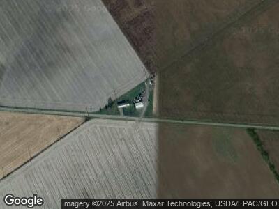
8886 Mccarty Rd Woodstock, OH 43084
Estimated Value: $144,000 - $209,713
3
Beds
2
Baths
1,782
Sq Ft
$94/Sq Ft
Est. Value
About This Home
This home is located at 8886 Mccarty Rd, Woodstock, OH 43084 and is currently estimated at $167,238, approximately $93 per square foot. 8886 Mccarty Rd is a home located in Champaign County with nearby schools including Triad Elementary School, Triad Middle School, and Triad High School.
Ownership History
Date
Name
Owned For
Owner Type
Purchase Details
Closed on
Sep 4, 2014
Sold by
Miller Marsha and Miller Brent
Bought by
Hollar Chad and Moore Lely
Current Estimated Value
Purchase Details
Closed on
May 2, 2011
Sold by
Honda Federal Credit Union
Bought by
Miller Marsha
Purchase Details
Closed on
Nov 17, 2010
Sold by
Ussher Thomas L and Case #10Cv113
Bought by
Honda Federal Credit Union
Purchase Details
Closed on
May 9, 2003
Sold by
Ussher Jerry
Bought by
Ussher Thomas L and Ussher Melinda G
Home Financials for this Owner
Home Financials are based on the most recent Mortgage that was taken out on this home.
Original Mortgage
$52,700
Interest Rate
6.43%
Mortgage Type
Purchase Money Mortgage
Create a Home Valuation Report for This Property
The Home Valuation Report is an in-depth analysis detailing your home's value as well as a comparison with similar homes in the area
Home Values in the Area
Average Home Value in this Area
Purchase History
| Date | Buyer | Sale Price | Title Company |
|---|---|---|---|
| Hollar Chad | $15,000 | None Available | |
| Miller Marsha | $20,000 | Attorney | |
| Honda Federal Credit Union | $33,371 | None Available | |
| Ussher Thomas L | $51,300 | -- |
Source: Public Records
Mortgage History
| Date | Status | Borrower | Loan Amount |
|---|---|---|---|
| Open | Hollar Chad | $34,400 | |
| Previous Owner | Ussher Thomas L | $52,700 |
Source: Public Records
Tax History Compared to Growth
Tax History
| Year | Tax Paid | Tax Assessment Tax Assessment Total Assessment is a certain percentage of the fair market value that is determined by local assessors to be the total taxable value of land and additions on the property. | Land | Improvement |
|---|---|---|---|---|
| 2024 | $1,015 | $26,390 | $10,480 | $15,910 |
| 2023 | $1,015 | $26,390 | $10,480 | $15,910 |
| 2022 | $1,014 | $26,390 | $10,480 | $15,910 |
| 2021 | $873 | $21,120 | $8,390 | $12,730 |
| 2020 | $873 | $21,120 | $8,390 | $12,730 |
| 2019 | $859 | $21,120 | $8,390 | $12,730 |
| 2018 | $852 | $21,580 | $8,040 | $13,540 |
| 2017 | $646 | $16,570 | $8,040 | $8,530 |
| 2016 | $642 | $16,570 | $8,040 | $8,530 |
| 2015 | $863 | $22,680 | $8,040 | $14,640 |
| 2014 | $851 | $22,680 | $8,040 | $14,640 |
| 2013 | $844 | $22,680 | $8,040 | $14,640 |
Source: Public Records
Map
Nearby Homes
- 0 Mccarty Rd Unit 225013774
- 2349 Park Rd
- 0 Berton Rd Unit 5081133
- 0 Urbana Woodstock Unit Lot 11 899909
- 0 Urbana Woodstock Unit 223037403
- 0 Urbana Woodstock Unit 1028849
- 6834 Cable Rd
- 215 N Main St
- 254 E Bennett St
- 258 E Bennett St
- 701 Mill St Unit Lot 49
- 701 Mill St Unit Lot 12
- 701 Mill St Unit 90
- 701 Mill St Unit Lot 129
- 701 Mill St Unit Lot 78
- 701 Mill St Unit Lot 48
- 701 Mill St Unit Lot 88
- 701 Mill St Unit Lot 170
- 701 Mill St Unit Lot 106
- 701 Mill St Unit 5
- 8886 Mccarty Rd
- 8606 Mccarty Rd
- 8542 Mccarty Rd
- 9287 Mccarty Rd
- 0 Mccarty Rd Unit 1468265
- 0 Mccarty Rd Unit B 2743764
- 0 Mccarty Rd Unit A 2743759
- 0 Mccarty Rd Unit 2712875
- 0 Mccarty Rd Unit 2712877
- 0 Mccarty Rd Unit 222025198
- 0 Mccarty Rd Unit 221024197
- 0 Mccarty Rd Unit A 289482
- 0 Mccarty Rd Unit 292189
- 0 Mccarty Rd Unit B 289483
- 0 Mccarty Rd Unit 281406
- 0 Mccarty Rd Unit 280244
- 0 Mccarty Rd Unit 281405
- 0 Mccarty Rd Unit 275724
- 0 Mccarty Rd Unit 275725
- 0 Mccarty Rd Unit 324311
