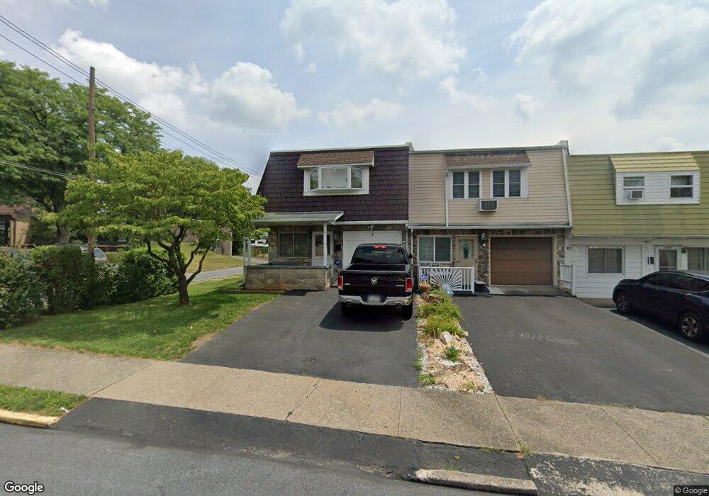
889 N Kiowa St Allentown, PA 18109
Rittersville NeighborhoodEstimated Value: $196,000 - $295,000
2
Beds
1
Bath
1,356
Sq Ft
$175/Sq Ft
Est. Value
About This Home
This home is located at 889 N Kiowa St, Allentown, PA 18109 and is currently estimated at $237,952, approximately $175 per square foot. 889 N Kiowa St is a home located in Lehigh County with nearby schools including Ritter Elementary School, Harrison-Morton Middle School, and Louis E. Dieruff High School.
Ownership History
Date
Name
Owned For
Owner Type
Purchase Details
Closed on
Dec 15, 2001
Sold by
Fantasia Anthony F and Fantasia Gail A
Bought by
Fantasia Anthony F
Current Estimated Value
Purchase Details
Closed on
Oct 12, 1992
Sold by
Fantasia Anthony F and Rizzuto Gail A
Bought by
Fantasia Anthony F and Fantasia Gail A
Purchase Details
Closed on
Apr 4, 1989
Sold by
Honzo Linda A
Bought by
Fantasia Anthony F and Rizzuto Gail A
Purchase Details
Closed on
Sep 26, 1980
Bought by
Honzo Linda A
Create a Home Valuation Report for This Property
The Home Valuation Report is an in-depth analysis detailing your home's value as well as a comparison with similar homes in the area
Home Values in the Area
Average Home Value in this Area
Purchase History
| Date | Buyer | Sale Price | Title Company |
|---|---|---|---|
| Fantasia Anthony F | -- | -- | |
| Fantasia Anthony F | -- | -- | |
| Fantasia Anthony F | $65,000 | -- | |
| Honzo Linda A | $40,000 | -- |
Source: Public Records
Tax History Compared to Growth
Tax History
| Year | Tax Paid | Tax Assessment Tax Assessment Total Assessment is a certain percentage of the fair market value that is determined by local assessors to be the total taxable value of land and additions on the property. | Land | Improvement |
|---|---|---|---|---|
| 2025 | $3,472 | $103,800 | $14,000 | $89,800 |
| 2024 | $3,472 | $103,800 | $14,000 | $89,800 |
| 2023 | $3,472 | $103,800 | $14,000 | $89,800 |
| 2022 | $3,354 | $103,800 | $89,800 | $14,000 |
| 2021 | $3,289 | $103,800 | $14,000 | $89,800 |
| 2020 | $3,205 | $103,800 | $14,000 | $89,800 |
| 2019 | $3,155 | $103,800 | $14,000 | $89,800 |
| 2018 | $2,931 | $103,800 | $14,000 | $89,800 |
| 2017 | $2,859 | $103,800 | $14,000 | $89,800 |
| 2016 | -- | $103,800 | $14,000 | $89,800 |
| 2015 | -- | $103,800 | $14,000 | $89,800 |
| 2014 | -- | $103,800 | $14,000 | $89,800 |
Source: Public Records
Map
Nearby Homes
- 1146 E Livingston St
- 923 N Kearney St
- 812 N Lacrosse St
- 1310 E Highland St
- 301 333 Union Blvd
- 805 N Oswego St
- 1404 E Pennsylvania St
- 619 N Jasper St
- 643 N Irving St
- 1623 E Dent St
- 744 E Green St
- 816 Shell St
- 1920 E Woodlawn St
- 2030 Hanover Ave Unit 2032
- 408 N Gilmore St
- 407 N Fenwick St
- 1103 N Van Buren St
- 1257 Troxell St
- 456 Hanover Ave
- 960 E Fairview St
- 887 N Kiowa St
- 885 N Kiowa St
- 881 N Kiowa St Unit 883
- 879 N Kiowa St
- 877 N Kiowa St
- 875 N Kiowa St
- 882 N Lacrosse St Unit 884
- 871 N Kiowa St Unit 873
- 878 N Lacrosse St Unit 880
- 1148 Union Blvd
- 1118 Union Blvd
- 869 N Kiowa St
- 741 N Kiowa St
- 872 N Lacrosse St Unit 874
- 867 N Kiowa St
- 1129 Union Blvd
- 866 N Lacrosse St Unit 870
- 859 N Kiowa St
- 1137 Union Blvd
- 1137 Union Blvd