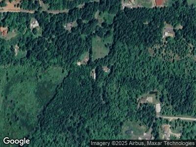
88939 Lois Ln Elmira, OR 97437
Estimated Value: $580,000 - $657,000
3
Beds
2
Baths
1,743
Sq Ft
$364/Sq Ft
Est. Value
About This Home
This home is located at 88939 Lois Ln, Elmira, OR 97437 and is currently estimated at $634,076, approximately $363 per square foot. 88939 Lois Ln is a home located in Lane County with nearby schools including Elmira Elementary School, Fern Ridge Middle School, and Elmira High School.
Ownership History
Date
Name
Owned For
Owner Type
Purchase Details
Closed on
Nov 29, 2010
Sold by
Nygren James A
Bought by
Howerton William D and Howerton Joellyne A
Current Estimated Value
Home Financials for this Owner
Home Financials are based on the most recent Mortgage that was taken out on this home.
Original Mortgage
$263,036
Interest Rate
4.17%
Mortgage Type
VA
Purchase Details
Closed on
Oct 13, 2000
Sold by
Norwest Bank Minnesota Na
Bought by
Nygren James A
Home Financials for this Owner
Home Financials are based on the most recent Mortgage that was taken out on this home.
Original Mortgage
$183,090
Interest Rate
7.96%
Mortgage Type
VA
Create a Home Valuation Report for This Property
The Home Valuation Report is an in-depth analysis detailing your home's value as well as a comparison with similar homes in the area
Home Values in the Area
Average Home Value in this Area
Purchase History
| Date | Buyer | Sale Price | Title Company |
|---|---|---|---|
| Howerton William D | $257,500 | First American Title | |
| Nygren James A | $179,000 | American Title Group |
Source: Public Records
Mortgage History
| Date | Status | Borrower | Loan Amount |
|---|---|---|---|
| Open | Howerton William D | $264,950 | |
| Closed | Howerton William D | $263,036 | |
| Previous Owner | Nygren James A | $316,160 | |
| Previous Owner | Nygren James A | $183,090 |
Source: Public Records
Tax History Compared to Growth
Tax History
| Year | Tax Paid | Tax Assessment Tax Assessment Total Assessment is a certain percentage of the fair market value that is determined by local assessors to be the total taxable value of land and additions on the property. | Land | Improvement |
|---|---|---|---|---|
| 2023 | $4,679 | $342,582 | $0 | $0 |
| 2022 | $4,373 | $332,604 | $0 | $0 |
| 2021 | $4,022 | $322,917 | $0 | $0 |
| 2020 | $4,022 | $313,512 | $0 | $0 |
| 2019 | -- | $304,381 | $0 | $0 |
| 2018 | -- | $286,909 | $0 | $0 |
| 2017 | -- | $286,909 | $0 | $0 |
| 2016 | -- | $278,552 | $0 | $0 |
| 2015 | -- | $270,439 | $0 | $0 |
| 2014 | -- | $262,562 | $0 | $0 |
Source: Public Records
Map
Nearby Homes
- 88909 Lois Ln
- 23789 Warthen Rd
- 23681 Suttle Rd
- 0 Suttle Rd
- 23200 Warthen Rd
- 24456 Warthen Rd
- 88597 Knight Rd
- 89407 Knight Rd
- 24743 Warthen Rd
- 0 Territorial Hwy
- 89975 Sheffler Rd
- 24704 Nottingham St
- 24710 Nottingham St
- 87938 10th St
- 87949 10th St
- 87973 Sherwood St
- 23020 Green Creek Rd
- 200 Bolton Hill Rd
- 89353 Poodle Creek Rd
- 88046 5th St
