Estimated Value: $448,352 - $565,000
3
Beds
1
Bath
1,228
Sq Ft
$417/Sq Ft
Est. Value
About This Home
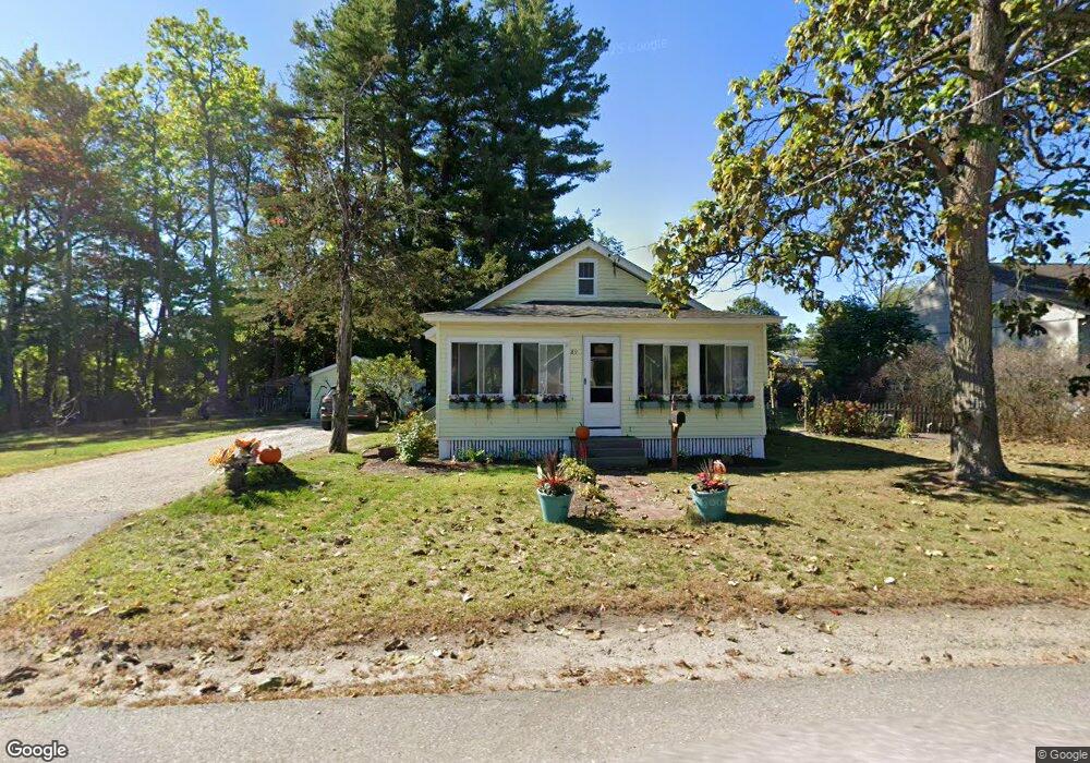
This home is located at 89 Central Ave, Ayer, MA 01432 and is currently estimated at $512,588, approximately $417 per square foot. 89 Central Ave is a home located in Middlesex County with nearby schools including Page Hilltop School, Lura A. White Elementary School, and Ayer Shirley Regional Middle School.
Ownership History
Date
Name
Owned For
Owner Type
Purchase Details
Closed on
Jan 19, 2006
Sold by
Bennett Michael C
Bought by
White Dennis M
Current Estimated Value
Home Financials for this Owner
Home Financials are based on the most recent Mortgage that was taken out on this home.
Original Mortgage
$176,250
Outstanding Balance
$99,417
Interest Rate
6.33%
Mortgage Type
Purchase Money Mortgage
Estimated Equity
$413,171
Purchase Details
Closed on
Jul 28, 1995
Sold by
Bennett Edwin C and Bennett Mary H
Bought by
Bennett Michael C
Home Financials for this Owner
Home Financials are based on the most recent Mortgage that was taken out on this home.
Original Mortgage
$68,000
Interest Rate
7.56%
Mortgage Type
Purchase Money Mortgage
Create a Home Valuation Report for This Property
The Home Valuation Report is an in-depth analysis detailing your home's value as well as a comparison with similar homes in the area
Home Values in the Area
Average Home Value in this Area
Purchase History
| Date | Buyer | Sale Price | Title Company |
|---|---|---|---|
| White Dennis M | $235,000 | -- | |
| Bennett Michael C | $85,000 | -- |
Source: Public Records
Mortgage History
| Date | Status | Borrower | Loan Amount |
|---|---|---|---|
| Open | White Dennis M | $176,250 | |
| Previous Owner | Bennett Michael C | $68,000 | |
| Previous Owner | Bennett Michael C | $20,000 |
Source: Public Records
Tax History
| Year | Tax Paid | Tax Assessment Tax Assessment Total Assessment is a certain percentage of the fair market value that is determined by local assessors to be the total taxable value of land and additions on the property. | Land | Improvement |
|---|---|---|---|---|
| 2025 | $4,138 | $346,000 | $144,400 | $201,600 |
| 2024 | $3,947 | $322,200 | $144,400 | $177,800 |
| 2023 | $3,711 | $298,800 | $135,200 | $163,600 |
| 2022 | $3,590 | $267,500 | $118,300 | $149,200 |
| 2021 | $8,917 | $241,300 | $108,200 | $133,100 |
| 2020 | $3,187 | $226,000 | $103,900 | $122,100 |
| 2019 | $2,940 | $215,700 | $99,000 | $116,700 |
| 2018 | $7,910 | $200,000 | $96,000 | $104,000 |
| 2017 | $2,619 | $182,000 | $81,600 | $100,400 |
| 2016 | $2,656 | $182,800 | $87,000 | $95,800 |
| 2015 | $2,664 | $182,200 | $92,800 | $89,400 |
| 2014 | $2,527 | $179,500 | $92,800 | $86,700 |
Source: Public Records
Map
Nearby Homes
- 100 Central Ave Unit 4
- 63 E Main St
- 21 High St
- 38 Norwood Ave
- 23 Nashua St
- 7 Baldwin Ct Unit 7
- 37 Willard St
- 98 Pleasant St
- 0ABC Park St
- 14 Brook St
- 55 Littleton Rd Unit 8B
- 31 Independence Dr
- 0 Ayer & Old Mill Rd
- 501 Farmers Row
- 18A S Shaker Rd
- 78 Shaker Rd
- 107 Old Mill Rd
- 210 Indian Hill Rd
- 9 Blanchard Rd
- 239 Ayer Rd Unit 16
- 85 Central Ave
- 88 Central Ave
- 20 Groton Harvard Rd
- 6 Groton Harvard Rd
- 6 Groton Harvard Rd Unit 5
- 6 Groton Harvard Rd Unit 4
- 6 Groton Harvard Rd Unit 3
- 6 Groton Harvard Rd Unit 2
- 6 Groton Harvard Rd Unit 1
- 6 Groton Harvard Rd Unit 6
- 6 Groton Harvard Rd Unit 6
- 6 Groton-Harvard Rd Unit 4
- 22 Groton Harvard Rd
- 22 Groton Harvard Rd Unit 1
- 100 Central Ave Unit 3
- 100 Central Ave Unit 2
- 100 Central Ave Unit 1
- 100 Central Ave Unit D
- 100 Central Ave Unit 100 D
- 100 Central Ave Unit C
Your Personal Tour Guide
Ask me questions while you tour the home.