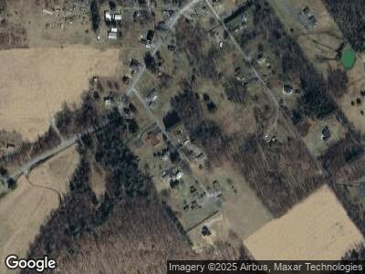
89 Chestnut Ln Lanse, PA 16849
Estimated Value: $143,000 - $197,147
--
Bed
--
Bath
--
Sq Ft
0.4
Acres
About This Home
This home is located at 89 Chestnut Ln, Lanse, PA 16849 and is currently estimated at $167,787. 89 Chestnut Ln is a home with nearby schools including West Branch Area Elementary School and West Branch Area Junior/Senior High School.
Ownership History
Date
Name
Owned For
Owner Type
Purchase Details
Closed on
Jul 21, 2015
Sold by
Beck Timothy M and Beck Kelly R
Bought by
Weidman Douglas J and Weidman Jessica S
Current Estimated Value
Home Financials for this Owner
Home Financials are based on the most recent Mortgage that was taken out on this home.
Original Mortgage
$143,355
Outstanding Balance
$114,120
Interest Rate
4.07%
Mortgage Type
FHA
Estimated Equity
$53,667
Purchase Details
Closed on
May 14, 2010
Sold by
Johnson Beatrice and Johnson James A
Bought by
Beck Timothy M and Beck Kelly R
Home Financials for this Owner
Home Financials are based on the most recent Mortgage that was taken out on this home.
Original Mortgage
$103,098
Interest Rate
5.13%
Mortgage Type
FHA
Create a Home Valuation Report for This Property
The Home Valuation Report is an in-depth analysis detailing your home's value as well as a comparison with similar homes in the area
Home Values in the Area
Average Home Value in this Area
Purchase History
| Date | Buyer | Sale Price | Title Company |
|---|---|---|---|
| Weidman Douglas J | $146,000 | Attorney | |
| Beck Timothy M | $105,000 | None Available |
Source: Public Records
Mortgage History
| Date | Status | Borrower | Loan Amount |
|---|---|---|---|
| Open | Weidman Douglas J | $143,355 | |
| Previous Owner | Beck Timothy M | $103,500 | |
| Previous Owner | Beck Timothy M | $103,098 |
Source: Public Records
Tax History Compared to Growth
Tax History
| Year | Tax Paid | Tax Assessment Tax Assessment Total Assessment is a certain percentage of the fair market value that is determined by local assessors to be the total taxable value of land and additions on the property. | Land | Improvement |
|---|---|---|---|---|
| 2025 | $2,067 | $27,150 | $1,200 | $25,950 |
| 2024 | $339 | $13,575 | $600 | $12,975 |
| 2023 | $1,842 | $13,575 | $600 | $12,975 |
| 2022 | $1,808 | $13,575 | $600 | $12,975 |
| 2021 | $1,816 | $13,575 | $600 | $12,975 |
| 2020 | $1,816 | $13,575 | $600 | $12,975 |
| 2019 | $1,816 | $13,575 | $600 | $12,975 |
| 2018 | $1,697 | $13,575 | $600 | $12,975 |
| 2017 | $1,744 | $13,575 | $600 | $12,975 |
| 2016 | -- | $13,575 | $600 | $12,975 |
| 2015 | -- | $13,125 | $600 | $12,525 |
| 2014 | -- | $13,125 | $600 | $12,525 |
Source: Public Records
Map
Nearby Homes
- 1558 Maple St
- 61 Pine St
- 694 Knox Run Rd
- 850 Sportsmans Rd
- 985 Knox Run Rd
- 297 Maple St
- 125 Colorado Rd
- 790 Cooper Ave
- 443 Firehouse Rd
- ON Hardscrabble Rd
- 0 Hardscrabble Rd
- 0 Hardscrabble Rd
- 4177 Morrisdale Allport Hwy
- 477 Harlem
- 5281 Morrisdale Allport Hwy
- 20 Groundhog Dr
- 4960 Morrisdale Allport Hwy
- 159 Oak Meadow Ln
- 0 Honeysuckle Ln
- 235 Glastonbury St
