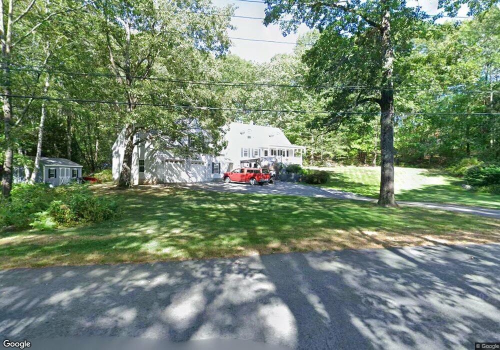
89 High Bridge Rd Hubbardston, MA 01452
Estimated Value: $447,000 - $576,000
3
Beds
2
Baths
1,638
Sq Ft
$302/Sq Ft
Est. Value
About This Home
This home is located at 89 High Bridge Rd, Hubbardston, MA 01452 and is currently estimated at $494,391, approximately $301 per square foot. 89 High Bridge Rd is a home located in Worcester County with nearby schools including Quabbin Regional Middle School and Quabbin Regional High School.
Ownership History
Date
Name
Owned For
Owner Type
Purchase Details
Closed on
Nov 5, 2025
Sold by
Oconnor Kevin and Oconnor Elizabeth A
Bought by
Oconnor Ft and Oconnor
Current Estimated Value
Purchase Details
Closed on
Nov 1, 1994
Sold by
Drouin Alan J and Kosakowski Steven
Bought by
Oconnor Kevin J and Oconnor Elizabeth
Purchase Details
Closed on
Aug 30, 1994
Sold by
Winslow Ronald C and Winslow Lorraine K
Bought by
Drouin Alan J and Kosakowski Steven
Create a Home Valuation Report for This Property
The Home Valuation Report is an in-depth analysis detailing your home's value as well as a comparison with similar homes in the area
Home Values in the Area
Average Home Value in this Area
Purchase History
| Date | Buyer | Sale Price | Title Company |
|---|---|---|---|
| Oconnor Ft | -- | -- | |
| Oconnor Kevin J | $113,800 | -- | |
| Drouin Alan J | $25,000 | -- |
Source: Public Records
Mortgage History
| Date | Status | Borrower | Loan Amount |
|---|---|---|---|
| Previous Owner | Drouin Alan J | $162,500 | |
| Previous Owner | Drouin Alan J | $21,000 | |
| Previous Owner | Drouin Alan J | $97,300 |
Source: Public Records
Tax History
| Year | Tax Paid | Tax Assessment Tax Assessment Total Assessment is a certain percentage of the fair market value that is determined by local assessors to be the total taxable value of land and additions on the property. | Land | Improvement |
|---|---|---|---|---|
| 2025 | $5,019 | $429,700 | $55,900 | $373,800 |
| 2024 | $4,619 | $391,800 | $50,200 | $341,600 |
| 2023 | $4,300 | $330,000 | $44,600 | $285,400 |
| 2022 | $4,620 | $330,000 | $44,600 | $285,400 |
| 2021 | $3,804 | $282,400 | $44,600 | $237,800 |
| 2020 | $10,591 | $278,300 | $44,600 | $233,700 |
| 2019 | $4,014 | $263,700 | $59,000 | $204,700 |
| 2018 | $4,289 | $253,200 | $59,000 | $194,200 |
| 2017 | $3,861 | $253,500 | $59,000 | $194,500 |
| 2016 | $3,732 | $234,700 | $59,000 | $175,700 |
| 2015 | $3,729 | $249,900 | $59,000 | $190,900 |
| 2014 | $3,687 | $253,900 | $59,000 | $194,900 |
Source: Public Records
Map
Nearby Homes
- 85 High Bridge Rd
- 91 High Bridge Rd
- 95 High Bridge Rd
- 107 Old Westminster Rd
- 81 High Bridge Rd
- 101 High Bridge Rd
- 111 Old Westminster Rd
- 113 Old Westminster Rd
- 114 Old Westminster Rd
- 117 Old Westminster Rd
- 117 Old Westminster Rd Unit 1
- 117 Old Westminster Rd Unit 117
- 118 Old Westminster Rd
- 104 Old Westminster Rd
- 121 Old Westminster Rd
- 100 Old Westminster Rd
- 125 Old Westminster Rd
- 127 Old Westminster Rd
- 129 Old Westminster Rd
- 98 Old Westminster Rd
Your Personal Tour Guide
Ask me questions while you tour the home.