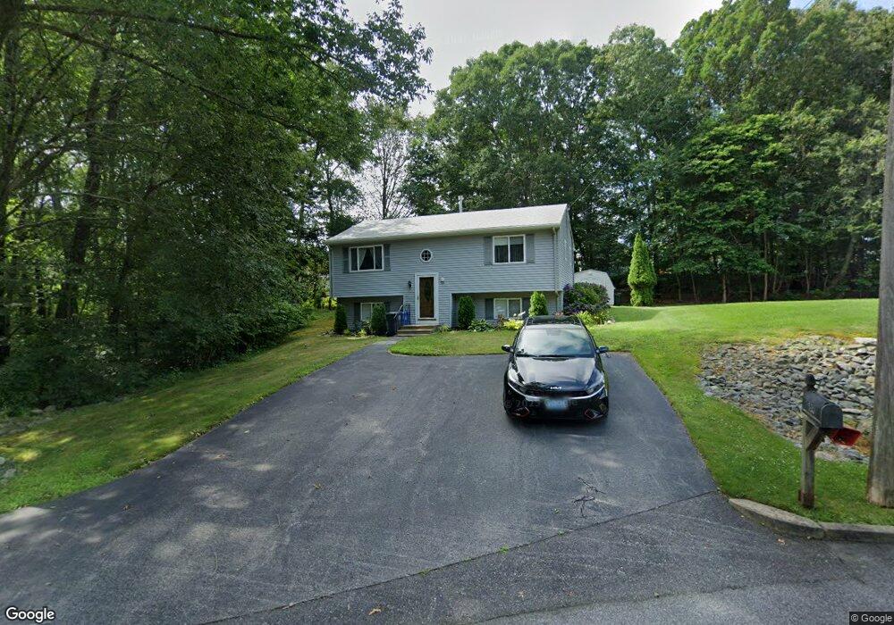
89 Lofty Rd Cranston, RI 02921
Western Cranston NeighborhoodEstimated Value: $448,000 - $570,000
2
Beds
1
Bath
864
Sq Ft
$584/Sq Ft
Est. Value
About This Home
This home is located at 89 Lofty Rd, Cranston, RI 02921 and is currently estimated at $504,565, approximately $583 per square foot. 89 Lofty Rd is a home located in Providence County with nearby schools including Oak Lawn School, Western Hills Middle School, and Cranston High School West.
Ownership History
Date
Name
Owned For
Owner Type
Purchase Details
Closed on
Oct 22, 2024
Sold by
Maggiacomo Philip
Bought by
Maggiacomo Philip and Grenier Lacey M
Current Estimated Value
Purchase Details
Closed on
Jun 7, 1994
Sold by
Paul Gerald Dev Inc
Bought by
Maggiacomo Philip and Maggiacomo Janice
Home Financials for this Owner
Home Financials are based on the most recent Mortgage that was taken out on this home.
Original Mortgage
$116,000
Interest Rate
8.49%
Create a Home Valuation Report for This Property
The Home Valuation Report is an in-depth analysis detailing your home's value as well as a comparison with similar homes in the area
Home Values in the Area
Average Home Value in this Area
Purchase History
| Date | Buyer | Sale Price | Title Company |
|---|---|---|---|
| Maggiacomo Philip | -- | None Available | |
| Maggiacomo Philip | -- | None Available | |
| Maggiacomo Philip | $123,000 | -- | |
| Maggiacomo Philip | $123,000 | -- |
Source: Public Records
Mortgage History
| Date | Status | Borrower | Loan Amount |
|---|---|---|---|
| Previous Owner | Maggiacomo Philip | $149,500 | |
| Previous Owner | Maggiacomo Philip | $143,493 | |
| Previous Owner | Maggiacomo Philip | $30,000 | |
| Previous Owner | Maggiacomo Philip | $116,000 |
Source: Public Records
Tax History
| Year | Tax Paid | Tax Assessment Tax Assessment Total Assessment is a certain percentage of the fair market value that is determined by local assessors to be the total taxable value of land and additions on the property. | Land | Improvement |
|---|---|---|---|---|
| 2025 | $5,420 | $390,500 | $135,500 | $255,000 |
| 2024 | $5,315 | $390,500 | $135,500 | $255,000 |
| 2023 | $5,180 | $274,100 | $97,000 | $177,100 |
| 2022 | $5,074 | $274,100 | $97,000 | $177,100 |
| 2021 | $4,934 | $274,100 | $97,000 | $177,100 |
| 2020 | $5,355 | $257,800 | $100,400 | $157,400 |
| 2019 | $5,355 | $257,800 | $100,400 | $157,400 |
| 2018 | $5,231 | $257,800 | $100,400 | $157,400 |
| 2017 | $5,315 | $231,700 | $90,000 | $141,700 |
| 2016 | $5,202 | $231,700 | $90,000 | $141,700 |
| 2015 | $5,202 | $231,700 | $90,000 | $141,700 |
| 2014 | $4,796 | $210,000 | $86,600 | $123,400 |
Source: Public Records
Map
Nearby Homes
- 1715 Phenix Ave
- 8 Ashton Ct
- 74 Cardinal Rd
- 64 Cardinal Rd
- 59 Camden Ln
- 62 Governors Hill Unit 572
- 22 Derby Ln
- 8 Lily Ln Unit 8
- 0 Natick Rd
- 15 Gilcrest Dr
- 1213 Phenix Ave
- 46 Hornbeam Dr
- 15 Carrie Ann Dr
- 550 Wakefield St Unit 2
- 42 Woodland Dr
- 2212 Phenix Ave
- 61 Crossland Rd
- 1 Countryside Way
- 1100 Phenix Ave
- 114 Burlingame Rd
Your Personal Tour Guide
Ask me questions while you tour the home.