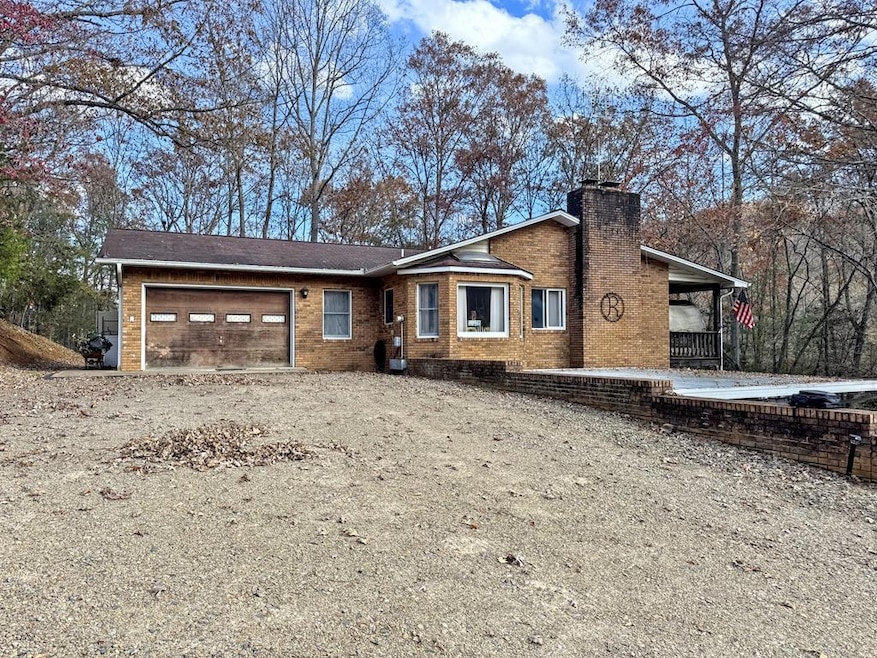
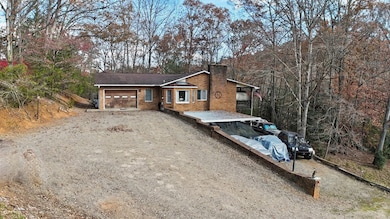
89 Nettie Hurst Rd Franklin, NC 28734
Estimated payment $1,393/month
Highlights
- RV Access or Parking
- Deck
- Multiple Fireplaces
- 3.84 Acre Lot
- Wood Burning Stove
- Ranch Style House
About This Home
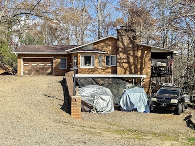
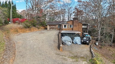
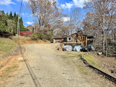
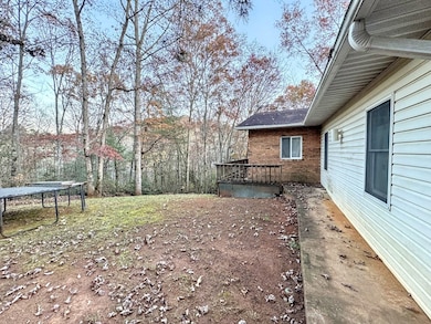
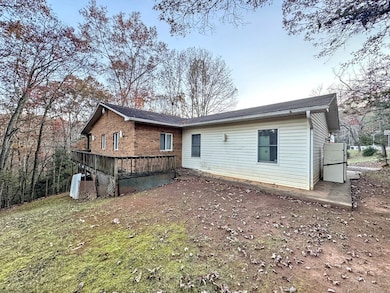
3 Bed 3 Bath Home on 3.84 Unrestricted acres in Riverbend area. First time on market since built in 1989. This home is well built & has many upgrades. The Main Level features: Living Room with Stone Fireplace, Spacious Kitchen, Master Bedroom with attached Full Bath including Tub & Walk-In Shower, Bedroom 2 with attached Full Bath, Large Covered Porch, & Garage off Kitchen. Lower Level features: Family Room with Woodstove, Large Bedroom 3, Laundry Room, Full Bath, 2 Utility Rooms, & covered patio off Family Room. This home has Central Vacuum, Security System, Intercom/Radio System. Each Level has its own parking & driveway access. Upper Level has an Attached Garage, Lower Level has a Dbl Carport. Home has a Private Drilled Well, & City Water down below along Riverbend Rd. This Home has a Great Location close to town, & Easy Access paved & gravel road. No 4x4 needed. The property lays good. It is mostly wooded with a some open yard area close to the house. Home is sold AS-IS.
Listing Agent
Re/Max Elite Realty Brokerage Phone: 8283494600 License #276589 Listed on: 11/10/2025

Home Details
Home Type
- Single Family
Est. Annual Taxes
- $1,324
Year Built
- Built in 1989
Lot Details
- 3.84 Acre Lot
- Open Lot
- Lot Has A Rolling Slope
- Partially Wooded Lot
Parking
- 3 Garage Spaces | 1 Attached and 2 Detached
- 2 Detached Carport Spaces
- RV Access or Parking
Home Design
- Ranch Style House
- Traditional Architecture
- Brick Exterior Construction
- Slab Foundation
- Shingle Roof
- Composition Roof
- Fiberglass Roof
- Vinyl Siding
Interior Spaces
- Central Vacuum
- Ceiling Fan
- Skylights
- Multiple Fireplaces
- Wood Burning Stove
- Stone Fireplace
- Insulated Windows
- Living Area on First Floor
- Home Security System
Kitchen
- Electric Oven or Range
- Recirculated Exhaust Fan
- Dishwasher
Flooring
- Carpet
- Vinyl
Bedrooms and Bathrooms
- 3 Bedrooms
- En-Suite Primary Bedroom
- 3 Full Bathrooms
- Soaking Tub
- Bathtub Includes Tile Surround
Laundry
- Laundry Room
- Washer and Dryer Hookup
Finished Basement
- Heated Basement
- Basement Fills Entire Space Under The House
- Interior and Exterior Basement Entry
- Fireplace in Basement
- Finished Basement Bathroom
- Basement with some natural light
Outdoor Features
- Deck
- Porch
Schools
- Iotla Elementary School
- Macon Middle School
- Franklin High School
Utilities
- Forced Air Heating and Cooling System
- Heating System Uses Propane
- Heating System Powered By Leased Propane
- Private Water Source
- Well
- Electric Water Heater
- Septic Tank
Community Details
- No Home Owners Association
Listing and Financial Details
- Assessor Parcel Number 6586805527
Map
Home Values in the Area
Average Home Value in this Area
Tax History
| Year | Tax Paid | Tax Assessment Tax Assessment Total Assessment is a certain percentage of the fair market value that is determined by local assessors to be the total taxable value of land and additions on the property. | Land | Improvement |
|---|---|---|---|---|
| 2025 | $1,324 | $354,010 | $87,180 | $266,830 |
| 2024 | $1,324 | $354,010 | $87,180 | $266,830 |
| 2023 | $1,271 | $354,010 | $87,180 | $266,830 |
| 2022 | $1,271 | $244,340 | $58,060 | $186,280 |
| 2021 | $1,232 | $247,340 | $58,060 | $189,280 |
| 2020 | $1,170 | $247,340 | $58,060 | $189,280 |
| 2018 | $1,143 | $259,720 | $60,480 | $199,240 |
| 2017 | $1,143 | $259,720 | $60,480 | $199,240 |
| 2016 | $1,117 | $259,720 | $60,480 | $199,240 |
| 2015 | $1,094 | $259,720 | $60,480 | $199,240 |
| 2014 | $964 | $288,570 | $69,120 | $219,450 |
| 2013 | -- | $288,570 | $69,120 | $219,450 |
Property History
| Date | Event | Price | List to Sale | Price per Sq Ft |
|---|---|---|---|---|
| 01/26/2026 01/26/26 | Pending | -- | -- | -- |
| 11/10/2025 11/10/25 | For Sale | $249,900 | -- | -- |
Purchase History
| Date | Type | Sale Price | Title Company |
|---|---|---|---|
| Warranty Deed | -- | None Listed On Document | |
| Warranty Deed | -- | None Listed On Document | |
| Interfamily Deed Transfer | -- | None Available | |
| Interfamily Deed Transfer | -- | None Available |
Source: Carolina Smokies Association of REALTORS®
MLS Number: 26042635
APN: 6586805527
- 00 Pine Ridge Dr
- 30 Maxies Corner Rd
- 113 Courtney Marie Dr
- 381 Parsons Way
- 58 Swallow Ln
- Lot 26 Bryson City Rd
- Lot 19 Bryson City Rd
- 153 Breezy Oak Ln
- 1616 Riverbend Rd
- 440 Lakeshore Dr
- 225 Iotla Church Rd
- 1350 Lake Emory Rd
- Lot 5 Quail Hollow
- 235 N Shore Dr
- 160 Lakeview Dr
- 567 Clyde Downs Rd
- 1817 Lakeside Dr
- 1781 Lake Emory Rd
- 1120 Jacobs Branch Rd
- Lot 44 Mews Ln
Ask me questions while you tour the home.